TopoQuest Logo
Do you find TopoQuest useful?
Help keep TopoQuest running and adding new maps/features by donating!
Bitcoin:  19c7KJd3qBynnjoSw5npx9KScwjBe4ifkT
Litecoin:  LXs6TkuXGGXo1vDsWCkWVdjQX94eUKd6ui
Home View Maps Find Maps Find Places Resources & Links


Muddy Creek, Wyoming Topographic Map

USGS Map Title: Muddy Creek, WY
USGS Map MRC: 44109H6
DRG (GeoTIFF) Download: o44109h6.tif


Neighboring USGS Topographic Map Quads:


  Fossil Lake, MT  
45109A7
 

  Castle Mountain, MT  
45109A6
 

  Silver Run Peak, MT  
45109A5
 

  Jim Smith Peak, WY  
44109H7
 

  Muddy Creek, WY  
44109H6
 

  Beartooth Butte, WY  
44109H5
 

  Hurricane Mesa, WY  
44109G7
 

  Hunter Peak, WY  
44109G6
 

  Windy Mountain, WY  
44109G5


Map MRC Location:

N45°
W110°
N45°
W109°
H8 H7 H6 H5 H4 H3 H2 H1
G8 G7 G6 G5 G4 G3 G2 G1
F8 F7 F6 F5 F4 F3 F2 F1
E8 E7 E6 E5 E4 E3 E2 E1
D8 D7 D6 D5 D4 D3 D2 D1
C8 C7 C6 C5 C4 C3 C2 C1
B8 B7 B6 B5 B4 B3 B2 B1
A8 A7 A6 A5 A4 A3 A2 A1
N44°
W110°
N44°
W109°

Muddy Creek, WY USGS 1:24K Topographic Map Preview:
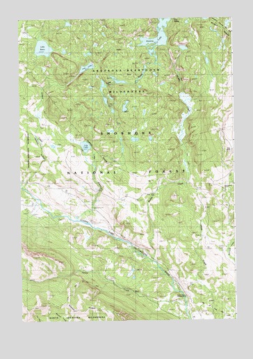
Muddy Creek, WY USGS Topographic Map
Click on map above to begin viewing in our Map Viewer.

This topographic map contains these locations and features:
Feature Name Type Latitude Longitude GNIS ID View Map
Clarks Fork TrailheadLocaleN44.8824°W109.6510°1608720View Map
Clay ButteSummitN44.9447°W109.6277°1598779View Map
Clay Butte TrailTrailN44.9627°W109.6327°1604566View Map
Copeland Lake TrailTrailN44.9922°W109.6991°1604567View Map
Crazy Mountain TrailTrailN44.9977°W109.7430°1604570View Map
Crossbow RanchLocaleN44.8830°W109.6663°1599041View Map
Few Acres RanchLocaleN44.8905°W109.6621°1599694View Map
Gilbert CreekStreamN44.9305°W109.7474°1599935View Map
Granite LakeLakeN44.9965°W109.6678°784169View Map
Granite LakeLakeN44.9916°W109.6685°1600032View Map
Granite Loop TrailTrailN44.9658°W109.6493°1604573View Map
Hunter Peak CampgroundLocaleN44.8841°W109.6529°1604574View Map
Hunter Peak RanchLocaleN44.8788°W109.6541°1600465View Map
L Bar RanchLocaleN44.9208°W109.7446°1600764View Map
Lake CreekStreamN44.9169°W109.7160°1600782View Map
Lake Creek CampgroundLocaleN44.9211°W109.7052°1600792View Map
Lake RenoLakeN44.9880°W109.7358°1602495View Map
Lake Reno TrailTrailN44.9933°W109.7424°1604578View Map
Lily LakeLakeN44.9473°W109.7118°1600914View Map
Lost LakeLakeN44.9800°W109.7102°1601147View Map
Lost Lake TrailTrailN44.9738°W109.7313°1604579View Map
Muddy CreekStreamN44.9005°W109.6738°1601615View Map
Park RapidsRapidsN44.9997°W109.6586°1602027View Map
Squaw CreekStreamN44.8813°W109.6552°1603309View Map
Squaw Creek TrailTrailN44.8874°W109.7232°1604584View Map
State Highway Maintenance CampLocaleN44.9294°W109.6324°1603343View Map
Upper Granite Loop TrailTrailN44.9819°W109.6410°1604588View Map

Note: Coordinates in the location and feature list above are referenced to NAD83 datum.


Copyright (C) 2008-2025 Ryan Niemi / Sunset Dynamics ... All Rights Reserved