TopoQuest Logo
Do you find TopoQuest useful?
Help keep TopoQuest running and adding new maps/features by donating!
Bitcoin:  19c7KJd3qBynnjoSw5npx9KScwjBe4ifkT
Litecoin:  LXs6TkuXGGXo1vDsWCkWVdjQX94eUKd6ui
Home View Maps Find Maps Find Places Resources & Links


Mule Hill, Oregon Topographic Map

USGS Map Title: Mule Hill, OR
USGS Map MRC: 42122A2
DRG (GeoTIFF) Download: o42122a2.tif


Neighboring USGS Topographic Map Quads:


  Little Chinquapin Mountain, OR  
42122B3
 

  Surveyor Mountain, OR  
42122B2
 

  Spencer Creek, OR  
42122B1
 

  Parker Mountain, OR  
42122A3
 

  Mule Hill, OR  
42122A2
 

  Chicken Hills, OR  
42122A1
 

  Copco, CA  
41122H3
 

  Secret Spring Mountain, CA  
41122H2
 

  Sams Neck, CA  
41122H1


Map MRC Location:

N43°
W123°
N43°
W122°
H8 H7 H6 H5 H4 H3 H2 H1
G8 G7 G6 G5 G4 G3 G2 G1
F8 F7 F6 F5 F4 F3 F2 F1
E8 E7 E6 E5 E4 E3 E2 E1
D8 D7 D6 D5 D4 D3 D2 D1
C8 C7 C6 C5 C4 C3 C2 C1
B8 B7 B6 B5 B4 B3 B2 B1
A8 A7 A6 A5 A4 A3 A2 A1
N42°
W123°
N42°
W122°

Mule Hill, OR USGS 1:24K Topographic Map Preview:
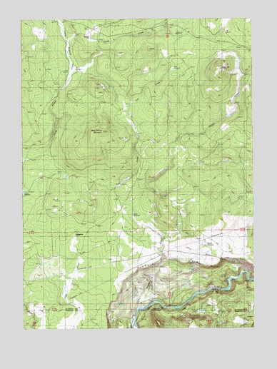
Mule Hill, OR USGS Topographic Map
Click on map above to begin viewing in our Map Viewer.

This topographic map contains these locations and features:
Feature Name Type Latitude Longitude GNIS ID View Map
Camp FourLocaleN42.1179°W122.2145°1118490View Map
Camp Four CreekStreamN42.1046°W122.2236°1139194View Map
Camp Four ReservoirReservoirN42.1190°W122.1632°1118530View Map
Forty-one RanchLocaleN42.0104°W122.1858°1120898View Map
Griffith ReservoirReservoirN42.0335°W122.1519°1121435View Map
Hayden CreekStreamN42.0079°W122.1886°1143401View Map
Long PrairieFlatN42.1135°W122.2247°1123443View Map
Mud SpringSpringN42.0835°W122.1922°1124472View Map
Mud Spring MountainSummitN42.0796°W122.2072°1124496View Map
Mule HillSummitN42.1046°W122.1425°1124519View Map
Pokegama (historical)Populated PlaceN42.0360°W122.2178°1132659View Map
Pokegama Post Office (historical)Post OfficeN42.0360°W122.2178°1165804View Map
Potter Mill (historical)Populated PlaceN42.0540°W122.2497°1132658View Map
Tom CreekStreamN42.0479°W122.1908°1128142View Map
Tom ReservoirReservoirN42.1047°W122.1689°1128146View Map
Way CemeteryCemeteryN42.0135°W122.1472°1128745View Map
Word ReservoirReservoirN42.0457°W122.1914°1129325View Map

Note: Coordinates in the location and feature list above are referenced to NAD83 datum.


Copyright (C) 2008-2025 Ryan Niemi / Sunset Dynamics ... All Rights Reserved