TopoQuest Logo
Do you find TopoQuest useful?
Help keep TopoQuest running and adding new maps/features by donating!
Bitcoin:  19c7KJd3qBynnjoSw5npx9KScwjBe4ifkT
Litecoin:  LXs6TkuXGGXo1vDsWCkWVdjQX94eUKd6ui
Home View Maps Find Maps Find Places Resources & Links


Myers Canyon, Colorado Topographic Map

USGS Map Title: Myers Canyon, CO
USGS Map MRC: 37104G3
DRG (GeoTIFF) Download: o37104g3.tif


Neighboring USGS Topographic Map Quads:


  Hog Ranch Canyon, CO  
37104H4
 

  Red Top Ranch, CO  
37104H3
 

  Yellowbank Creek, CO  
37104H2
 

  North Rattlesnake Butte, CO  
37104G4
 

  Myers Canyon, CO  
37104G3
 

  Sanford Hills, CO  
37104G2
 

  South Rattlesnake Butte, CO  
37104F4
 

  Jones Lake Spring, CO  
37104F3
 

  Sun Valley Ranch, CO  
37104F2


Map MRC Location:

N38°
W105°
N38°
W104°
H8 H7 H6 H5 H4 H3 H2 H1
G8 G7 G6 G5 G4 G3 G2 G1
F8 F7 F6 F5 F4 F3 F2 F1
E8 E7 E6 E5 E4 E3 E2 E1
D8 D7 D6 D5 D4 D3 D2 D1
C8 C7 C6 C5 C4 C3 C2 C1
B8 B7 B6 B5 B4 B3 B2 B1
A8 A7 A6 A5 A4 A3 A2 A1
N37°
W105°
N37°
W104°

Myers Canyon, CO USGS 1:24K Topographic Map Preview:
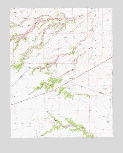
Myers Canyon, CO USGS Topographic Map
Click on map above to begin viewing in our Map Viewer.

This topographic map contains these locations and features:
Feature Name Type Latitude Longitude GNIS ID View Map
A Bar RanchLocaleN37.7667°W104.3214°194159View Map
Averson SpringSpringN37.7589°W104.2889°194158View Map
Baxter ReservoirReservoirN37.8431°W104.3449°194178View Map
Big Flannery ReservoirReservoirN37.7697°W104.2608°194161View Map
Blue HillSummitN37.7953°W104.3211°194163View Map
Cable ReservoirReservoirN37.8347°W104.3192°194175View Map
Cactus Flat WindmillLocaleN37.7964°W104.2616°194164View Map
Canyon ReservoirReservoirN37.8280°W104.3550°194173View Map
Cedar CrestPopulated PlaceN37.8070°W104.2986°194168View Map
Cottonwood SpringSpringN37.8739°W104.2730°194180View Map
El Hondo SpringSpringN37.8464°W104.3086°194177View Map
Federal ReservoirReservoirN37.8304°W104.3414°194174View Map
Flannery WindmillLocaleN37.7653°W104.2583°194160View Map
Iron SpringSpringN37.8533°W104.2764°194179View Map
Knowlton RanchLocaleN37.7972°W104.3025°194162View Map
Log House ReservoirReservoirN37.8204°W104.3314°194170View Map
Lone Jack CanyonValleyN37.8642°W104.3043°194114View Map
Madden CanyonValleyN37.8677°W104.2791°194113View Map
Mayer ReservoirReservoirN37.8707°W104.3705°194184View Map
Myers CampLocaleN37.8370°W104.2766°194176View Map
Myers SpringSpringN37.8150°W104.2997°194169View Map
Nevitt SpringSpringN37.8017°W104.3352°194165View Map
Oscar SpringSpringN37.8581°W104.3536°194182View Map
Prairie Dog ReservoirReservoirN37.8577°W104.3610°194183View Map
Railroad Fill ReservoirReservoirN37.7902°W104.3711°194167View Map
Rikoff ReservoirReservoirN37.8028°W104.3689°194166View Map
Robins CanyonValleyN37.8655°W104.3251°194112View Map
Spurlock RanchLocaleN37.8695°W104.3097°194181View Map
Whiskey SpringSpringN37.8267°W104.3569°194172View Map

Note: Coordinates in the location and feature list above are referenced to NAD83 datum.


Copyright (C) 2008-2025 Ryan Niemi / Sunset Dynamics ... All Rights Reserved