TopoQuest Logo
Do you find TopoQuest useful?
Help keep TopoQuest running and adding new maps/features by donating!
Bitcoin:  19c7KJd3qBynnjoSw5npx9KScwjBe4ifkT
Litecoin:  LXs6TkuXGGXo1vDsWCkWVdjQX94eUKd6ui
Home View Maps Find Maps Find Places Resources & Links


Red Top Ranch, Colorado Topographic Map

USGS Map Title: Red Top Ranch, CO
USGS Map MRC: 37104H3
DRG (GeoTIFF) Download: o37104h3.tif


Neighboring USGS Topographic Map Quads:


  Doyle Bridge, CO  
38104A4
 

  Chicos Well, CO  
38104A3
 

  Flying A Ranch, CO  
38104A2
 

  Hog Ranch Canyon, CO  
37104H4
 

  Red Top Ranch, CO  
37104H3
 

  Yellowbank Creek, CO  
37104H2
 

  North Rattlesnake Butte, CO  
37104G4
 

  Myers Canyon, CO  
37104G3
 

  Sanford Hills, CO  
37104G2


Map MRC Location:

N38°
W105°
N38°
W104°
H8 H7 H6 H5 H4 H3 H2 H1
G8 G7 G6 G5 G4 G3 G2 G1
F8 F7 F6 F5 F4 F3 F2 F1
E8 E7 E6 E5 E4 E3 E2 E1
D8 D7 D6 D5 D4 D3 D2 D1
C8 C7 C6 C5 C4 C3 C2 C1
B8 B7 B6 B5 B4 B3 B2 B1
A8 A7 A6 A5 A4 A3 A2 A1
N37°
W105°
N37°
W104°

Red Top Ranch, CO USGS 1:24K Topographic Map Preview:
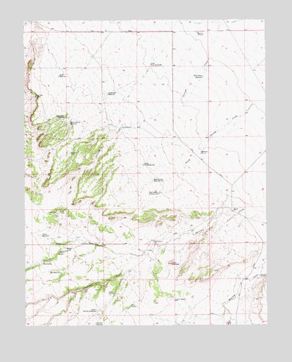
Red Top Ranch, CO USGS Topographic Map
Click on map above to begin viewing in our Map Viewer.

This topographic map contains these locations and features:
Feature Name Type Latitude Longitude GNIS ID View Map
Airy SpringSpringN37.8831°W104.3211°194018View Map
Big Flat WindmillLocaleN37.9950°W104.2855°193999View Map
Cone PinnacleSummitN37.9003°W104.3000°194016View Map
Division WindmillLocaleN37.8853°W104.2986°194019View Map
Doyle ReservoirReservoirN37.9773°W104.3573°193994View Map
Fee WindmillLocaleN37.9097°W104.3094°194015View Map
Freds CampLocaleN37.9214°W104.3591°194002View Map
Jack WindmillLocaleN37.9564°W104.3255°194003View Map
Kierce ReservoirReservoirN37.9121°W104.3668°194009View Map
Little Twin Dump ReservoirReservoirN37.9814°W104.3101°193997View Map
Lower Peterson ReservoirReservoirN37.8813°W104.3389°194013View Map
McElhaney CanyonValleyN37.9087°W104.3025°193992View Map
McElhaney WindmillLocaleN37.9089°W104.3394°194010View Map
Myers CanyonValleyN37.8774°W104.2697°194022View Map
Peck ReservoirReservoirN37.8975°W104.3627°194012View Map
Peck SpringSpringN37.9006°W104.3661°194011View Map
Peterson ReservoirReservoirN37.8759°W104.3393°194014View Map
Peterson WindmillLocaleN37.8886°W104.3294°194017View Map
Plum CreekStreamN37.8783°W104.2694°194171View Map
Red Top RanchLocaleN37.9220°W104.2677°194008View Map
Sanford WindmillLocaleN37.8953°W104.2541°194020View Map
School Section ReservoirReservoirN37.9578°W104.3518°194001View Map
South Studebaker ReservoirReservoirN37.9410°W104.3137°194004View Map
Studebaker ReservoirReservoirN37.9698°W104.3324°193998View Map
Twin Dump ReservoirReservoirN37.9766°W104.2831°194000View Map
Upper Doyle ReservoirReservoirN37.9599°W104.3546°193996View Map
Upper Doyle WindmillLocaleN37.9692°W104.3697°193995View Map
West Pasture Reservoir Number 1ReservoirN37.9345°W104.3091°194005View Map
West Pasture Reservoir Number 2ReservoirN37.9295°W104.3056°194006View Map

Note: Coordinates in the location and feature list above are referenced to NAD83 datum.


Copyright (C) 2008-2025 Ryan Niemi / Sunset Dynamics ... All Rights Reserved