TopoQuest Logo
Do you find TopoQuest useful?
Help keep TopoQuest running and adding new maps/features by donating!
Bitcoin:  19c7KJd3qBynnjoSw5npx9KScwjBe4ifkT
Litecoin:  LXs6TkuXGGXo1vDsWCkWVdjQX94eUKd6ui
Home View Maps Find Maps Find Places Resources & Links


Myrtle, Minnesota Topographic Map

USGS Map Title: Myrtle, MN
USGS Map MRC: 43093E2
DRG (GeoTIFF) Download: o43093e2.tif


Neighboring USGS Topographic Map Quads:


  Albert Lea East, MN  
43093F3
 

  Hayward, MN  
43093F2
 

  Austin West, MN  
43093F1
 

  Glenville, MN  
43093E3
 

  Myrtle, MN  
43093E2
 

  London, MN  
43093E1
 

  Fertile NE, IA  
43093D3
 

  Northwood, IA  
43093D2
 

  Carpenter, IA  
43093D1


Map MRC Location:

N44°
W94°
N44°
W93°
H8 H7 H6 H5 H4 H3 H2 H1
G8 G7 G6 G5 G4 G3 G2 G1
F8 F7 F6 F5 F4 F3 F2 F1
E8 E7 E6 E5 E4 E3 E2 E1
D8 D7 D6 D5 D4 D3 D2 D1
C8 C7 C6 C5 C4 C3 C2 C1
B8 B7 B6 B5 B4 B3 B2 B1
A8 A7 A6 A5 A4 A3 A2 A1
N43°
W94°
N43°
W93°

Myrtle, MN USGS 1:24K Topographic Map Preview:
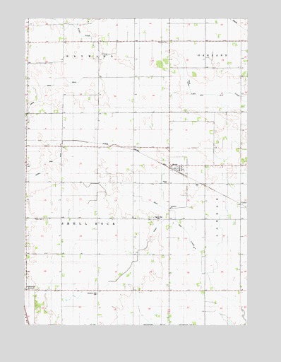
Myrtle, MN USGS Topographic Map
Click on map above to begin viewing in our Map Viewer.

This topographic map contains these locations and features:
Feature Name Type Latitude Longitude GNIS ID View Map
Barron SchoolSchoolN43.5733°W93.1896°639648View Map
Benesh SchoolSchoolN43.6055°W93.1496°639916View Map
Bethlehem ChurchChurchN43.5483°W93.1683°640056View Map
Bohemian CemeteryCemeteryN43.6152°W93.1694°640333View Map
City of MyrtleCivilN43.5631°W93.1631°2395145View Map
Corner SchoolSchoolN43.5725°W93.2494°641510View Map
County Ditch Number FortynineCanalN43.5652°W93.2399°1817609View Map
County Ditch Number SeventyoneCanalN43.5436°W93.1660°1817610View Map
Danish CemeteryCemeteryN43.5583°W93.1696°642624View Map
Davis SchoolSchoolN43.5138°W93.1491°642654View Map
Funfar SchoolSchoolN43.6016°W93.1885°643992View Map
Judicial Ditch Number TwentyCanalN43.5969°W93.2396°1817608View Map
Kestner CemeteryCemeteryN43.6083°W93.1585°2049896View Map
Kirk SchoolSchoolN43.6000°W93.2480°646180View Map
KQPR-FM (Albert Lea)TowerN43.6161°W93.2133°663003View Map
Krikva CemeteryCemeteryN43.6083°W93.2099°2049895View Map
Lao SchoolSchoolN43.5147°W93.2124°646492View Map
Mockingbird Hill CemeteryCemeteryN43.5575°W93.1302°2049889View Map
MyrtlePopulated PlaceN43.5644°W93.1635°648414View Map
MyrtleLocaleN43.5630°W93.1641°2049698View Map
Myrtle Fire DepartmentBuildingN43.5642°W93.1638°2666286View Map
Myrtle MuseumBuildingN43.5638°W93.1641°2049697View Map
Myrtle Post OfficePost OfficeN43.5644°W93.1635°2049696View Map
Nelson SchoolSchoolN43.6161°W93.2221°648471View Map
Pilgrims Rest CemeteryCemeteryN43.5430°W93.1752°649422View Map
Schilling SchoolSchoolN43.5500°W93.1280°651285View Map
Township of Shell RockCivilN43.5419°W93.2272°665590View Map
Wanders Rest CemeteryCemeteryN43.5133°W93.2096°653762View Map
Will SchoolSchoolN43.5438°W93.1933°654157View Map

Note: Coordinates in the location and feature list above are referenced to NAD83 datum.


Copyright (C) 2008-2024 Ryan Niemi / Sunset Dynamics ... All Rights Reserved