TopoQuest Logo
Do you find TopoQuest useful?
Help keep TopoQuest running and adding new maps/features by donating!
Bitcoin:  19c7KJd3qBynnjoSw5npx9KScwjBe4ifkT
Litecoin:  LXs6TkuXGGXo1vDsWCkWVdjQX94eUKd6ui
Home View Maps Find Maps Find Places Resources & Links


Hayward, Minnesota Topographic Map

USGS Map Title: Hayward, MN
USGS Map MRC: 43093F2
DRG (GeoTIFF) Download: o43093f2.tif


Neighboring USGS Topographic Map Quads:


  Ellendale, MN  
43093G3
 

  Hollandale, MN  
43093G2
 

  Blooming Prairie, MN  
43093G1
 

  Albert Lea East, MN  
43093F3
 

  Hayward, MN  
43093F2
 

  Austin West, MN  
43093F1
 

  Glenville, MN  
43093E3
 

  Myrtle, MN  
43093E2
 

  London, MN  
43093E1


Map MRC Location:

N44°
W94°
N44°
W93°
H8 H7 H6 H5 H4 H3 H2 H1
G8 G7 G6 G5 G4 G3 G2 G1
F8 F7 F6 F5 F4 F3 F2 F1
E8 E7 E6 E5 E4 E3 E2 E1
D8 D7 D6 D5 D4 D3 D2 D1
C8 C7 C6 C5 C4 C3 C2 C1
B8 B7 B6 B5 B4 B3 B2 B1
A8 A7 A6 A5 A4 A3 A2 A1
N43°
W94°
N43°
W93°

Hayward, MN USGS 1:24K Topographic Map Preview:
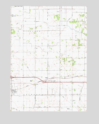
Hayward, MN USGS Topographic Map
Click on map above to begin viewing in our Map Viewer.

This topographic map contains these locations and features:
Feature Name Type Latitude Longitude GNIS ID View Map
Albert Lea - Austin KampgroundLocaleN43.6611°W93.1835°2049822View Map
Bell SchoolSchoolN43.7022°W93.2094°639882View Map
Campbell SchoolSchoolN43.6663°W93.2277°640855View Map
City of HaywardCivilN43.6500°W93.2460°2394338View Map
County Ditch Number FortysevenCanalN43.6302°W93.1919°1817603View Map
County Ditch Number TwelveCanalN43.6447°W93.1946°1817602View Map
Crook SchoolSchoolN43.7383°W93.2391°642454View Map
Deer CreekStreamN43.7422°W93.1663°642709View Map
Deveraux SchoolSchoolN43.6769°W93.1899°642780View Map
Fairview CemeteryCemeteryN43.6888°W93.1294°643505View Map
HaywardPopulated PlaceN43.6505°W93.2441°644798View Map
HaywardLocaleN43.6500°W93.2446°2049818View Map
Hayward CemeteryCemeteryN43.6444°W93.2430°2049894View Map
Hayward Fire DepartmentBuildingN43.6476°W93.2437°2666296View Map
Hayward Lutheran ChurchChurchN43.6488°W93.2444°2049821View Map
Hayward Post OfficePost OfficeN43.6505°W93.2441°2049819View Map
Hillside CemeteryCemeteryN43.6669°W93.1571°644998View Map
Holiday Park Gold CourseLocaleN43.6613°W93.1913°2049820View Map
Hollandale JunctionPopulated PlaceN43.6636°W93.1894°654758View Map
Interchange 163CrossingN43.6652°W93.2485°2049882View Map
Interchange 166CrossingN43.6611°W93.1960°2049881View Map
Judicial Ditch Number EighteenCanalN43.7097°W93.2441°1817605View Map
KAAL-TV (Austin)TowerN43.6283°W93.1535°663144View Map
KAUS-FM (Austin)TowerN43.6283°W93.1535°663011View Map
Lee SchoolSchoolN43.7100°W93.1583°646575View Map
Lyle SchoolSchoolN43.6516°W93.1491°647320View Map
Moscow CemeteryCemeteryN43.7313°W93.1294°2049899View Map
Moscow ChurchChurchN43.7316°W93.1294°1817606View Map
MucklandPopulated PlaceN43.7447°W93.1891°654837View Map
Oakland ChurchChurchN43.6736°W93.1683°648875View Map
Oakland Lutheran CemeteryCemeteryN43.6733°W93.1685°2049898View Map
PetranPopulated PlaceN43.6566°W93.2091°649339View Map
Saint Pauls CemeteryCemeteryN43.7391°W93.2485°650978View Map
Seventh-day Adventist CemeteryCemeteryN43.7386°W93.2494°1817601View Map
SigsbeePopulated PlaceN43.6933°W93.2088°654942View Map
Sigsbee Post Office (historical)Post OfficeN43.6933°W93.2088°2049704View Map
South HollandalePopulated PlaceN43.7208°W93.1896°654949View Map
Stoa SchoolSchoolN43.7325°W93.1360°652645View Map
Sumner SchoolSchoolN43.6841°W93.1524°652802View Map
Township of HaywardCivilN43.6295°W93.2287°664429View Map
Township of RicelandCivilN43.7168°W93.2293°665408View Map
Twin GrovePopulated PlaceN43.7027°W93.1883°654981View Map

Note: Coordinates in the location and feature list above are referenced to NAD83 datum.


Copyright (C) 2008-2024 Ryan Niemi / Sunset Dynamics ... All Rights Reserved