TopoQuest Logo
Do you find TopoQuest useful?
Help keep TopoQuest running and adding new maps/features by donating!
Bitcoin:  19c7KJd3qBynnjoSw5npx9KScwjBe4ifkT
Litecoin:  LXs6TkuXGGXo1vDsWCkWVdjQX94eUKd6ui
Home View Maps Find Maps Find Places Resources & Links


N Bar Coulee, Montana Topographic Map

USGS Map Title: N Bar Coulee, MT
USGS Map MRC: 46106E1
DRG (GeoTIFF) Download: o46106e1.tif


Neighboring USGS Topographic Map Quads:


  Angela, MT  
46106F2
 

  Angela NE, MT  
46106F1
 

  Horse Creek Hill, MT  
46105F8
 

  Hobo Coulee, MT  
46106E2
 

  N Bar Coulee, MT  
46106E1
 

  Deadman Creek, MT  
46105E8
 

  Hathaway NW, MT  
46106D2
 

  Butterfly Creek, MT  
46106D1
 

  Big Hill, MT  
46105D8


Map MRC Location:

N47°
W107°
N47°
W106°
H8 H7 H6 H5 H4 H3 H2 H1
G8 G7 G6 G5 G4 G3 G2 G1
F8 F7 F6 F5 F4 F3 F2 F1
E8 E7 E6 E5 E4 E3 E2 E1
D8 D7 D6 D5 D4 D3 D2 D1
C8 C7 C6 C5 C4 C3 C2 C1
B8 B7 B6 B5 B4 B3 B2 B1
A8 A7 A6 A5 A4 A3 A2 A1
N46°
W107°
N46°
W106°

N Bar Coulee, MT USGS 1:24K Topographic Map Preview:
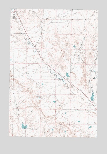
N Bar Coulee, MT USGS Topographic Map
Click on map above to begin viewing in our Map Viewer.

This topographic map contains these locations and features:
Feature Name Type Latitude Longitude GNIS ID View Map
10N45E28BBBA01 WellWellN46.6006°W106.0800°817052View Map
10N45E28BBBA02 WellWellN46.5997°W106.0797°817046View Map
10N45E28BBBB01 WellWellN46.6006°W106.0806°817053View Map
Alkali CreekStreamN46.6153°W106.0725°801987View Map
Brewer Number 2 DamDamN46.5100°W106.0106°802252View Map
Grimes CreekStreamN46.5950°W106.0997°805873View Map
Harding Number 1 DamDamN46.5083°W106.0889°802250View Map
Harding Number 2 DamDamN46.5067°W106.0639°802251View Map
N Bar CouleeValleyN46.5578°W106.0478°802152View Map
Owens CouleeValleyN46.5344°W106.0153°802160View Map
Stone Shack (historical)LocaleN46.6008°W106.0820°1716837View Map
Stone Shack Post Office (historical)Post OfficeN46.6008°W106.0820°1716838View Map
Venn Number 1 DamDamN46.5417°W106.0089°802245View Map
Venn Number 4 DamDamN46.5883°W106.0356°802246View Map
Venn Number 7 DamDamN46.5617°W106.0439°802247View Map
Venn Number 8 DamDamN46.5650°W106.0039°802248View Map
Venn Number 9 DamDamN46.5350°W106.0622°802249View Map
Venn RanchLocaleN46.5328°W106.0103°802225View Map

Note: Coordinates in the location and feature list above are referenced to NAD83 datum.


Copyright (C) 2008-2025 Ryan Niemi / Sunset Dynamics ... All Rights Reserved