TopoQuest Logo
Do you find TopoQuest useful?
Help keep TopoQuest running and adding new maps/features by donating!
Bitcoin:  19c7KJd3qBynnjoSw5npx9KScwjBe4ifkT
Litecoin:  LXs6TkuXGGXo1vDsWCkWVdjQX94eUKd6ui
Home View Maps Find Maps Find Places Resources & Links


Horse Creek Hill, Montana Topographic Map

USGS Map Title: Horse Creek Hill, MT
USGS Map MRC: 46105F8
DRG (GeoTIFF) Download: o46105f8.tif


Neighboring USGS Topographic Map Quads:


  Crow Rock SE, MT  
46106G1
 

  Twin Buttes School, MT  
46105G8
 

  Morehouse Creek, MT  
46105G7
 

  Angela NE, MT  
46106F1
 

  Horse Creek Hill, MT  
46105F8
 

  Coal Bank Spring, MT  
46105F7
 

  N Bar Coulee, MT  
46106E1
 

  Deadman Creek, MT  
46105E8
 

  Noble Reservoir, MT  
46105E7


Map MRC Location:

N47°
W106°
N47°
W105°
H8 H7 H6 H5 H4 H3 H2 H1
G8 G7 G6 G5 G4 G3 G2 G1
F8 F7 F6 F5 F4 F3 F2 F1
E8 E7 E6 E5 E4 E3 E2 E1
D8 D7 D6 D5 D4 D3 D2 D1
C8 C7 C6 C5 C4 C3 C2 C1
B8 B7 B6 B5 B4 B3 B2 B1
A8 A7 A6 A5 A4 A3 A2 A1
N46°
W106°
N46°
W105°

Horse Creek Hill, MT USGS 1:24K Topographic Map Preview:
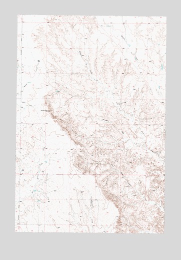
Horse Creek Hill, MT USGS Topographic Map
Click on map above to begin viewing in our Map Viewer.

This topographic map contains these locations and features:
Feature Name Type Latitude Longitude GNIS ID View Map
10N46E06DBCC01 WellWellN46.6481°W105.9861°817455View Map
10N46E06DBCC02 WellWellN46.6481°W105.9861°817456View Map
10N46E08CCCC01 WellWellN46.6303°W105.9747°817271View Map
11N46E07CBCB01 WellWellN46.7211°W105.9958°817960View Map
11N46E07CBCC01 WellWellN46.7197°W105.9961°817954View Map
11N46E07DBAB01 WellWellN46.7236°W105.9833°817969View Map
11N46E09BDBB01 WellWellN46.7269°W105.9478°817986View Map
11N46E17BABC01 WellWellN46.7150°W105.9695°817924View Map
11N46E19BBDB01 WellWellN46.6994°W105.9939°817842View Map
11N46E31CCBD01 WellWellN46.6606°W105.9950°817551View Map
11N46E31DDDB01 WellWellN46.6600°W105.9786°817541View Map
11N46E33CCAB01 WellWellN46.6619°W105.9514°817570View Map
22N46E21DC__10 WellWellN46.6892°W105.9411°817795View Map
Cap Rock Number 1 DamDamN46.7200°W105.8789°796321View Map
Clevenger SpringSpringN46.6996°W105.9133°769932View Map
Hilcrest (historical)Populated PlaceN46.6431°W105.9750°1716874View Map
Hillcrest Post Office (historical)Post OfficeN46.6431°W105.9750°1716875View Map
Horse Creek HillSummitN46.6947°W105.9733°772557View Map
Meredith Post Office (historical)Post OfficeN46.7083°W105.9867°1716857View Map
Thompson CreekStreamN46.6747°W105.8914°777577View Map

Note: Coordinates in the location and feature list above are referenced to NAD83 datum.


Copyright (C) 2008-2025 Ryan Niemi / Sunset Dynamics ... All Rights Reserved