TopoQuest Logo
Do you find TopoQuest useful?
Help keep TopoQuest running and adding new maps/features by donating!
Bitcoin:  19c7KJd3qBynnjoSw5npx9KScwjBe4ifkT
Litecoin:  LXs6TkuXGGXo1vDsWCkWVdjQX94eUKd6ui
Home View Maps Find Maps Find Places Resources & Links


Belknap Creek, Wyoming Topographic Map

USGS Map Title: Belknap Creek, WY
USGS Map MRC: 44109C3
DRG (GeoTIFF) Download: o44109c3.tif


Neighboring USGS Topographic Map Quads:


  Wapiti, WY  
44109D4
 

  Castle Rock Creek, WY  
44109D3
 

  Irma Flats, WY  
44109D2
 

  Twin Creek, WY  
44109C4
 

  Belknap Creek, WY  
44109C3
 

  Devils Tooth, WY  
44109C2
 

  Aldrich Basin, WY  
44109B4
 

  North Fork Pickett Creek, WY  
44109B3
 

  Thomas Reservoir, WY  
44109B2


Map MRC Location:

N45°
W110°
N45°
W109°
H8 H7 H6 H5 H4 H3 H2 H1
G8 G7 G6 G5 G4 G3 G2 G1
F8 F7 F6 F5 F4 F3 F2 F1
E8 E7 E6 E5 E4 E3 E2 E1
D8 D7 D6 D5 D4 D3 D2 D1
C8 C7 C6 C5 C4 C3 C2 C1
B8 B7 B6 B5 B4 B3 B2 B1
A8 A7 A6 A5 A4 A3 A2 A1
N44°
W110°
N44°
W109°

Belknap Creek, WY USGS 1:24K Topographic Map Preview:
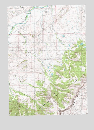
Belknap Creek, WY USGS Topographic Map
Click on map above to begin viewing in our Map Viewer.

This topographic map contains these locations and features:
Feature Name Type Latitude Longitude GNIS ID View Map
Belknap CreekStreamN44.3530°W109.3627°1598094View Map
Belknap Creek Number 1 DamDamN44.2983°W109.3040°1607670View Map
Belknap Creek Number 1 ReservoirReservoirN44.2966°W109.3055°1607671View Map
Belknap Creek Number 4 DamDamN44.3050°W109.3074°1607668View Map
Belknap Creek Number 4 ReservoirReservoirN44.3050°W109.3074°1607669View Map
Belknap Creek Number 5 DamDamN44.3100°W109.3224°1607820View Map
Belknap Creek Number 5 ReservoirReservoirN44.3100°W109.3208°1607821View Map
Belknap RanchLocaleN44.3450°W109.3549°1598095View Map
Big Wind MineMineN44.3000°W109.3507°1725940View Map
Carter Mountain Weather StationLocaleN44.2952°W109.3104°1604664View Map
Coe LodgeLocaleN44.3286°W109.2554°1598839View Map
Deer CreekStreamN44.3727°W109.3296°1599202View Map
East Fork Rock CreekStreamN44.2819°W109.3735°1599487View Map
Irma LakeReservoirN44.3302°W109.2570°1600525View Map
Irma Lake DamDamN44.3316°W109.2557°1607736View Map
Jordan CreekStreamN44.3427°W109.3729°1600661View Map
Lakeview DitchCanalN44.3550°W109.3360°1600817View Map
Lily LakeLakeN44.3264°W109.2519°1600913View Map
Middle Fork Rock CreekStreamN44.2738°W109.3699°1601409View Map
Pelcher RanchLocaleN44.3336°W109.3738°1602078View Map
Swan Creek Number 2 DamDamN44.3366°W109.2624°1607826View Map
Swan Creek Number 2 ReservoirReservoirN44.3366°W109.2618°1607827View Map
Swan Creek Number 7 DamDamN44.3333°W109.3290°1607666View Map
Swan Creek Number 7 ReservoirReservoirN44.3333°W109.3290°1607667View Map
Timber CreekStreamN44.3677°W109.3399°1604513View Map
Wapiti Valley CemeteryCemeteryN44.3413°W109.3607°2774451View Map
West Fork Rock CreekStreamN44.2736°W109.3696°1604071View Map
Willow CreekStreamN44.3733°W109.3121°1604199View Map

Note: Coordinates in the location and feature list above are referenced to NAD83 datum.


Copyright (C) 2008-2025 Ryan Niemi / Sunset Dynamics ... All Rights Reserved