TopoQuest Logo
Do you find TopoQuest useful?
Help keep TopoQuest running and adding new maps/features by donating!
Bitcoin:  19c7KJd3qBynnjoSw5npx9KScwjBe4ifkT
Litecoin:  LXs6TkuXGGXo1vDsWCkWVdjQX94eUKd6ui
Home View Maps Find Maps Find Places Resources & Links


Wapiti, Wyoming Topographic Map

USGS Map Title: Wapiti, WY
USGS Map MRC: 44109D4
DRG (GeoTIFF) Download: o44109d4.tif


Neighboring USGS Topographic Map Quads:


  Dead Indian Peak, WY  
44109E5
 

  Jim Mountain, WY  
44109E4
 

  Logan Mountain, WY  
44109E3
 

  Flag Peak, WY  
44109D5
 

  Wapiti, WY  
44109D4
 

  Castle Rock Creek, WY  
44109D3
 

  Ptarmigan Mountain, WY  
44109C5
 

  Twin Creek, WY  
44109C4
 

  Belknap Creek, WY  
44109C3


Map MRC Location:

N45°
W110°
N45°
W109°
H8 H7 H6 H5 H4 H3 H2 H1
G8 G7 G6 G5 G4 G3 G2 G1
F8 F7 F6 F5 F4 F3 F2 F1
E8 E7 E6 E5 E4 E3 E2 E1
D8 D7 D6 D5 D4 D3 D2 D1
C8 C7 C6 C5 C4 C3 C2 C1
B8 B7 B6 B5 B4 B3 B2 B1
A8 A7 A6 A5 A4 A3 A2 A1
N44°
W110°
N44°
W109°

Wapiti, WY USGS 1:24K Topographic Map Preview:
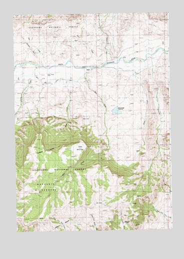
Wapiti, WY USGS Topographic Map
Click on map above to begin viewing in our Map Viewer.

This topographic map contains these locations and features:
Feature Name Type Latitude Longitude GNIS ID View Map
Bi Ho Ba Girl Scout CampLocaleN44.4263°W109.4232°1598128View Map
Bradford RanchLocaleN44.4694°W109.4821°1598349View Map
Breteche CreekStreamN44.4752°W109.3902°1598366View Map
Chinese WallRidgeN44.4777°W109.4854°1598745View Map
Dahlem RanchLocaleN44.4599°W109.3868°1599106View Map
Diamond Bar Cow CampLocaleN44.3799°W109.4160°1599239View Map
Dunn CreekStreamN44.4697°W109.4349°1599423View Map
Flying L Skytel Airport (historical)AirportN44.4661°W109.4735°1604675View Map
Frost DamDamN44.4399°W109.4991°1607662View Map
Frost ReservoirReservoirN44.4399°W109.4991°1607663View Map
Green CreekStreamN44.4708°W109.4802°1600069View Map
Jim CreekStreamN44.4713°W109.4246°1600616View Map
North Fork Valley DitchCanalN44.4602°W109.4718°1601827View Map
Park County Fire Protection District 2 Station 4 Wapiti ValleyBuildingN44.4734°W109.4213°2673592View Map
Rand CreekStreamN44.4697°W109.4524°1602385View Map
River Rest ResortLocaleN44.4727°W109.4157°1602543View Map
Slack CreekStreamN44.4733°W109.3968°1602961View Map
Stonebridge DamDamN44.4416°W109.4224°1607664View Map
Stonebridge ReservoirReservoirN44.4434°W109.4177°1603380View Map
Table MountainSummitN44.4230°W109.4493°1603511View Map
Table Mountain TrailTrailN44.4049°W109.4960°1608726View Map
Wall CreekStreamN44.4702°W109.4704°1603963View Map
WapitiPopulated PlaceN44.4686°W109.4377°1603972View Map
Wapiti Elementary SchoolSchoolN44.4663°W109.4416°1795589View Map
Wapiti Valley Church CemeteryCemeteryN44.4620°W109.4495°2774454View Map
Whit CreekStreamN44.4688°W109.4435°1604134View Map

Note: Coordinates in the location and feature list above are referenced to NAD83 datum.


Copyright (C) 2008-2025 Ryan Niemi / Sunset Dynamics ... All Rights Reserved