TopoQuest Logo
Do you find TopoQuest useful?
Help keep TopoQuest running and adding new maps/features by donating!
Bitcoin:  19c7KJd3qBynnjoSw5npx9KScwjBe4ifkT
Litecoin:  LXs6TkuXGGXo1vDsWCkWVdjQX94eUKd6ui
Home View Maps Find Maps Find Places Resources & Links


Bell Farm, Kentucky Topographic Map

USGS Map Title: Bell Farm, KY
USGS Map MRC: 36084F6
DRG (GeoTIFF) Download: o36084f6.tif


Neighboring USGS Topographic Map Quads:


  Monticello, KY  
36084G7
 

  Coopersville, KY  
36084G6
 

  Nevelsville, KY  
36084G5
 

  Parmleysville, KY  
36084F7
 

  Bell Farm, KY  
36084F6
 

  Barthell, KY  
36084F5
 

  Sharp Place, TN  
36084E7
 

  Barthell SW, TN  
36084E6
 

  Oneida North, TN  
36084E5


Map MRC Location:

N37°
W85°
N37°
W84°
H8 H7 H6 H5 H4 H3 H2 H1
G8 G7 G6 G5 G4 G3 G2 G1
F8 F7 F6 F5 F4 F3 F2 F1
E8 E7 E6 E5 E4 E3 E2 E1
D8 D7 D6 D5 D4 D3 D2 D1
C8 C7 C6 C5 C4 C3 C2 C1
B8 B7 B6 B5 B4 B3 B2 B1
A8 A7 A6 A5 A4 A3 A2 A1
N36°
W85°
N36°
W84°

Bell Farm, KY USGS 1:24K Topographic Map Preview:
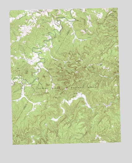
Bell Farm, KY USGS Topographic Map
Click on map above to begin viewing in our Map Viewer.

This topographic map contains these locations and features:
Feature Name Type Latitude Longitude GNIS ID View Map
Anderson CemeteryCemeteryN36.7423°W84.7423°2568734View Map
Backbone RidgeRidgeN36.6804°W84.6783°486186View Map
Barrier CemeteryCemeteryN36.7440°W84.7372°510421View Map
Barrier Cemetery Number 2CemeteryN36.7477°W84.7284°2568737View Map
Bawley FordCrossingN36.7392°W84.6941°2568738View Map
Bell CemeteryCemeteryN36.7248°W84.7060°510538View Map
Bell CemeteryCemeteryN36.7301°W84.7341°510539View Map
Bell FarmLocaleN36.6715°W84.6727°510540View Map
Bell Farm Horse CampLocaleN36.6695°W84.6683°516593View Map
Bell Farm Post Office (historical)Post OfficeN36.6713°W84.6731°2558376View Map
Bell HillSummitN36.7201°W84.6927°510541View Map
Bell Hill SchoolSchoolN36.7240°W84.6994°510542View Map
Bertram MountainSummitN36.7487°W84.6966°510564View Map
Big CliffCliffN36.6715°W84.7091°510637View Map
Burke-Kidd CemeteryCemeteryN36.7407°W84.6900°2568753View Map
Burkes BranchStreamN36.7398°W84.6730°511076View Map
Burkes CemeteryCemeteryN36.7370°W84.6797°511077View Map
Burkes CreekStreamN36.7387°W84.6755°511078View Map
Carl Kidd GraveyardCemeteryN36.7359°W84.6951°2568761View Map
Chimney RockPillarN36.6915°W84.7316°511348View Map
Co-operative DivisionCivilN36.6907°W84.6274°1936946View Map
Co-operative Post Office (historical)Post OfficeN36.6886°W84.6264°2558375View Map
Criswell CemeteryCemeteryN36.7226°W84.7419°511641View Map
David L Crownshed GraveCemeteryN36.7500°W84.7210°2568784View Map
Deer LoopTrailN36.6467°W84.7272°516602View Map
Denney FordCrossingN36.7222°W84.7029°2568787View Map
Denney Pumping StationLocaleN36.7166°W84.7098°2568789View Map
Denny Farm CemeteryCemeteryN36.7150°W84.7030°2568790View Map
Dobbs HillSummitN36.6976°W84.6466°511839View Map
Dobbs HollowValleyN36.7169°W84.7084°511841View Map
Dobbs School (historical)SchoolN36.7079°W84.7320°2568793View Map
Dolen BranchStreamN36.6615°W84.6627°511858View Map
Dolen MountainSummitN36.6412°W84.6961°511859View Map
Dolen SchoolSchoolN36.6679°W84.6788°511860View Map
Foster CemeteryCemeteryN36.7212°W84.6630°512220View Map
Foster HollowValleyN36.7240°W84.6736°512221View Map
Foster MountainSummitN36.6962°W84.7436°512222View Map
Frank MountainSummitN36.7406°W84.7130°512239View Map
Fred HollowValleyN36.7005°W84.6873°512243View Map
Full HollowValleyN36.7266°W84.7052°512263View Map
Grant Roberts CemeteryCemeteryN36.7429°W84.7217°2568817View Map
Great Meadow CampgroundLocaleN36.6326°W84.7277°517073View Map
Green FordCrossingN36.6818°W84.7272°2568818View Map
Green Ford ChurchChurchN36.6806°W84.7274°512433View Map
Gregory BranchStreamN36.7048°W84.7324°512455View Map
Gregory CemeteryCemeteryN36.7240°W84.7409°2568819View Map
Gregory Post Office (historical)Post OfficeN36.6612°W84.6363°2558377View Map
GriffinPopulated PlaceN36.7045°W84.7288°512459View Map
Griffin CemeteryCemeteryN36.7126°W84.7110°512461View Map
Griffin Oil Pool (historical)LocaleN36.6947°W84.7268°2568822View Map
Griffin Post Office (historical)Post OfficeN36.7057°W84.7287°2568823View Map
Griffin School Number 2 (historical)SchoolN36.7080°W84.7307°2568824View Map
Hemlock Grove Camping AreaLocaleN36.6425°W84.7097°2558378View Map
Hemlock Grove Picnic AreaLocaleN36.6451°W84.7022°517072View Map
Hill CemeteryCemeteryN36.6598°W84.6591°512708View Map
Hollow RockPillarN36.6681°W84.6966°512750View Map
Huckleberry HollowValleyN36.6934°W84.7074°512827View Map
Huckleberry RidgeRidgeN36.6931°W84.6883°512830View Map
Jacksons Step-up MountainSummitN36.7309°W84.6633°512973View Map
John Barrier CemeteryCemeteryN36.7497°W84.7221°2568834View Map
Johnson ForkStreamN36.7479°W84.7274°513050View Map
Kennedy CreekStreamN36.7390°W84.6930°513121View Map
Laurel RidgeRidgeN36.6317°W84.6508°513262View Map
Lexton MountainSummitN36.6384°W84.6783°513368View Map
Lonesome CreekStreamN36.6770°W84.7369°513580View Map
Lonesome FordCrossingN36.6770°W84.7364°2568846View Map
Lonesome ValleyValleyN36.6772°W84.7370°2568847View Map
Middle CliffCliffN36.6798°W84.7086°513920View Map
Peter GapGapN36.7084°W84.6827°514513View Map
Phelps HollowValleyN36.6852°W84.7189°514527View Map
Phillips CemeteryCemeteryN36.7173°W84.7360°516594View Map
Pleasant Ridge ChurchChurchN36.6965°W84.6594°514647View Map
Puncheoncamp BranchStreamN36.6587°W84.6399°514797View Map
Racoon LoopTrailN36.6279°W84.7258°516603View Map
Rice MountainSummitN36.6934°W84.7324°514906View Map
Rigney-Gregory CemeteryCemeteryN36.7425°W84.7233°2568872View Map
Rocky BranchStreamN36.7454°W84.7133°515063View Map
Rocky Branch SchoolSchoolN36.7473°W84.7122°515068View Map
RockybranchPopulated PlaceN36.7351°W84.7333°515082View Map
Rockybranch Post Office (historical)Post OfficeN36.7343°W84.7332°2568876View Map
Ryan CemeteryCemeteryN36.7194°W84.7032°2568878View Map
Shearer- Dobbs CemeteryCemeteryN36.6959°W84.6610°515340View Map
Siles MountainSummitN36.7326°W84.7088°515411View Map
Skullbone Lookout TowerTowerN36.7331°W84.6413°517284View Map
Skullbones KnobSummitN36.7362°W84.6477°515458View Map
Slavans SchoolSchoolN36.7487°W84.6647°515481View Map
Smith CemeteryCemeteryN36.6495°W84.7035°503741View Map
Steele CemeteryCemeteryN36.6999°W84.7166°2568884View Map
Steele FordCrossingN36.7016°W84.7160°2568885View Map
Steele HollowValleyN36.6960°W84.7157°515682View Map
Steele Old Mill (historical)LocaleN36.6956°W84.7157°2568886View Map
Stillhouse HollowValleyN36.6823°W84.7173°515712View Map
Stone Dye BranchStreamN36.6873°W84.7036°515724View Map
The Caylor CemeteryCemeteryN36.7474°W84.7086°2568712View Map
The ChimneySummitN36.6704°W84.7177°515908View Map
The CutoffGapN36.7223°W84.6277°515910View Map
The Denny HollowValleyN36.7167°W84.7013°2568687View Map
The Frank SpringSpringN36.7464°W84.7092°2568689View Map
The Mill CliffCliffN36.7464°W84.7121°2568691View Map
The PilotSummitN36.6884°W84.7119°515917View Map
Turkey BranchStreamN36.6342°W84.7136°516043View Map
Watts BranchStreamN36.6576°W84.6558°516249View Map
Watts MountainSummitN36.6465°W84.6552°516252View Map
Wolf Ridge LookoverLocaleN36.7459°W84.6277°516452View Map
Wolf SchoolSchoolN36.7020°W84.6688°516454View Map

Note: Coordinates in the location and feature list above are referenced to NAD83 datum.


Copyright (C) 2008-2024 Ryan Niemi / Sunset Dynamics ... All Rights Reserved