TopoQuest Logo
Do you find TopoQuest useful?
Help keep TopoQuest running and adding new maps/features by donating!
Bitcoin:  19c7KJd3qBynnjoSw5npx9KScwjBe4ifkT
Litecoin:  LXs6TkuXGGXo1vDsWCkWVdjQX94eUKd6ui
Home View Maps Find Maps Find Places Resources & Links


Barthell SW, Tennessee Topographic Map

USGS Map Title: Barthell SW, TN
USGS Map MRC: 36084E6
DRG (GeoTIFF) Download: o36084e6.tif


Neighboring USGS Topographic Map Quads:


  Parmleysville, KY  
36084F7
 

  Bell Farm, KY  
36084F6
 

  Barthell, KY  
36084F5
 

  Sharp Place, TN  
36084E7
 

  Barthell SW, TN  
36084E6
 

  Oneida North, TN  
36084E5
 

  Stockton, TN  
36084D7
 

  Honey Creek, TN  
36084D6
 

  Oneida South, TN  
36084D5


Map MRC Location:

N37°
W85°
N37°
W84°
H8 H7 H6 H5 H4 H3 H2 H1
G8 G7 G6 G5 G4 G3 G2 G1
F8 F7 F6 F5 F4 F3 F2 F1
E8 E7 E6 E5 E4 E3 E2 E1
D8 D7 D6 D5 D4 D3 D2 D1
C8 C7 C6 C5 C4 C3 C2 C1
B8 B7 B6 B5 B4 B3 B2 B1
A8 A7 A6 A5 A4 A3 A2 A1
N36°
W85°
N36°
W84°

Barthell SW, TN USGS 1:24K Topographic Map Preview:
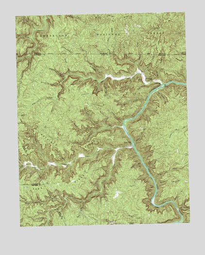
Barthell SW, TN USGS Topographic Map
Click on map above to begin viewing in our Map Viewer.

This topographic map contains these locations and features:
Feature Name Type Latitude Longitude GNIS ID View Map
Alder BranchStreamN36.5887°W84.7127°1327447View Map
Anderson Cave BranchStreamN36.5848°W84.6888°1327458View Map
Andy CreekStreamN36.5362°W84.7444°1327461View Map
Betty BranchStreamN36.5870°W84.6652°1327588View Map
Big BranchStreamN36.5723°W84.6547°1327599View Map
Big BranchStreamN36.6117°W84.7377°510626View Map
Big IslandIslandN36.5817°W84.6419°1327624View Map
Big South Fork National River and Recreation AreaParkN36.5347°W84.6651°1309762View Map
Bill BranchStreamN36.5006°W84.6319°1327639View Map
Black House BranchStreamN36.5159°W84.7152°1326907View Map
Black House CreekStreamN36.5887°W84.7130°1327649View Map
Blevins BranchStreamN36.5234°W84.6494°1327661View Map
Buffalo BranchStreamN36.6165°W84.7349°511037View Map
Bum CreekStreamN36.5740°W84.7208°1327760View Map
Burke KnobSummitN36.5848°W84.6613°1327766View Map
Burkes BranchStreamN36.5887°W84.6574°1327767View Map
Cecil ForkStreamN36.5145°W84.7022°1327857View Map
Charit CreekStreamN36.5365°W84.7272°1327875View Map
Charit Creek CampgroundLocaleN36.5373°W84.7266°1640775View Map
Chestnut RidgeRidgeN36.5987°W84.7030°511337View Map
Cold Spring BranchStreamN36.5792°W84.6477°1327952View Map
Commissioner District 7CivilN36.5364°W84.6389°2464640View Map
Craft BranchStreamN36.5826°W84.6552°1327988View Map
Dry BranchStreamN36.5892°W84.6599°1328076View Map
Duncan HollowValleyN36.5365°W84.6595°1328098View Map
Elva (historical)Populated PlaceN36.5848°W84.6458°1640776View Map
Fork RidgeRidgeN36.5245°W84.7119°1328214View Map
Gobblers KnobSummitN36.5667°W84.7477°1328280View Map
Grand BranchStreamN36.5367°W84.7127°1328295View Map
Harvey BranchStreamN36.5606°W84.6719°1328400View Map
Hatfield RidgeRidgeN36.5476°W84.7091°1328405View Map
Hollow Rock BranchStreamN36.5845°W84.7169°1328460View Map
Hutts BranchStreamN36.5948°W84.6619°512846View Map
Kidd BranchStreamN36.6062°W84.6827°513132View Map
Laurel ForkStreamN36.5442°W84.6763°1326948View Map
Lin BranchStreamN36.5095°W84.6302°1326951View Map
Longfield BranchStreamN36.5856°W84.6849°1328783View Map
Massey BranchStreamN36.6012°W84.7399°1328845View Map
Middle CreekStreamN36.5348°W84.7361°1328892View Map
Middle Prong Parch Corn CreekStreamN36.5554°W84.6927°1328897View Map
Mill CreekStreamN36.5262°W84.6508°1328910View Map
Mill CreekStreamN36.5365°W84.7441°1328911View Map
Miller BranchStreamN36.5837°W84.6447°1328917View Map
No Business CreekStreamN36.5826°W84.6427°1329016View Map
No Business SchoolSchoolN36.5848°W84.6505°1329017View Map
Oil House BranchStreamN36.5867°W84.7002°1329051View Map
Parch Corn CreekStreamN36.5590°W84.6722°1329092View Map
Right Prong Parch Corn CreekStreamN36.5581°W84.6863°1639604View Map
Rough BranchStreamN36.5895°W84.7105°1639660View Map
Rough Shoals BranchStreamN36.5076°W84.6338°1326977View Map
Slavens BranchStreamN36.5479°W84.6647°1327033View Map
Slavens CemeteryCemeteryN36.5562°W84.6583°1327034View Map
Station Camp CreekStreamN36.5462°W84.6652°1327102View Map
Station Camp SchoolSchoolN36.5481°W84.6669°1327103View Map
Stevens BranchStreamN36.5126°W84.6369°1327110View Map
Tacket CreekStreamN36.5884°W84.6824°1327181View Map
Terry CemeteryCemeteryN36.5753°W84.6841°1327197View Map
Twin ArchesArchN36.5409°W84.7355°1640782View Map
Wilson HollowValleyN36.5975°W84.6688°516405View Map

Note: Coordinates in the location and feature list above are referenced to NAD83 datum.


Copyright (C) 2008-2025 Ryan Niemi / Sunset Dynamics ... All Rights Reserved