TopoQuest Logo
Do you find TopoQuest useful?
Help keep TopoQuest running and adding new maps/features by donating!
Bitcoin:  19c7KJd3qBynnjoSw5npx9KScwjBe4ifkT
Litecoin:  LXs6TkuXGGXo1vDsWCkWVdjQX94eUKd6ui
Home View Maps Find Maps Find Places Resources & Links


Naylor, Missouri Topographic Map

USGS Map Title: Naylor, MO
USGS Map MRC: 36090E5
DRG (GeoTIFF) Download: o36090e5.tif


Neighboring USGS Topographic Map Quads:


  Flatwoods, MO  
36090F6
 

  Fairdealing, MO  
36090F5
 

  Harviell, MO  
36090F4
 

  Oxly, MO  
36090E6
 

  Naylor, MO  
36090E5
 

  Vastus, MO  
36090E4
 

  Datto, AR  
36090D6
 

  Corning, AR  
36090D5
 

  McDougal, AR  
36090D4


Map MRC Location:

N37°
W91°
N37°
W90°
H8 H7 H6 H5 H4 H3 H2 H1
G8 G7 G6 G5 G4 G3 G2 G1
F8 F7 F6 F5 F4 F3 F2 F1
E8 E7 E6 E5 E4 E3 E2 E1
D8 D7 D6 D5 D4 D3 D2 D1
C8 C7 C6 C5 C4 C3 C2 C1
B8 B7 B6 B5 B4 B3 B2 B1
A8 A7 A6 A5 A4 A3 A2 A1
N36°
W91°
N36°
W90°

Naylor, MO USGS 1:24K Topographic Map Preview:
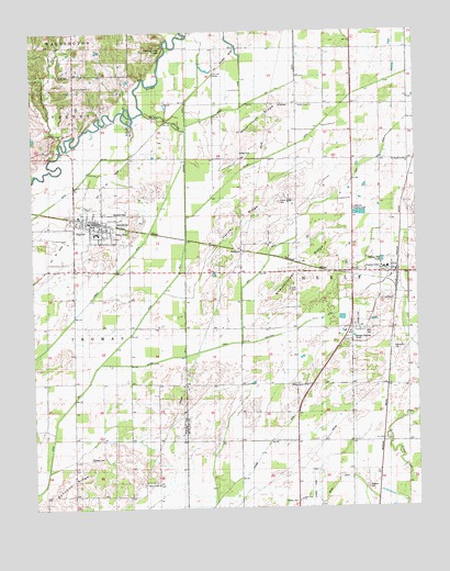
Naylor, MO USGS Topographic Map
Click on map above to begin viewing in our Map Viewer.

This topographic map contains these locations and features:
Feature Name Type Latitude Longitude GNIS ID View Map
Barfield CemeteryCemeteryN36.5751°W90.5976°743078View Map
Beech Ridge School (historical)SchoolN36.5323°W90.5940°713877View Map
Big SinkBasinN36.5931°W90.5565°714211View Map
Booser (historical)Populated PlaceN36.5912°W90.5026°735308View Map
Brown DitchCanalN36.6070°W90.5565°714774View Map
Buncomb ChurchChurchN36.5067°W90.5848°715041View Map
Buncomb RidgeRidgeN36.5039°W90.6187°738383View Map
Buncomb SchoolSchoolN36.5037°W90.6121°715042View Map
Butler County Fire Protection District Neelyville StationBuildingN36.5619°W90.5093°2620722View Map
Buzzard RunStreamN36.5956°W90.6157°715153View Map
Byrnes DitchCanalN36.5128°W90.5521°715167View Map
City of NaylorCivilN36.5745°W90.6056°2395161View Map
City of NeelyvilleCivilN36.5563°W90.5137°2395164View Map
Corinth General ChurchChurchN36.6106°W90.6104°743084View Map
Crab CemeteryCemeteryN36.5570°W90.5415°716439View Map
Ditch Number 1CanalN36.5423°W90.6207°755053View Map
Ditch Number 3CanalN36.5362°W90.6051°755097View Map
Eaton CemeteryCemeteryN36.5131°W90.6065°735589View Map
Ferguson SwitchLocaleN36.5095°W90.5129°740132View Map
Friendship ChurchChurchN36.5545°W90.5115°743080View Map
Gaines SloughStreamN36.6039°W90.5884°738510View Map
Gaines SwitchLocaleN36.6062°W90.5748°735307View Map
GheenPopulated PlaceN36.5995°W90.5840°739608View Map
Gum CemeteryCemeteryN36.6137°W90.6118°743085View Map
Gum SchoolSchoolN36.6145°W90.6068°718924View Map
Harris RidgeRidgeN36.5751°W90.5573°738507View Map
Harris Ridge CemeteryCemeteryN36.5801°W90.5448°719150View Map
Harris Ridge School (historical)SchoolN36.5659°W90.5384°719151View Map
Hart DitchCanalN36.5817°W90.5276°719173View Map
Hart SchoolSchoolN36.5912°W90.5029°719175View Map
Harviell DitchCanalN36.5962°W90.5362°719194View Map
Hazel Dell SchoolSchoolN36.5276°W90.5207°719281View Map
HubbellsPopulated PlaceN36.5676°W90.5573°740944View Map
Independence ChurchChurchN36.5317°W90.5362°720090View Map
Jennings DitchCanalN36.5889°W90.5746°720301View Map
Jennings School (historical)SchoolN36.5942°W90.5707°720303View Map
Lakeview Country ClubLocaleN36.5784°W90.5201°743081View Map
Lateral Number 1CanalN36.5384°W90.5854°755263View Map
Lutz CemeteryCemeteryN36.5473°W90.5151°735306View Map
Mackintosh RidgeRidgeN36.6020°W90.5496°738509View Map
Mackintosh SchoolSchoolN36.6062°W90.5379°721729View Map
Masonic CemeteryCemeteryN36.5776°W90.5959°743079View Map
MendosaLocaleN36.5323°W90.5101°740151View Map
Moark DitchCanalN36.5064°W90.5273°722505View Map
NaylorPopulated PlaceN36.5753°W90.6040°735742View Map
Naylor Volunteer Fire DepartmentBuildingN36.5750°W90.6056°2621568View Map
Neeleyville CemeteryCemeteryN36.5420°W90.5079°723148View Map
Neeleyville DitchCanalN36.5459°W90.5423°723149View Map
NeelyvillePopulated PlaceN36.5617°W90.5062°735744View Map
Neelyville Post OfficePost OfficeN36.5617°W90.5084°2782839View Map
Oakdale School (historical)SchoolN36.6231°W90.5209°723659View Map
ParksPopulated PlaceN36.6139°W90.5654°741138View Map
Rattlesnake KnobSummitN36.6203°W90.5821°738511View Map
Roberts CemeteryCemeteryN36.5056°W90.5162°725395View Map
Saint Margarite Mary ChurchChurchN36.5909°W90.5021°743082View Map
Sharecropper RidgeRidgeN36.5634°W90.5373°738508View Map
Sheely CemeteryCemeteryN36.5020°W90.5398°726297View Map
Sims (historical)Populated PlaceN36.5459°W90.5079°739609View Map
Sims CemeteryCemeteryN36.5464°W90.5162°726477View Map
Sixteen to One SchoolSchoolN36.5245°W90.5482°726499View Map
State Line ChurchChurchN36.5020°W90.5384°743077View Map
Taft DitchCanalN36.6126°W90.5387°727437View Map
Township of NeelyCivilN36.5691°W90.5241°766355View Map
Walnut Grove ChurchChurchN36.6059°W90.5382°743083View Map

Note: Coordinates in the location and feature list above are referenced to NAD83 datum.


Copyright (C) 2008-2024 Ryan Niemi / Sunset Dynamics ... All Rights Reserved