TopoQuest Logo
Do you find TopoQuest useful?
Help keep TopoQuest running and adding new maps/features by donating!
Bitcoin:  19c7KJd3qBynnjoSw5npx9KScwjBe4ifkT
Litecoin:  LXs6TkuXGGXo1vDsWCkWVdjQX94eUKd6ui
Home View Maps Find Maps Find Places Resources & Links


Fairdealing, Missouri Topographic Map

USGS Map Title: Fairdealing, MO
USGS Map MRC: 36090F5
DRG (GeoTIFF) Download: o36090f5.tif


Neighboring USGS Topographic Map Quads:


  Hogan Hollow, MO  
36090G6
 

  Stringtown, MO  
36090G5
 

  Poplar Bluff, MO  
36090G4
 

  Flatwoods, MO  
36090F6
 

  Fairdealing, MO  
36090F5
 

  Harviell, MO  
36090F4
 

  Oxly, MO  
36090E6
 

  Naylor, MO  
36090E5
 

  Vastus, MO  
36090E4


Map MRC Location:

N37°
W91°
N37°
W90°
H8 H7 H6 H5 H4 H3 H2 H1
G8 G7 G6 G5 G4 G3 G2 G1
F8 F7 F6 F5 F4 F3 F2 F1
E8 E7 E6 E5 E4 E3 E2 E1
D8 D7 D6 D5 D4 D3 D2 D1
C8 C7 C6 C5 C4 C3 C2 C1
B8 B7 B6 B5 B4 B3 B2 B1
A8 A7 A6 A5 A4 A3 A2 A1
N36°
W91°
N36°
W90°

Fairdealing, MO USGS 1:24K Topographic Map Preview:
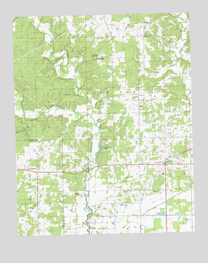
Fairdealing, MO USGS Topographic Map
Click on map above to begin viewing in our Map Viewer.

This topographic map contains these locations and features:
Feature Name Type Latitude Longitude GNIS ID View Map
Ball Mill BridgeBridgeN36.6326°W90.5762°754995View Map
Bay Springs CemeteryCemeteryN36.7450°W90.5276°735291View Map
Bay Springs ChurchChurchN36.7448°W90.5276°713758View Map
Beaverdam CreekStreamN36.6923°W90.5707°748752View Map
Belcher (historical)Populated PlaceN36.7237°W90.5754°740370View Map
Belcher Post OfficePost OfficeN36.7237°W90.5754°760079View Map
Bethel ChurchChurchN36.6656°W90.5193°714041View Map
Burnham SchoolSchoolN36.6551°W90.6090°735544View Map
Butler County Fire Protection District Hillview StationBuildingN36.6637°W90.5345°2620724View Map
Campground HollowValleyN36.6923°W90.6179°715322View Map
Case Bolt BranchStreamN36.6387°W90.5721°715467View Map
Cochran CemeteryCemeteryN36.6862°W90.5193°716056View Map
Cope BranchStreamN36.6326°W90.5784°716294View Map
Corinth Church (historical)ChurchN36.6278°W90.6090°716314View Map
Dickens CemeteryCemeteryN36.6953°W90.5379°743142View Map
Dolly BranchStreamN36.7145°W90.5809°749677View Map
FairdealingPopulated PlaceN36.6628°W90.6168°717731View Map
Fairdealing Census Designated PlaceCensusN36.6615°W90.6084°2587068View Map
Fairdealing Post OfficePost OfficeN36.6628°W90.6174°2779475View Map
Forest Grove SchoolSchoolN36.6809°W90.5112°718085View Map
Fox BranchStreamN36.6320°W90.5748°718136View Map
Friendship ChurchChurchN36.6356°W90.5654°730011View Map
Gobbler KnobSummitN36.6484°W90.5807°738516View Map
Haw BranchStreamN36.7239°W90.5071°735642View Map
Hickory Grove SchoolSchoolN36.7159°W90.6087°719469View Map
Hillview SchoolSchoolN36.6648°W90.5362°743144View Map
Kenner Spring BranchStreamN36.7348°W90.5021°750588View Map
Kinsey CemeteryCemeteryN36.6420°W90.5476°730001View Map
Kremlin MillPopulated PlaceN36.6314°W90.5709°735295View Map
Kremlin SchoolSchoolN36.6314°W90.5696°720696View Map
Lone HillPopulated PlaceN36.7012°W90.5373°721450View Map
Lone Hill CemeteryCemeteryN36.7006°W90.5384°735294View Map
Lone Hill ChurchChurchN36.7006°W90.5379°746917View Map
Lone Hill Lookout TowerTowerN36.7262°W90.5673°743139View Map
Lone Hill SchoolSchoolN36.7012°W90.5379°746916View Map
Military CemeteryCemeteryN36.7059°W90.5890°722317View Map
Myers LakeReservoirN36.6744°W90.5640°738515View Map
New Harmony ChurchChurchN36.7042°W90.5379°743141View Map
Oak Ridge ChurchChurchN36.7370°W90.5332°743138View Map
Oak Ridge School (historical)SchoolN36.7359°W90.5332°746915View Map
Oak Ridge School (historical)SchoolN36.7381°W90.5318°723643View Map
Pleasant Hill School (historical)SchoolN36.6501°W90.5446°735786View Map
Pleasant Valley SchoolSchoolN36.6642°W90.5429°724626View Map
Powers Mill (historical)LocaleN36.6995°W90.5959°735293View Map
Resnick LakeReservoirN36.7480°W90.5626°762493View Map
Resnik Lake DamDamN36.7484°W90.5634°762492View Map
Roxie (historical)Populated PlaceN36.7292°W90.5062°735292View Map
Russell Lake DamDamN36.7384°W90.5001°764163View Map
SEMO CampLocaleN36.6776°W90.5618°743143View Map
Spell BranchStreamN36.6937°W90.5798°726843View Map
Spell School (historical)SchoolN36.6759°W90.5943°726844View Map
State Public Hunting AreaParkN36.7253°W90.5673°743140View Map
TaftPopulated PlaceN36.6351°W90.5379°741311View Map
Township of Beaver DamCivilN36.7045°W90.5414°766349View Map
Wattle Landing Strip (historical)AirportN36.6317°W90.5073°743150View Map
Wolf CreekStreamN36.7484°W90.5112°752950View Map

Note: Coordinates in the location and feature list above are referenced to NAD83 datum.


Copyright (C) 2008-2024 Ryan Niemi / Sunset Dynamics ... All Rights Reserved