TopoQuest Logo
Do you find TopoQuest useful?
Help keep TopoQuest running and adding new maps/features by donating!
Bitcoin:  19c7KJd3qBynnjoSw5npx9KScwjBe4ifkT
Litecoin:  LXs6TkuXGGXo1vDsWCkWVdjQX94eUKd6ui
Home View Maps Find Maps Find Places Resources & Links


New Burlington, Ohio Topographic Map

USGS Map Title: New Burlington, OH
USGS Map MRC: 39083E8
DRG (GeoTIFF) Download: o39083e8.tif


Neighboring USGS Topographic Map Quads:


  Bellbrook, OH  
39084F1
 

  Xenia, OH  
39083F8
 

  Cedarville, OH  
39083F7
 

  Waynesville, OH  
39084E1
 

  New Burlington, OH  
39083E8
 

  Port William, OH  
39083E7
 

  Oregonia, OH  
39084D1
 

  Clarksville, OH  
39083D8
 

  Wilmington, OH  
39083D7


Map MRC Location:

N40°
W84°
N40°
W83°
H8 H7 H6 H5 H4 H3 H2 H1
G8 G7 G6 G5 G4 G3 G2 G1
F8 F7 F6 F5 F4 F3 F2 F1
E8 E7 E6 E5 E4 E3 E2 E1
D8 D7 D6 D5 D4 D3 D2 D1
C8 C7 C6 C5 C4 C3 C2 C1
B8 B7 B6 B5 B4 B3 B2 B1
A8 A7 A6 A5 A4 A3 A2 A1
N39°
W84°
N39°
W83°

New Burlington, OH USGS 1:24K Topographic Map Preview:
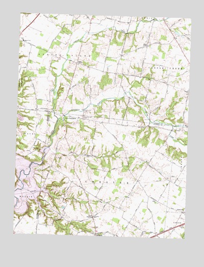
New Burlington, OH USGS Topographic Map
Click on map above to begin viewing in our Map Viewer.

This topographic map contains these locations and features:
Feature Name Type Latitude Longitude GNIS ID View Map
Anderson ForkStreamN39.5653°W83.9697°1085185View Map
Babb CemeteryCemeteryN39.5812°W83.9080°1962988View Map
Babbtown School (historical)SchoolN39.5828°W83.9047°1080552View Map
Buck RunStreamN39.5464°W83.9683°1065943View Map
Buck Run School (historical)SchoolN39.5467°W83.9599°1053425View Map
Caesar Creek Alpaca RanchLocaleN39.5708°W83.9886°2516503View Map
Caesar Creek ChurchChurchN39.5476°W83.9841°1038601View Map
Caesars Creek CemeteryCemeteryN39.5476°W83.9835°1963085View Map
Chester CemeteryCemeteryN39.5198°W83.8963°1963040View Map
Chester ChurchChurchN39.5201°W83.8966°1068194View Map
Chester School (historical)SchoolN39.5189°W83.9030°1053427View Map
Chester Township New Burlington Fire and Rescue Station 1BuildingN39.5553°W83.9646°2550117View Map
Chester Township New Burlington Fire and Rescue Station 2BuildingN39.5104°W83.9413°2550449View Map
CornstalkPopulated PlaceN39.5703°W83.9858°1079558View Map
Craig School (historical)SchoolN39.5934°W83.9377°1080550View Map
Eleazer ChurchChurchN39.5834°W83.8752°1040110View Map
Eleazor CemeteryCemeteryN39.5814°W83.8761°1962990View Map
Fairview School (historical)SchoolN39.5706°W83.9860°1080547View Map
Fricke AirportAirportN39.6155°W83.9907°1083026View Map
Glady School (historical)SchoolN39.6228°W83.9752°1080549View Map
GurneyvillePopulated PlaceN39.5148°W83.8769°1064777View Map
Gurneyville Post Office (historical)Post OfficeN39.5153°W83.8763°1966641View Map
Haines School (historical)SchoolN39.5070°W83.9827°1053429View Map
Hoffman School (historical)SchoolN39.5420°W83.9033°1053430View Map
Keiter CemeteryCemeteryN39.5617°W83.8812°1042213View Map
KingmanPopulated PlaceN39.5009°W83.9399°1064941View Map
Kingman Post Office (historical)Post OfficeN39.5014°W83.9402°1966643View Map
Maple CornerPopulated PlaceN39.6084°W83.9066°1062872View Map
Maple Corner CemeteryCemeteryN39.6106°W83.9066°1962992View Map
Massie Township Fire and Emergency Medical Services DepartmentBuildingN39.5004°W83.9995°2550534View Map
McKay Station Post Office (historical)Post OfficeN39.5389°W83.8777°1966646View Map
McKaysPopulated PlaceN39.5395°W83.8772°1061246View Map
McKnight School (historical)SchoolN39.6031°W83.9769°1080548View Map
Mercer CemeteryCemeteryN39.6098°W83.9543°1962994View Map
New BurlingtonPopulated PlaceN39.5620°W83.9655°1056447View Map
New Burlington CemeteryCemeteryN39.5673°W83.9513°1963054View Map
New Burlington Post Office (historical)Post OfficeN39.5626°W83.9652°1966650View Map
North KingmanPopulated PlaceN39.5106°W83.9430°1062920View Map
Painters RunStreamN39.5639°W83.8852°1070655View Map
Peterson School (historical)SchoolN39.5628°W83.9110°1053433View Map
Pogue CornersLocaleN39.5978°W83.9574°1044656View Map
Richland ChurchChurchN39.6248°W83.9619°1044979View Map
Richland School (historical)SchoolN39.6231°W83.9505°1080551View Map
Sharon CemeteryCemeteryN39.5048°W83.9410°1963059View Map
Sharon United Methodist ChurchChurchN39.5048°W83.9410°1068222View Map
Spring Valley SchoolSchoolN39.6092°W83.9966°1046582View Map
Spring Valley Township Fire DepartmentBuildingN39.6149°W83.9987°2549435View Map
Township of ChesterCivilN39.5203°W83.9350°1085877View Map
Township of Spring ValleyCivilN39.6071°W83.9862°1086173View Map
Trace RunStreamN39.5156°W83.9999°1047123View Map
Turkey RunStreamN39.5256°W83.9944°1047204View Map
Village of HarveysburgCivilN39.5022°W83.9985°2398262View Map
West Engle Mill Road BridgeBridgeN39.5706°W83.9519°1050896View Map
Zoar ChurchChurchN39.5906°W83.9041°1048289View Map
Zoar Church CemeteryCemeteryN39.5906°W83.9038°1962997View Map

Note: Coordinates in the location and feature list above are referenced to NAD83 datum.


Copyright (C) 2008-2025 Ryan Niemi / Sunset Dynamics ... All Rights Reserved