TopoQuest Logo
Do you find TopoQuest useful?
Help keep TopoQuest running and adding new maps/features by donating!
Bitcoin:  19c7KJd3qBynnjoSw5npx9KScwjBe4ifkT
Litecoin:  LXs6TkuXGGXo1vDsWCkWVdjQX94eUKd6ui
Home View Maps Find Maps Find Places Resources & Links


New Deal, Texas Topographic Map

USGS Map Title: New Deal, TX
USGS Map MRC: 33101F7
DRG (GeoTIFF) Download: o33101f7.tif


Neighboring USGS Topographic Map Quads:


  Abernathy SW, TX  
33101G8
 

  Abernathy, TX  
33101G7
 

  Heckville, TX  
33101G6
 

  Shallowater, TX  
33101F8
 

  New Deal, TX  
33101F7
 

  Idalou, TX  
33101F6
 

  Lubbock West, TX  
33101E8
 

  Lubbock East, TX  
33101E7
 

  Buffalo Springs Lake, TX  
33101E6


Map MRC Location:

N34°
W102°
N34°
W101°
H8 H7 H6 H5 H4 H3 H2 H1
G8 G7 G6 G5 G4 G3 G2 G1
F8 F7 F6 F5 F4 F3 F2 F1
E8 E7 E6 E5 E4 E3 E2 E1
D8 D7 D6 D5 D4 D3 D2 D1
C8 C7 C6 C5 C4 C3 C2 C1
B8 B7 B6 B5 B4 B3 B2 B1
A8 A7 A6 A5 A4 A3 A2 A1
N33°
W102°
N33°
W101°

New Deal, TX USGS 1:24K Topographic Map Preview:
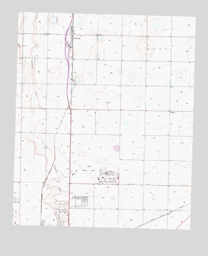
New Deal, TX USGS Topographic Map
Click on map above to begin viewing in our Map Viewer.

This topographic map contains these locations and features:
Feature Name Type Latitude Longitude GNIS ID View Map
AeroCareBuildingN33.6567°W101.8340°2656175View Map
City of Lubbock Industrial AreaLocaleN33.6565°W101.8107°1354531View Map
Davies ParkParkN33.6279°W101.8499°2028472View Map
LibertyPopulated PlaceN33.6940°W101.7671°1380082View Map
Lubbock Country ClubLocaleN33.6340°W101.8402°1384607View Map
Lubbock County Detention CenterBuildingN33.6324°W101.7946°2738839View Map
Lubbock Fire Department Station 11BuildingN33.6587°W101.8133°2551269View Map
Lubbock International Airport Police DepartmentBuildingN33.6566°W101.8222°2750621View Map
Lubbock Preston Smith International AirportAirportN33.6566°W101.8225°1387111View Map
Lubbock Terminal ReservoirReservoirN33.6716°W101.8041°1864597View Map
Lubbock Terminal Reservoir LeveeDamN33.6734°W101.8021°1864596View Map
New DealPopulated PlaceN33.7373°W101.8366°1363706View Map
New Deal City HallBuildingN33.7296°W101.8394°2753813View Map
New Deal Police DepartmentBuildingN33.7296°W101.8394°2750499View Map
New Deal Post OfficePost OfficeN33.7411°W101.8376°2731311View Map
New Deal Volunteer Fire DepartmentBuildingN33.7296°W101.8394°2551142View Map
Skyline Baptist ChurchChurchN33.6384°W101.8274°2022451View Map
South Plains Army Air Field (historical)MilitaryN33.6614°W101.8103°2096209View Map
Town of New DealCivilN33.7120°W101.8434°2413043View Map
Wright Elementary SchoolSchoolN33.6262°W101.8495°2007720View Map

Note: Coordinates in the location and feature list above are referenced to NAD83 datum.


Copyright (C) 2008-2025 Ryan Niemi / Sunset Dynamics ... All Rights Reserved