TopoQuest Logo
Do you find TopoQuest useful?
Help keep TopoQuest running and adding new maps/features by donating!
Bitcoin:  19c7KJd3qBynnjoSw5npx9KScwjBe4ifkT
Litecoin:  LXs6TkuXGGXo1vDsWCkWVdjQX94eUKd6ui
Home View Maps Find Maps Find Places Resources & Links


New Preston, Connecticut Topographic Map

USGS Map Title: New Preston, CT
USGS Map MRC: 41073F3
DRG (GeoTIFF) Download: o41073f3.tif


Neighboring USGS Topographic Map Quads:


  Ellsworth, CT  
41073G4
 

  Cornwall, CT  
41073G3
 

  West Torrington, CT  
41073G2
 

  Kent, CT  
41073F4
 

  New Preston, CT  
41073F3
 

  Litchfield, CT  
41073F2
 

  New Milford, CT  
41073E4
 

  Roxbury, CT  
41073E3
 

  Woodbury, CT  
41073E2


Map MRC Location:

N42°
W74°
N42°
W73°
H8 H7 H6 H5 H4 H3 H2 H1
G8 G7 G6 G5 G4 G3 G2 G1
F8 F7 F6 F5 F4 F3 F2 F1
E8 E7 E6 E5 E4 E3 E2 E1
D8 D7 D6 D5 D4 D3 D2 D1
C8 C7 C6 C5 C4 C3 C2 C1
B8 B7 B6 B5 B4 B3 B2 B1
A8 A7 A6 A5 A4 A3 A2 A1
N41°
W74°
N41°
W73°

New Preston, CT USGS 1:24K Topographic Map Preview:
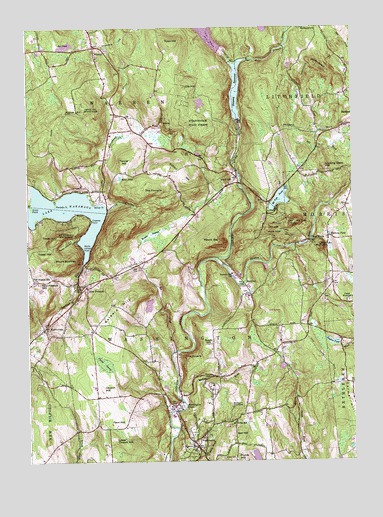
New Preston, CT USGS Topographic Map
Click on map above to begin viewing in our Map Viewer.

This topographic map contains these locations and features:
Feature Name Type Latitude Longitude GNIS ID View Map
Above AllSummitN41.7270°W73.3529°205036View Map
Above All State ParkParkN41.7268°W73.3529°205037View Map
Arrow PointCapeN41.6979°W73.3735°205124View Map
Baldwin HillSummitN41.6707°W73.3398°205228View Map
Bantam RiverStreamN41.6832°W73.3035°205247View Map
Bates PondLakeN41.7069°W73.3391°205311View Map
Bee BrookStreamN41.6570°W73.3182°205402View Map
Bell HillSummitN41.6315°W73.2948°205434View Map
Bryan PlazaParkN41.6409°W73.3176°1931825View Map
Cambrown AirportAirportN41.6676°W73.2829°213136View Map
Camp WashingtonLocaleN41.6709°W73.2515°205989View Map
Cheeree PointCapeN41.6945°W73.3501°206210View Map
Church HillSummitN41.6459°W73.3468°206278View Map
City HillSummitN41.7326°W73.3143°206287View Map
Cozy Hills CampgroundLocaleN41.7154°W73.2629°1931914View Map
East Branch Shepaug RiverStreamN41.7393°W73.2948°206793View Map
Eel PondLakeN41.7448°W73.3599°206905View Map
Emmons City (historical)Populated PlaceN41.6895°W73.2598°1931950View Map
Emmons PondLakeN41.6902°W73.2588°206961View Map
Fenn HillSummitN41.6373°W73.3412°207055View Map
Glenholme SchoolSchoolN41.6468°W73.3046°1932001View Map
Goose Pond DamDamN41.7484°W73.2846°1771616View Map
Gunn Memorial LibraryBuildingN41.6329°W73.3104°1932019View Map
Gunn Memorial MuseumBuildingN41.6329°W73.3104°1932020View Map
Historical AcademySchoolN41.7443°W73.3493°1932055View Map
Hopkins VineyardLocaleN41.7048°W73.3540°1932059View Map
Judea CemeteryCemeteryN41.6258°W73.3005°208211View Map
Lake WaramaugLakeN41.6978°W73.3622°211809View Map
Lake Waramaug BrookStreamN41.6995°W73.3473°208358View Map
Little Mount TomSummitN41.6862°W73.2615°208515View Map
Looking Glass HillSummitN41.7101°W73.2607°208592View Map
Lower Church HillSummitN41.6318°W73.3426°208619View Map
Mallory BrookStreamN41.6429°W73.3162°208680View Map
Marble DalePopulated PlaceN41.6637°W73.3690°208713View Map
Marks HollowValleyN41.6887°W73.3579°208727View Map
Marks Hollow PointCapeN41.6868°W73.3535°208728View Map
Meeker SwampSwampN41.6897°W73.3259°208815View Map
Mount BushnellSummitN41.6826°W73.3601°205886View Map
Mount Bushnell State ParkParkN41.6895°W73.3623°209074View Map
Mount ProspectSummitN41.7395°W73.2640°210005View Map
Mount RatSummitN41.6882°W73.3035°210101View Map
Mount TomSummitN41.6934°W73.2734°211500View Map
Mount Tom PondLakeN41.7006°W73.2779°209096View Map
Mount Tom State ParkParkN41.6915°W73.2765°209097View Map
New ChurchChurchN41.6770°W73.3726°209226View Map
New PrestonPopulated PlaceN41.6751°W73.3518°209251View Map
New Preston Census Designated PlaceCensusN41.6813°W73.3522°2377838View Map
New Preston Congregational ChurchChurchN41.6748°W73.3565°1932231View Map
New Preston Fire DepartmentBuildingN41.6683°W73.3603°2420377View Map
New Preston HillSummitN41.6765°W73.3707°209252View Map
New Preston Hill Historic DistrictParkN41.6770°W73.3712°1932232View Map
New Preston Marble Dale Post OfficePost OfficeN41.6624°W73.3697°2783294View Map
New Preston Station (historical)LocaleN41.6595°W73.3190°1932234View Map
Pinnacle ValleyValleyN41.6993°W73.3412°209813View Map
Plumb HillSummitN41.6257°W73.2923°209862View Map
Poplar SwampSwampN41.6532°W73.3459°209933View Map
Preston HillLocaleN41.6770°W73.3715°209984View Map
Quist PondReservoirN41.6700°W73.3285°1771615View Map
Quist Pond DamDamN41.6718°W73.3262°1771614View Map
Rabbit HillSummitN41.7262°W73.3185°210076View Map
Randalls PointCapeN41.6990°W73.3640°210097View Map
Robin HillSummitN41.6593°W73.3060°210242View Map
RomfordPopulated PlaceN41.6754°W73.2910°212560View Map
Romford CemeteryCemeteryN41.6734°W73.2905°1932324View Map
Rumsey Hall SchoolSchoolN41.6793°W73.2965°210346View Map
Shepaug ReservoirReservoirN41.7317°W73.2944°210808View Map
Shepaug Reservoir DamDamN41.7234°W73.2939°1771473View Map
Tanner HillSummitN41.7109°W73.3373°211357View Map
The GunnerySchoolN41.6293°W73.3107°207574View Map
The PinnaclePillarN41.6545°W73.3135°211428View Map
The PinnaclePillarN41.7029°W73.3276°211429View Map
Tinker HillSummitN41.6895°W73.3643°211470View Map
Tower HillSummitN41.6848°W73.3679°211524View Map
Town HillSummitN41.7457°W73.3190°211530View Map
Town of WarrenCivilN41.7406°W73.3449°213523View Map
Town of WashingtonCivilN41.6523°W73.3144°213524View Map
Tuller SchoolSchoolN41.6359°W73.2965°211585View Map
Upper Shepaug Reservoir DamDamN41.7439°W73.3004°1771416View Map
WarrenPopulated PlaceN41.7429°W73.3487°212584View Map
Warren Volunteer Fire CompanyBuildingN41.7427°W73.3482°2420456View Map
WashingtonPopulated PlaceN41.6315°W73.3107°212585View Map
Washington Ambulance AssociationBuildingN41.6542°W73.3186°2660896View Map
Washington DepotLocaleN41.6409°W73.3160°211829View Map
Washington Fire Marshal's OfficeBuildingN41.6574°W73.3689°2420363View Map
Washington Golf CourseLocaleN41.6404°W73.2968°212999View Map
Washington Volunteer Fire DepartmentBuildingN41.6543°W73.3185°2420358View Map
West Branch Shepaug RiverStreamN41.7393°W73.2948°211931View Map
West MorrisPopulated PlaceN41.6887°W73.2623°212589View Map
Willow PointCapeN41.6993°W73.3493°212160View Map
WoodvillePopulated PlaceN41.7048°W73.2971°212600View Map
Wyant PondReservoirN41.6261°W73.2881°1771424View Map
Zeiglers PondLakeN41.6593°W73.2581°212317View Map

Note: Coordinates in the location and feature list above are referenced to NAD83 datum.


Copyright (C) 2008-2024 Ryan Niemi / Sunset Dynamics ... All Rights Reserved