TopoQuest Logo
Do you find TopoQuest useful?
Help keep TopoQuest running and adding new maps/features by donating!
Bitcoin:  19c7KJd3qBynnjoSw5npx9KScwjBe4ifkT
Litecoin:  LXs6TkuXGGXo1vDsWCkWVdjQX94eUKd6ui
Home View Maps Find Maps Find Places Resources & Links


New Windsor, Illinois Topographic Map

USGS Map Title: New Windsor, IL
USGS Map MRC: 41090B4
DRG (GeoTIFF) Download: o41090b4.tif


Neighboring USGS Topographic Map Quads:


  Matherville, IL  
41090C5
 

  Orion, IL  
41090C4
 

  Andover, IL  
41090C3
 

  Viola, IL  
41090B5
 

  New Windsor, IL  
41090B4
 

  Woodhull, IL  
41090B3
 

  Alexis, IL  
41090A5
 

  North Henderson, IL  
41090A4
 

  Wataga, IL  
41090A3


Map MRC Location:

N42°
W91°
N42°
W90°
H8 H7 H6 H5 H4 H3 H2 H1
G8 G7 G6 G5 G4 G3 G2 G1
F8 F7 F6 F5 F4 F3 F2 F1
E8 E7 E6 E5 E4 E3 E2 E1
D8 D7 D6 D5 D4 D3 D2 D1
C8 C7 C6 C5 C4 C3 C2 C1
B8 B7 B6 B5 B4 B3 B2 B1
A8 A7 A6 A5 A4 A3 A2 A1
N41°
W91°
N41°
W90°

New Windsor, IL USGS 1:24K Topographic Map Preview:
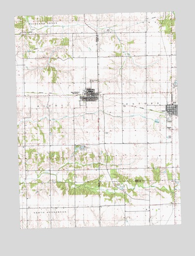
New Windsor, IL USGS Topographic Map
Click on map above to begin viewing in our Map Viewer.

This topographic map contains these locations and features:
Feature Name Type Latitude Longitude GNIS ID View Map
AlphaPopulated PlaceN41.1917°W90.3801°403453View Map
Alpha CemeteryCemeteryN41.2059°W90.3787°403454View Map
Alpha Coal MineMineN41.1625°W90.3823°403455View Map
Alpha Police DepartmentBuildingN41.1914°W90.3821°2756846View Map
Alpha Post OfficePost OfficeN41.1914°W90.3805°1812529View Map
Alpha United Methodist ChurchChurchN41.1936°W90.3771°1984835View Map
Alwood SchoolSchoolN41.1956°W90.3787°426941View Map
Calvary CemeteryCemeteryN41.2039°W90.4371°1808623View Map
Calvary Lutheran ChurchChurchN41.2028°W90.4368°425853View Map
Eureka School (historical)SchoolN41.1370°W90.4571°1719858View Map
GriffinPopulated PlaceN41.2403°W90.4896°422761View Map
Hazel Dell School (historical)SchoolN41.1731°W90.4568°1719857View Map
Hopewell School (historical)SchoolN41.2025°W90.4940°1719856View Map
Maple Ridge School (historical)SchoolN41.1370°W90.4951°1719859View Map
Maranatha ChapelChurchN41.1798°W90.3821°425852View Map
New WindsorPopulated PlaceN41.2023°W90.4424°414472View Map
New Windsor CemeteryCemeteryN41.2103°W90.4423°414473View Map
New Windsor Post OfficePost OfficeN41.2023°W90.4406°1808638View Map
New Windsor Public LibraryBuildingN41.2025°W90.4415°1808639View Map
Oakridge SchoolSchoolN41.1734°W90.4996°414915View Map
Oxford (historical)Populated PlaceN41.1736°W90.4332°1812589View Map
Oxford CemeteryCemeteryN41.1798°W90.4326°415283View Map
Oxford Township Fire ProfessionalBuildingN41.1919°W90.3808°2640858View Map
Rivoli Fire Protection District New Windsor StationBuildingN41.2027°W90.4412°2640484View Map
Streeter School (historical)SchoolN41.2248°W90.4551°1719855View Map
Township of OxfordCivilN41.1946°W90.3799°429519View Map
Township of RivoliCivilN41.1954°W90.4924°429648View Map
Tri - County Ambulance DistrictBuildingN41.1918°W90.3809°2673999View Map
Union School (historical)SchoolN41.1370°W90.3804°1719854View Map
Village of AlphaCivilN41.1918°W90.3806°2397943View Map
Village of WindsorCivilN41.2018°W90.4444°2399713View Map
Winola Junior High SchoolSchoolN41.2059°W90.4449°425851View Map

Note: Coordinates in the location and feature list above are referenced to NAD83 datum.


Copyright (C) 2008-2025 Ryan Niemi / Sunset Dynamics ... All Rights Reserved