TopoQuest Logo
Do you find TopoQuest useful?
Help keep TopoQuest running and adding new maps/features by donating!
Bitcoin:  19c7KJd3qBynnjoSw5npx9KScwjBe4ifkT
Litecoin:  LXs6TkuXGGXo1vDsWCkWVdjQX94eUKd6ui
Home View Maps Find Maps Find Places Resources & Links


Wataga, Illinois Topographic Map

USGS Map Title: Wataga, IL
USGS Map MRC: 41090A3
DRG (GeoTIFF) Download: o41090a3.tif


Neighboring USGS Topographic Map Quads:


  New Windsor, IL  
41090B4
 

  Woodhull, IL  
41090B3
 

  Nekoma, IL  
41090B2
 

  North Henderson, IL  
41090A4
 

  Wataga, IL  
41090A3
 

  Oneida, IL  
41090A2
 

  Galesburg West, IL  
40090H4
 

  Galesburg East, IL  
40090H3
 

  Appleton, IL  
40090H2


Map MRC Location:

N42°
W91°
N42°
W90°
H8 H7 H6 H5 H4 H3 H2 H1
G8 G7 G6 G5 G4 G3 G2 G1
F8 F7 F6 F5 F4 F3 F2 F1
E8 E7 E6 E5 E4 E3 E2 E1
D8 D7 D6 D5 D4 D3 D2 D1
C8 C7 C6 C5 C4 C3 C2 C1
B8 B7 B6 B5 B4 B3 B2 B1
A8 A7 A6 A5 A4 A3 A2 A1
N41°
W91°
N41°
W90°

Wataga, IL USGS 1:24K Topographic Map Preview:
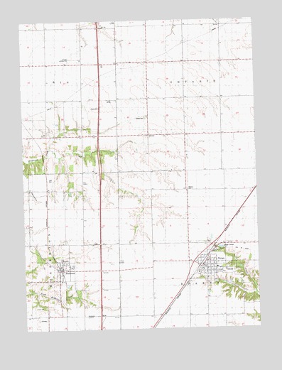
Wataga, IL USGS Topographic Map
Click on map above to begin viewing in our Map Viewer.

This topographic map contains these locations and features:
Feature Name Type Latitude Longitude GNIS ID View Map
Bruner CemeteryCemeteryN41.0897°W90.3380°405005View Map
Centennial School (historical)SchoolN41.1070°W90.3071°405781View Map
Condra School (historical)SchoolN41.0414°W90.3743°406461View Map
Galesburg Research CemeteryCemeteryN41.0045°W90.3660°1815969View Map
Gum CemeteryCemeteryN41.0092°W90.3693°1719879View Map
HendersonPopulated PlaceN41.0250°W90.3562°410046View Map
Henderson CemeteryCemeteryN41.0280°W90.3529°1815972View Map
Henderson Post OfficePost OfficeN41.0259°W90.3553°2788325View Map
Henderson Township Fire Protection DistrictBuildingN41.0205°W90.3547°2640778View Map
Johnson Landing Strip (historical)AirportN41.1098°W90.3465°1720337View Map
Junk CemeteryCemeteryN41.0603°W90.3618°1719880View Map
Military School (historical)SchoolN41.0011°W90.3062°413533View Map
OntarioPopulated PlaceN41.0786°W90.3076°423044View Map
Ontario CemeteryCemeteryN41.0856°W90.3087°1719881View Map
Robbins CemeteryCemeteryN41.0564°W90.2876°1815996View Map
Robbins School (historical)SchoolN41.0567°W90.2876°416747View Map
Rowe School (historical)SchoolN41.0292°W90.3243°417011View Map
Sunrise School (historical)SchoolN41.0564°W90.3576°419407View Map
Talbot School (historical)SchoolN41.0925°W90.2685°419521View Map
Township of OntarioCivilN41.1078°W90.2664°429494View Map
Township of SpartaCivilN41.0199°W90.2677°429782View Map
Village of HendersonCivilN41.0239°W90.3536°2398487View Map
Village of WatagaCivilN41.0252°W90.2754°2400101View Map
Washington School (historical)SchoolN41.0786°W90.3429°420606View Map
WatagaPopulated PlaceN41.0253°W90.2798°420630View Map
Wataga CemeteryCemeteryN41.0224°W90.2689°1816007View Map
Wataga Elementary SchoolSchoolN41.0228°W90.2821°1816008View Map
Wataga Fire DepartmentBuildingN41.0256°W90.2792°2640465View Map
Wataga Post OfficePost OfficeN41.0240°W90.2804°2788365View Map

Note: Coordinates in the location and feature list above are referenced to NAD83 datum.


Copyright (C) 2008-2024 Ryan Niemi / Sunset Dynamics ... All Rights Reserved