TopoQuest Logo
Do you find TopoQuest useful?
Help keep TopoQuest running and adding new maps/features by donating!
Bitcoin:  19c7KJd3qBynnjoSw5npx9KScwjBe4ifkT
Litecoin:  LXs6TkuXGGXo1vDsWCkWVdjQX94eUKd6ui
Home View Maps Find Maps Find Places Resources & Links


Newman Grove, Nebraska Topographic Map

USGS Map Title: Newman Grove, NE
USGS Map MRC: 41097F7
DRG (GeoTIFF) Download: o41097f7.tif


Neighboring USGS Topographic Map Quads:


  Closter SW, NE  
41097G8
 

  Closter SE, NE  
41097G7
 

  Battle Creek SW, NE  
41097G6
 

  Albion East, NE  
41097F8
 

  Newman Grove, NE  
41097F7
 

  Lindsay, NE  
41097F6
 

  Saint Edward SW, NE  
41097E8
 

  Saint Edward, NE  
41097E7
 

  Lindsay SW, NE  
41097E6


Map MRC Location:

N42°
W98°
N42°
W97°
H8 H7 H6 H5 H4 H3 H2 H1
G8 G7 G6 G5 G4 G3 G2 G1
F8 F7 F6 F5 F4 F3 F2 F1
E8 E7 E6 E5 E4 E3 E2 E1
D8 D7 D6 D5 D4 D3 D2 D1
C8 C7 C6 C5 C4 C3 C2 C1
B8 B7 B6 B5 B4 B3 B2 B1
A8 A7 A6 A5 A4 A3 A2 A1
N41°
W98°
N41°
W97°

Newman Grove, NE USGS 1:24K Topographic Map Preview:
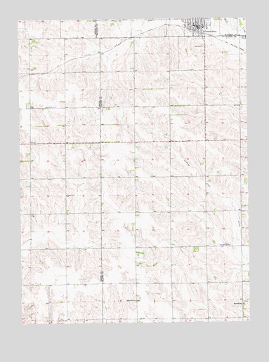
Newman Grove, NE USGS Topographic Map
Click on map above to begin viewing in our Map Viewer.

This topographic map contains these locations and features:
Feature Name Type Latitude Longitude GNIS ID View Map
City of Newman GroveCivilN41.7469°W97.7767°838343View Map
Fellowship Bible ChurchChurchN41.7464°W97.7701°1880537View Map
Grace ChurchChurchN41.7464°W97.7781°1880535View Map
Happy Hill SchoolSchoolN41.6339°W97.8123°829781View Map
Hope CemeteryCemeteryN41.7383°W97.7745°830120View Map
Leader Public SchoolSchoolN41.7142°W97.8595°836372View Map
Looking Glass ChurchChurchN41.6564°W97.7606°830885View Map
Mid-Nebraska Lutheran HomeHospitalN41.7472°W97.7831°1880531View Map
Nazarene ChurchChurchN41.7470°W97.7798°1880539View Map
Newman Grove (historical)LocaleN41.7442°W97.7764°1880533View Map
Newman Grove Family DentistryHospitalN41.7470°W97.7784°1880530View Map
Newman Grove Medical ClinicHospitalN41.7472°W97.7837°1880532View Map
Newman Grove Police DepartmentBuildingN41.7469°W97.7763°1880528View Map
Newman Grove Post OfficePost OfficeN41.7469°W97.7763°1880529View Map
Newman Grove Public LibraryBuildingN41.7464°W97.7753°1880527View Map
Newman Grove Public SchoolsSchoolN41.7464°W97.7748°1880534View Map
Newman Grove Volunteer Fire DepartmentBuildingN41.7454°W97.7748°2553237View Map
RosenburgPopulated PlaceN41.6320°W97.7539°832722View Map
Rosenburg Post Office (historical)Post OfficeN41.6320°W97.7539°1880838View Map
Salem ChurchChurchN41.6539°W97.8120°833139View Map
School Number 31 (historical)SchoolN41.6261°W97.8503°836566View Map
School Number 37 (historical)SchoolN41.6775°W97.8501°836646View Map
School Number 61SchoolN41.6775°W97.8131°836948View Map
School Number 63SchoolN41.6775°W97.7537°836971View Map
Shell Creek Lutheran ChurchChurchN41.7497°W97.7762°1880538View Map
Township of WalkerCivilN41.6773°W97.7734°838313View Map
Trinity Lutheran ChurchChurchN41.7470°W97.7728°1880536View Map
United Methodist ChurchChurchN41.7475°W97.7792°1880541View Map
Zion Lutheran ChurchChurchN41.7495°W97.7812°1880540View Map

Note: Coordinates in the location and feature list above are referenced to NAD83 datum.


Copyright (C) 2008-2025 Ryan Niemi / Sunset Dynamics ... All Rights Reserved