TopoQuest Logo
Do you find TopoQuest useful?
Help keep TopoQuest running and adding new maps/features by donating!
Bitcoin:  19c7KJd3qBynnjoSw5npx9KScwjBe4ifkT
Litecoin:  LXs6TkuXGGXo1vDsWCkWVdjQX94eUKd6ui
Home View Maps Find Maps Find Places Resources & Links


Saint Edward, Nebraska Topographic Map

USGS Map Title: Saint Edward, NE
USGS Map MRC: 41097E7
DRG (GeoTIFF) Download: o41097e7.tif


Neighboring USGS Topographic Map Quads:


  Albion East, NE  
41097F8
 

  Newman Grove, NE  
41097F7
 

  Lindsay, NE  
41097F6
 

  Saint Edward SW, NE  
41097E8
 

  Saint Edward, NE  
41097E7
 

  Lindsay SW, NE  
41097E6
 

  Merchiston, NE  
41097D8
 

  Fullerton NE, NE  
41097D7
 

  Genoa, NE  
41097D6


Map MRC Location:

N42°
W98°
N42°
W97°
H8 H7 H6 H5 H4 H3 H2 H1
G8 G7 G6 G5 G4 G3 G2 G1
F8 F7 F6 F5 F4 F3 F2 F1
E8 E7 E6 E5 E4 E3 E2 E1
D8 D7 D6 D5 D4 D3 D2 D1
C8 C7 C6 C5 C4 C3 C2 C1
B8 B7 B6 B5 B4 B3 B2 B1
A8 A7 A6 A5 A4 A3 A2 A1
N41°
W98°
N41°
W97°

Saint Edward, NE USGS 1:24K Topographic Map Preview:
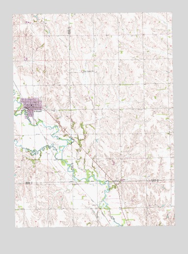
Saint Edward, NE USGS Topographic Map
Click on map above to begin viewing in our Map Viewer.

This topographic map contains these locations and features:
Feature Name Type Latitude Longitude GNIS ID View Map
Big Cut School (historical)SchoolN41.5133°W97.8103°827415View Map
Bogus CreekStreamN41.5395°W97.8378°827537View Map
City of Saint EdwardCivilN41.5714°W97.8612°2396485View Map
Cloverlodge Care CenterHospitalN41.5725°W97.8537°1880767View Map
Elm School (historical)SchoolN41.5111°W97.7528°829092View Map
Evergreen CemeteryCemeteryN41.5678°W97.8414°829173View Map
Faith Lutheran ChurchChurchN41.5689°W97.8620°1880773View Map
J W Carters Grain Company ElevatorLocaleN41.5664°W97.8626°1880769View Map
Kingdom Hall of Jehovahs WitnessesChurchN41.5708°W97.8606°1880774View Map
Mount Pleasant SchoolSchoolN41.5908°W97.8117°831481View Map
Roberts DamDamN41.5311°W97.8741°1767063View Map
Saint EdwardPopulated PlaceN41.5700°W97.8659°832856View Map
Saint EdwardLocaleN41.5706°W97.8642°1880777View Map
Saint Edward City ParkParkN41.5720°W97.8642°1880781View Map
Saint Edward City Park CampgroundLocaleN41.5720°W97.8642°1880782View Map
Saint Edward Family DentistryHospitalN41.5689°W97.8517°1880772View Map
Saint Edward Fire and Rescue DepartmentBuildingN41.5691°W97.8523°1880778View Map
Saint Edward Historical MarkerParkN41.5720°W97.8642°1880780View Map
Saint Edward Medical ClinicHospitalN41.5689°W97.8551°1880768View Map
Saint Edward Police DepartmentBuildingN41.5708°W97.8659°1880779View Map
Saint Edward Post OfficePost OfficeN41.5701°W97.8663°1880786View Map
Saint Edward Public LibraryBuildingN41.5703°W97.8653°1880771View Map
Saint Edward Public SchoolsSchoolN41.5714°W97.8612°1880783View Map
Saint Edwards Catholic ChurchChurchN41.5733°W97.8592°1880775View Map
School Number 11SchoolN41.5472°W97.8589°836167View Map
School Number 27SchoolN41.5903°W97.7728°836495View Map
School Number 59SchoolN41.5470°W97.8109°836912View Map
Township of WoodvilleCivilN41.5693°W97.7730°838339View Map
Tri Valley Cooperative ElevatorLocaleN41.5695°W97.8651°1880770View Map
United Methodist Presbyterian ChurchChurchN41.5703°W97.8634°1880776View Map

Note: Coordinates in the location and feature list above are referenced to NAD83 datum.


Copyright (C) 2008-2024 Ryan Niemi / Sunset Dynamics ... All Rights Reserved