TopoQuest Logo
Do you find TopoQuest useful?
Help keep TopoQuest running and adding new maps/features by donating!
Bitcoin:  19c7KJd3qBynnjoSw5npx9KScwjBe4ifkT
Litecoin:  LXs6TkuXGGXo1vDsWCkWVdjQX94eUKd6ui
Home View Maps Find Maps Find Places Resources & Links


Newmansville, Illinois Topographic Map

USGS Map Title: Newmansville, IL
USGS Map MRC: 40090A1
DRG (GeoTIFF) Download: o40090a1.tif


Neighboring USGS Topographic Map Quads:


  Bath, IL  
40090B2
 

  Kilbourne, IL  
40090B1
 

  Biggs, IL  
40089B8
 

  Chandlerville, IL  
40090A2
 

  Newmansville, IL  
40090A1
 

  Oakford, IL  
40089A8
 

  Virginia, IL  
39090H2
 

  Ashland, IL  
39090H1
 

  Tallula, IL  
39089H8


Map MRC Location:

N41°
W91°
N41°
W90°
H8 H7 H6 H5 H4 H3 H2 H1
G8 G7 G6 G5 G4 G3 G2 G1
F8 F7 F6 F5 F4 F3 F2 F1
E8 E7 E6 E5 E4 E3 E2 E1
D8 D7 D6 D5 D4 D3 D2 D1
C8 C7 C6 C5 C4 C3 C2 C1
B8 B7 B6 B5 B4 B3 B2 B1
A8 A7 A6 A5 A4 A3 A2 A1
N40°
W91°
N40°
W90°

Newmansville, IL USGS 1:24K Topographic Map Preview:
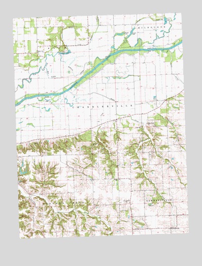
Newmansville, IL USGS Topographic Map
Click on map above to begin viewing in our Map Viewer.

This topographic map contains these locations and features:
Feature Name Type Latitude Longitude GNIS ID View Map
Anderson School (historical)SchoolN40.1198°W90.1060°403513View Map
Anderson SloughGutN40.1170°W90.0871°403515View Map
Angelo LakeLakeN40.1147°W90.0377°403525View Map
Bowles LakeLakeN40.1141°W90.0457°404739View Map
Clary CreekStreamN40.1042°W90.0196°406180View Map
Cox CreekStreamN40.0234°W90.1160°406691View Map
Dick School (historical)SchoolN40.0606°W90.0707°407193View Map
Fancher CreekStreamN40.0545°W90.0279°408261View Map
Fish LakeLakeN40.1041°W90.0877°408387View Map
Friend LakeLakeN40.0646°W90.1151°408755View Map
Harbison-Davis CemeteryCemeteryN40.0528°W90.1121°1720418View Map
Hickey CemeteryCemeteryN40.0611°W90.0329°1720420View Map
Jordan CreekStreamN40.1103°W90.0676°411245View Map
Jordan School (historical)SchoolN40.1189°W90.0698°411252View Map
Little Shepherd CemeteryCemeteryN40.0184°W90.0459°1720428View Map
Long BranchGutN40.1087°W90.0746°412547View Map
Longs LakeReservoirN40.0371°W90.1205°1691587View Map
Longs Lake DamDamN40.0367°W90.1218°1691586View Map
Lynn School (historical)SchoolN40.0714°W90.0207°412771View Map
McHenry SloughGutN40.0925°W90.0812°413279View Map
Middle CreekStreamN40.0834°W90.0854°413487View Map
Miller CreekStreamN40.0789°W90.0607°413583View Map
Mount Olive CemeteryCemeteryN40.0655°W90.0503°1965525View Map
Mount Olive ChurchChurchN40.0653°W90.0512°414021View Map
Mud SloughLakeN40.0940°W90.1007°414200View Map
NewmansvillePopulated PlaceN40.0034°W90.0118°414494View Map
Newmansville CemeteryCemeteryN40.0042°W90.0112°1773039View Map
Opossum HollowValleyN40.0689°W90.0206°415148View Map
Pleasant Hill School (historical)SchoolN40.0153°W90.0515°415851View Map
Pontiac CemeteryCemeteryN40.0319°W90.0512°1720442View Map
Pontiac School (historical)SchoolN40.0331°W90.0515°416009View Map
Pratt LakeLakeN40.1207°W90.0122°416189View Map
Shick Shack HillSummitN40.0584°W90.0271°418386View Map
Township of ChandlervilleCivilN40.0704°W90.0609°428788View Map
Township of NewmansvilleCivilN40.0032°W90.0229°429439View Map
Township of Panther CreekCivilN40.0033°W90.1069°429525View Map
Victory School (historical)SchoolN40.0253°W90.0985°420304View Map
White CityPopulated PlaceN40.1050°W90.1076°421031View Map
Wilson School (historical)SchoolN40.0473°W90.1068°421300View Map
Witty CemeteryCemeteryN40.0167°W90.0293°1720463View Map

Note: Coordinates in the location and feature list above are referenced to NAD83 datum.


Copyright (C) 2008-2024 Ryan Niemi / Sunset Dynamics ... All Rights Reserved