TopoQuest Logo
Do you find TopoQuest useful?
Help keep TopoQuest running and adding new maps/features by donating!
Bitcoin:  19c7KJd3qBynnjoSw5npx9KScwjBe4ifkT
Litecoin:  LXs6TkuXGGXo1vDsWCkWVdjQX94eUKd6ui
Home View Maps Find Maps Find Places Resources & Links


Tallula, Illinois Topographic Map

USGS Map Title: Tallula, IL
USGS Map MRC: 39089H8
DRG (GeoTIFF) Download: o39089h8.tif


Neighboring USGS Topographic Map Quads:


  Newmansville, IL  
40090A1
 

  Oakford, IL  
40089A8
 

  Petersburg, IL  
40089A7
 

  Ashland, IL  
39090H1
 

  Tallula, IL  
39089H8
 

  Salisbury, IL  
39089H7
 

  Prentice, IL  
39090G1
 

  Pleasant Plains, IL  
39089G8
 

  Farmingdale, IL  
39089G7


Map MRC Location:

N40°
W90°
N40°
W89°
H8 H7 H6 H5 H4 H3 H2 H1
G8 G7 G6 G5 G4 G3 G2 G1
F8 F7 F6 F5 F4 F3 F2 F1
E8 E7 E6 E5 E4 E3 E2 E1
D8 D7 D6 D5 D4 D3 D2 D1
C8 C7 C6 C5 C4 C3 C2 C1
B8 B7 B6 B5 B4 B3 B2 B1
A8 A7 A6 A5 A4 A3 A2 A1
N39°
W90°
N39°
W89°

Tallula, IL USGS 1:24K Topographic Map Preview:
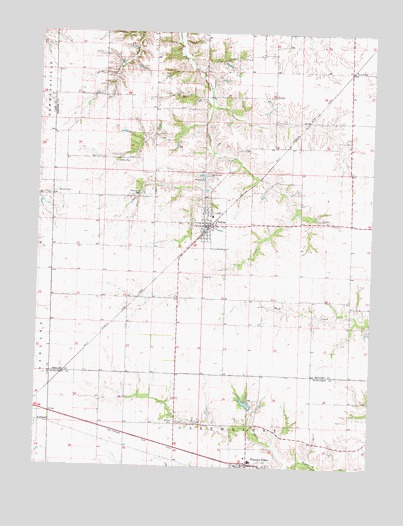
Tallula, IL USGS Topographic Map
Click on map above to begin viewing in our Map Viewer.

This topographic map contains these locations and features:
Feature Name Type Latitude Longitude GNIS ID View Map
Bethel CemeteryCemeteryN39.8881°W89.9479°404273View Map
Brandt HeliportAirportN39.8773°W89.9246°427695View Map
Braun PondReservoirN39.8934°W89.9212°1691907View Map
Braun Pond DamDamN39.8917°W89.9184°1691906View Map
Calvary Baptist ChurchChurchN39.9439°W89.9379°1808799View Map
Five PointLocaleN39.9892°W89.8834°1748055View Map
Greenwood CemeteryCemeteryN39.9530°W89.9620°409457View Map
Hill TopPopulated PlaceN39.9892°W89.8832°422700View Map
North Fork Richland CreekStreamN39.8762°W89.9046°414604View Map
Petersburg South Number 15 Election PrecinctCivilN39.9899°W89.8854°1928591View Map
Pleasant Plains Fire Protection DistrictBuildingN39.8790°W89.9230°2640231View Map
Pleasant Plains High SchoolSchoolN39.8769°W89.9192°1821099View Map
Pleasant Plains Police DepartmentBuildingN39.8756°W89.9222°2758944View Map
Smedly CemeteryCemeteryN39.9631°W89.9710°418614View Map
TallulaPopulated PlaceN39.9445°W89.9373°419528View Map
Tallula Christian ChurchChurchN39.9481°W89.9384°1808819View Map
Tallula Elementary SchoolSchoolN39.9473°W89.9351°1808820View Map
Tallula Fire DepartmentBuildingN39.9472°W89.9357°2640148View Map
Tallula Freewill Baptist ChurchChurchN39.9475°W89.9368°1808821View Map
Tallula Number 11 Election PrecinctCivilN39.9502°W89.9435°1928655View Map
Tallula Post OfficePost OfficeN39.9444°W89.9374°2788320View Map
Village of TallulaCivilN39.9457°W89.9366°2399948View Map
White CemeteryCemeteryN39.9593°W89.9367°421025View Map
Willson CemeteryCemeteryN39.9531°W89.9940°421274View Map

Note: Coordinates in the location and feature list above are referenced to NAD83 datum.


Copyright (C) 2008-2024 Ryan Niemi / Sunset Dynamics ... All Rights Reserved