TopoQuest Logo
Do you find TopoQuest useful?
Help keep TopoQuest running and adding new maps/features by donating!
Bitcoin:  19c7KJd3qBynnjoSw5npx9KScwjBe4ifkT
Litecoin:  LXs6TkuXGGXo1vDsWCkWVdjQX94eUKd6ui
Home View Maps Find Maps Find Places Resources & Links


Newville, Alabama Topographic Map

USGS Map Title: Newville, AL
USGS Map MRC: 31085D3
DRG (GeoTIFF) Download: o31085d3.tif


Neighboring USGS Topographic Map Quads:


  Clopton, AL  
31085E4
 

  Abbeville West, AL  
31085E3
 

  Abbeville East, AL  
31085E2
 

  Echo, AL  
31085D4
 

  Newville, AL  
31085D3
 

  Haleburg, AL  
31085D2
 

  Midland City, AL  
31085C4
 

  Headland, AL  
31085C3
 

  Sigma, AL  
31085C2


Map MRC Location:

N32°
W86°
N32°
W85°
H8 H7 H6 H5 H4 H3 H2 H1
G8 G7 G6 G5 G4 G3 G2 G1
F8 F7 F6 F5 F4 F3 F2 F1
E8 E7 E6 E5 E4 E3 E2 E1
D8 D7 D6 D5 D4 D3 D2 D1
C8 C7 C6 C5 C4 C3 C2 C1
B8 B7 B6 B5 B4 B3 B2 B1
A8 A7 A6 A5 A4 A3 A2 A1
N31°
W86°
N31°
W85°

Newville, AL USGS 1:24K Topographic Map Preview:
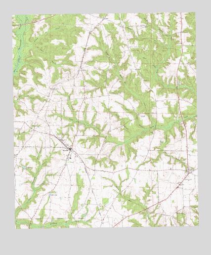
Newville, AL USGS Topographic Map
Click on map above to begin viewing in our Map Viewer.

This topographic map contains these locations and features:
Feature Name Type Latitude Longitude GNIS ID View Map
Abbeville Missionary HolinessChurchN31.3806°W85.3152°2580313View Map
Black BranchStreamN31.4818°W85.3666°114398View Map
Buck BranchStreamN31.4677°W85.2766°115100View Map
Caney BranchStreamN31.4316°W85.2847°115561View Map
CappsPopulated PlaceN31.4971°W85.3119°115606View Map
Center CemeteryCemeteryN31.4677°W85.3285°142987View Map
Center United Methodist ChurchChurchN31.4671°W85.3285°115833View Map
Clemmons Gin BranchStreamN31.4321°W85.2710°116250View Map
DanzeyPopulated PlaceN31.4674°W85.2905°156249View Map
Favorite CreekStreamN31.3957°W85.3716°133488View Map
George BranchStreamN31.4285°W85.2924°118898View Map
Griffin PondReservoirN31.3950°W85.3507°119409View Map
Headland-Newville DivisionCivilN31.4024°W85.3236°165799View Map
Herrings Airfield (historical)AirportN31.4396°W85.2883°1730179View Map
Hodges Mathis Mill CreekStreamN31.4338°W85.2788°120176View Map
Lake MilaReservoirN31.4109°W85.3682°122719View Map
Little BranchStreamN31.4816°W85.2716°121713View Map
Little CreekStreamN31.4796°W85.2685°121763View Map
Mill Grove (historical)LocaleN31.4191°W85.2569°149918View Map
Mount Sinai CemeteryCemeteryN31.4174°W85.3744°123385View Map
Murphy Gin BranchStreamN31.4832°W85.3669°123603View Map
New Zion Freewill Baptist ChurchChurchN31.3996°W85.2630°152685View Map
NewvillePopulated PlaceN31.4218°W85.3377°152690View Map
Newville Baptist ChurchChurchN31.4224°W85.3380°142992View Map
Newville CemeteryCemeteryN31.4227°W85.3374°142991View Map
Newville High SchoolSchoolN31.4160°W85.3366°149919View Map
Newville Post OfficePost OfficeN31.4214°W85.3359°2788954View Map
Newville Volunteer Fire DepartmentBuildingN31.4167°W85.3365°2691405View Map
Noles BranchStreamN31.4110°W85.3572°123965View Map
Oakey GrovePopulated PlaceN31.4885°W85.2599°1730180View Map
Oakey Grove Baptist ChurchChurchN31.4891°W85.2594°155180View Map
Oaky Grove CemeteryCemeteryN31.4891°W85.2594°142988View Map
Philadelphia ChurchChurchN31.4413°W85.2777°154641View Map
Poor CreekStreamN31.4832°W85.3669°125134View Map
Rocky Mountain ChurchChurchN31.3824°W85.2602°125872View Map
Rosenwall SchoolSchoolN31.4266°W85.3433°125952View Map
Tolbert Baptist ChurchChurchN31.4307°W85.2802°153700View Map
Tolbert CemeteryCemeteryN31.4310°W85.2805°142989View Map
Town of NewvilleCivilN31.4206°W85.3367°2406991View Map
TumbletonPopulated PlaceN31.4066°W85.2566°128120View Map
Tumbleton ChurchChurchN31.3863°W85.2547°128121View Map
Union Springs CemeteryCemeteryN31.4568°W85.3497°142986View Map
Union Springs Missionary Baptist ChurchChurchN31.4566°W85.3491°153803View Map
Welcome ChurchChurchN31.4610°W85.2860°128720View Map
Wesley Hill ChurchChurchN31.4091°W85.2977°132087View Map
White BranchStreamN31.4371°W85.3310°128856View Map
Zion CemeteryCemeteryN31.4001°W85.2625°142990View Map

Note: Coordinates in the location and feature list above are referenced to NAD83 datum.


Copyright (C) 2008-2025 Ryan Niemi / Sunset Dynamics ... All Rights Reserved