TopoQuest Logo
Do you find TopoQuest useful?
Help keep TopoQuest running and adding new maps/features by donating!
Bitcoin:  19c7KJd3qBynnjoSw5npx9KScwjBe4ifkT
Litecoin:  LXs6TkuXGGXo1vDsWCkWVdjQX94eUKd6ui
Home View Maps Find Maps Find Places Resources & Links


Clopton, Alabama Topographic Map

USGS Map Title: Clopton, AL
USGS Map MRC: 31085E4
DRG (GeoTIFF) Download: o31085e4.tif


Neighboring USGS Topographic Map Quads:


  Clio, AL  
31085F5
 

  Texasville, AL  
31085F4
 

  Lawrenceville, AL  
31085F3
 

  Skipperville, AL  
31085E5
 

  Clopton, AL  
31085E4
 

  Abbeville West, AL  
31085E3
 

  Ewell, AL  
31085D5
 

  Echo, AL  
31085D4
 

  Newville, AL  
31085D3


Map MRC Location:

N32°
W86°
N32°
W85°
H8 H7 H6 H5 H4 H3 H2 H1
G8 G7 G6 G5 G4 G3 G2 G1
F8 F7 F6 F5 F4 F3 F2 F1
E8 E7 E6 E5 E4 E3 E2 E1
D8 D7 D6 D5 D4 D3 D2 D1
C8 C7 C6 C5 C4 C3 C2 C1
B8 B7 B6 B5 B4 B3 B2 B1
A8 A7 A6 A5 A4 A3 A2 A1
N31°
W86°
N31°
W85°

Clopton, AL USGS 1:24K Topographic Map Preview:
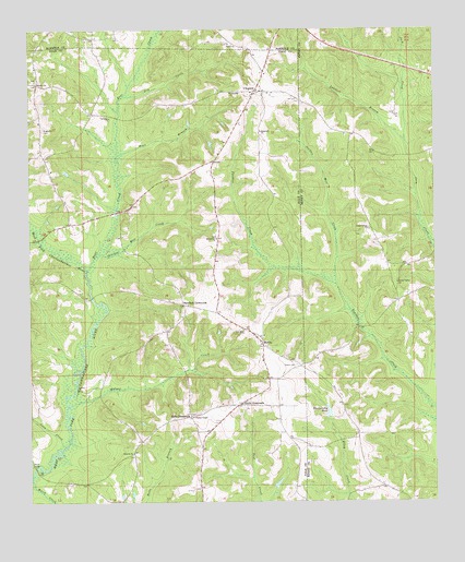
Clopton, AL USGS Topographic Map
Click on map above to begin viewing in our Map Viewer.

This topographic map contains these locations and features:
Feature Name Type Latitude Longitude GNIS ID View Map
Barefield CrossroadsPopulated PlaceN31.5518°W85.4524°156023View Map
Bear CreekStreamN31.5618°W85.4822°113657View Map
Bells CrossroadsPopulated PlaceN31.5227°W85.4508°113892View Map
Bells School (historical)SchoolN31.5235°W85.4477°133455View Map
Bersheba School (historical)SchoolN31.5579°W85.4988°133456View Map
BerthaPopulated PlaceN31.5413°W85.4280°113974View Map
Blankenship PondReservoirN31.5237°W85.4080°114483View Map
Browns United Methodist ChurchChurchN31.5127°W85.4685°115010View Map
CloptonPopulated PlaceN31.6085°W85.4299°116275View Map
Clopton CemeteryCemeteryN31.6093°W85.4283°1729897View Map
Clopton Post OfficePost OfficeN31.6088°W85.4305°167326View Map
Clopton United Methodist ChurchChurchN31.6088°W85.4285°133473View Map
Corn CreekStreamN31.5149°W85.4894°116650View Map
Dry CreekStreamN31.6074°W85.4705°117528View Map
Dykes CemeteryCemeteryN31.5407°W85.4658°133484View Map
Friendship Baptist ChurchChurchN31.6085°W85.4374°118665View Map
G B Blankenship DamDamN31.5218°W85.4083°129878View Map
Good Tidings ChurchChurchN31.5727°W85.3949°119135View Map
Green Valley ChurchChurchN31.5582°W85.3869°119352View Map
Hopewell ChurchChurchN31.5982°W85.4283°120364View Map
Hopn BranchStreamN31.5916°W85.4727°120391View Map
Lambert BranchStreamN31.5952°W85.3838°121355View Map
Lewis Mill (historical)LocaleN31.5779°W85.4727°133500View Map
Magnolia CemeteryCemeteryN31.5990°W85.4955°122205View Map
Magnolia Church (historical)ChurchN31.5993°W85.4958°133506View Map
Magnolia School (historical)SchoolN31.5985°W85.4958°133507View Map
Monks Mill BridgeBridgeN31.5541°W85.4810°133514View Map
Mount Carmel CemeteryCemeteryN31.5699°W85.4422°1729926View Map
Mount Carmel ChurchChurchN31.5699°W85.4422°123169View Map
New Hope Baptist ChurchChurchN31.5454°W85.4338°155894View Map
New Hope CemeteryCemeteryN31.5457°W85.4344°1729898View Map
New Hope School (historical)SchoolN31.5457°W85.4347°133524View Map
Peebles Mill CreekStreamN31.5574°W85.4052°124566View Map
Peniel Baptist ChurchChurchN31.6110°W85.4969°124584View Map
Peniel CemeteryCemeteryN31.6115°W85.4974°1730135View Map
Saint Jeans ChurchChurchN31.6018°W85.4749°153252View Map
Salem CemeteryCemeteryN31.5363°W85.4177°126235View Map
Shiloh ChurchChurchN31.6213°W85.4377°126728View Map
Snells CrossroadsPopulated PlaceN31.5257°W85.4360°127074View Map
Stuckey Mill CreekStreamN31.5660°W85.4791°153592View Map
Walnut CreekStreamN31.5254°W85.4877°128547View Map
Ward BridgeBridgeN31.5093°W85.4985°128571View Map
Ward CreekStreamN31.5060°W85.4999°163941View Map
Wesley Chapel United Methodist ChurchChurchN31.5227°W85.4499°155932View Map
Wilkerson CemeteryCemeteryN31.6213°W85.4383°134837View Map

Note: Coordinates in the location and feature list above are referenced to NAD83 datum.


Copyright (C) 2008-2025 Ryan Niemi / Sunset Dynamics ... All Rights Reserved