TopoQuest Logo
Do you find TopoQuest useful?
Help keep TopoQuest running and adding new maps/features by donating!
Bitcoin:  19c7KJd3qBynnjoSw5npx9KScwjBe4ifkT
Litecoin:  LXs6TkuXGGXo1vDsWCkWVdjQX94eUKd6ui
Home View Maps Find Maps Find Places Resources & Links


Nielsen Coulee, Montana Topographic Map

USGS Map Title: Nielsen Coulee, MT
USGS Map MRC: 48105E4
DRG (GeoTIFF) Download: o48105e4.tif


Neighboring USGS Topographic Map Quads:


  South of Four Buttes, MT  
48105F5
 

  Cabarett Coulee, MT  
48105F4
 

  Line Coulee, MT  
48105F3
 

  Jakes Coulee, MT  
48105E5
 

  Nielsen Coulee, MT  
48105E4
 

  Bredette, MT  
48105E3
 

  Reed Springs, MT  
48105D5
 

  Bears Nest, MT  
48105D4
 

  Windy Butte, MT  
48105D3


Map MRC Location:

N49°
W106°
N49°
W105°
H8 H7 H6 H5 H4 H3 H2 H1
G8 G7 G6 G5 G4 G3 G2 G1
F8 F7 F6 F5 F4 F3 F2 F1
E8 E7 E6 E5 E4 E3 E2 E1
D8 D7 D6 D5 D4 D3 D2 D1
C8 C7 C6 C5 C4 C3 C2 C1
B8 B7 B6 B5 B4 B3 B2 B1
A8 A7 A6 A5 A4 A3 A2 A1
N48°
W106°
N48°
W105°

Nielsen Coulee, MT USGS 1:24K Topographic Map Preview:
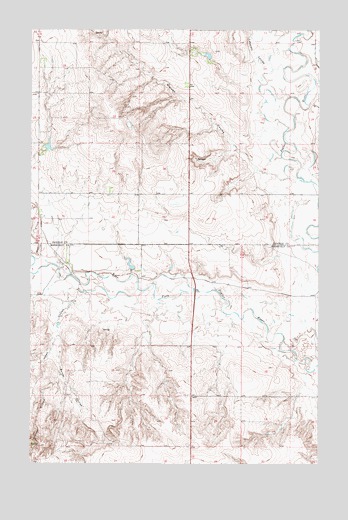
Nielsen Coulee, MT USGS Topographic Map
Click on map above to begin viewing in our Map Viewer.

This topographic map contains these locations and features:
Feature Name Type Latitude Longitude GNIS ID View Map
32N48E03DAAB01 WellWellN48.5550°W105.4550°1635867View Map
32N48E13ABBC01 WellWellN48.5384°W105.4186°1635831View Map
32N48E23DDDD01 WellWellN48.5056°W105.4317°1635751View Map
33N48E29CDDD01 WellWellN48.5786°W105.4655°1635935View Map
33N48E31BCCA01 WellWellN48.5722°W105.4956°1635914View Map
33N48E33ADAD01 WellWellN48.5725°W105.4325°1635915View Map
33N48E33ADDD01 WellWellN48.5709°W105.4330°1635910View Map
33N48E33BBBB01 WellWellN48.5764°W105.4530°1635929View Map
Cabarett CouleeValleyN48.6145°W105.3989°805875View Map
Christensen Number 1 DamDamN48.5567°W105.4572°797644View Map
Christensen Number 2 DamDamN48.5567°W105.4339°797643View Map
Fort Peck Reservation DivisionCivilN48.5973°W105.4974°1940618View Map
Jakes CouleeValleyN48.5464°W105.4817°805877View Map
Kahle (historical)Populated PlaceN48.5800°W105.4705°1637379View Map
Kahle Post Office (historical)Post OfficeN48.5800°W105.4705°1637377View Map
Krause CouleeValleyN48.5247°W105.4881°773131View Map
Nielsen CouleeValleyN48.5870°W105.4047°774631View Map
PCB DamDamN48.6167°W105.4239°798162View Map
Police CreekStreamN48.5575°W105.4911°805879View Map
Pratt DamDamN48.5917°W105.4939°797728View Map
Reiner CouleeValleyN48.5370°W105.4872°775698View Map

Note: Coordinates in the location and feature list above are referenced to NAD83 datum.


Copyright (C) 2008-2025 Ryan Niemi / Sunset Dynamics ... All Rights Reserved