TopoQuest Logo
Do you find TopoQuest useful?
Help keep TopoQuest running and adding new maps/features by donating!
Bitcoin:  19c7KJd3qBynnjoSw5npx9KScwjBe4ifkT
Litecoin:  LXs6TkuXGGXo1vDsWCkWVdjQX94eUKd6ui
Home View Maps Find Maps Find Places Resources & Links


North Western, New York Topographic Map

USGS Map Title: North Western, NY
USGS Map MRC: 43075C3
DRG (GeoTIFF) Download: o43075c3.tif


Neighboring USGS Topographic Map Quads:


  West Leyden, NY  
43075D4
 

  Boonville, NY  
43075D3
 

  Forestport, NY  
43075D2
 

  Westernville, NY  
43075C4
 

  North Western, NY  
43075C3
 

  Remsen, NY  
43075C2
 

  Rome, NY  
43075B4
 

  Oriskany, NY  
43075B3
 

  South Trenton, NY  
43075B2


Map MRC Location:

N44°
W76°
N44°
W75°
H8 H7 H6 H5 H4 H3 H2 H1
G8 G7 G6 G5 G4 G3 G2 G1
F8 F7 F6 F5 F4 F3 F2 F1
E8 E7 E6 E5 E4 E3 E2 E1
D8 D7 D6 D5 D4 D3 D2 D1
C8 C7 C6 C5 C4 C3 C2 C1
B8 B7 B6 B5 B4 B3 B2 B1
A8 A7 A6 A5 A4 A3 A2 A1
N43°
W76°
N43°
W75°

North Western, NY USGS 1:24K Topographic Map Preview:
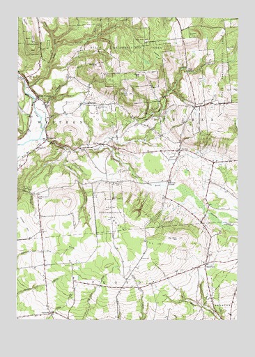
North Western, NY USGS Topographic Map
Click on map above to begin viewing in our Map Viewer.

This topographic map contains these locations and features:
Feature Name Type Latitude Longitude GNIS ID View Map
Beaver Meadow BrookStreamN43.3212°W75.3285°943402View Map
Belle Maison FarmsLocaleN43.2508°W75.3514°2515590View Map
Big BrookStreamN43.3212°W75.3488°943845View Map
Big BrookPopulated PlaceN43.3223°W75.3268°972230View Map
Boody HillSummitN43.3431°W75.3121°944437View Map
Bowen HillSummitN43.3673°W75.2763°944509View Map
Buck HillSummitN43.3648°W75.3668°945023View Map
Bunt BrookStreamN43.3673°W75.3310°945191View Map
CamrodenPopulated PlaceN43.2528°W75.3552°945714View Map
Camroden Golf CourseLocaleN43.2587°W75.3619°2615359View Map
Carmichael HillPopulated PlaceN43.3392°W75.3379°972300View Map
Carmichael Hill CemeteryCemeteryN43.3387°W75.3285°945865View Map
Cyrus BrookStreamN43.3631°W75.3538°947977View Map
East FloydPopulated PlaceN43.2731°W75.2677°949070View Map
Fink HollowPopulated PlaceN43.3526°W75.2791°972471View Map
Flying Acres Airport (historical)AirportN43.3417°W75.3574°978193View Map
FrenchvillePopulated PlaceN43.3251°W75.3582°950707View Map
Frenchville CemeteryCemeteryN43.3212°W75.3630°950708View Map
Gifford CreekStreamN43.3212°W75.3488°951076View Map
Gifford HillSummitN43.2887°W75.3696°951081View Map
Gifford Hill SchoolSchoolN43.3003°W75.3624°951082View Map
Gulf CreekStreamN43.3203°W75.3452°951916View Map
Holland Patent Central High SchoolSchoolN43.2539°W75.2544°2436576View Map
Holland Patent Middle SchoolSchoolN43.2528°W75.2544°2436573View Map
Lansing KillStreamN43.3509°W75.3749°970278View Map
Maple MountainSummitN43.3512°W75.3052°956438View Map
Merrick CornerPopulated PlaceN43.3070°W75.2891°972790View Map
Meszler HillSummitN43.3548°W75.3296°957028View Map
Nisbet CemeteryCemeteryN43.3003°W75.3210°958619View Map
North WesternPopulated PlaceN43.3423°W75.3635°958945View Map
North Western United Methodist ChurchChurchN43.3419°W75.3637°2616153View Map
Oakes HillSummitN43.3578°W75.2938°959163View Map
Pen Bonc HillSummitN43.2837°W75.2829°960130View Map
Penn Mountain CemeteryCemeteryN43.3627°W75.2559°960143View Map
South HillSummitN43.2815°W75.2949°965781View Map
SteubenPopulated PlaceN43.3201°W75.2829°966371View Map
Steuben Corners CemeteryCemeteryN43.3167°W75.2885°942109View Map
Steuben United Methodist ChurchChurchN43.3204°W75.2830°2616293View Map
Stone CemeteryCemeteryN43.3065°W75.3190°966490View Map
Stringer BrookStreamN43.3434°W75.3691°966639View Map
Tannery BrookStreamN43.3290°W75.3604°967049View Map
Town of SteubenCivilN43.3465°W75.2648°979525View Map
Volunteer Fire Company of WesternBuildingN43.3128°W75.3744°2734916View Map
Ward CemeteryCemeteryN43.2773°W75.2663°968781View Map
Wells CreekStreamN43.3245°W75.3621°969046View Map

Note: Coordinates in the location and feature list above are referenced to NAD83 datum.


Copyright (C) 2008-2024 Ryan Niemi / Sunset Dynamics ... All Rights Reserved