TopoQuest Logo
Do you find TopoQuest useful?
Help keep TopoQuest running and adding new maps/features by donating!
Bitcoin:  19c7KJd3qBynnjoSw5npx9KScwjBe4ifkT
Litecoin:  LXs6TkuXGGXo1vDsWCkWVdjQX94eUKd6ui
Home View Maps Find Maps Find Places Resources & Links


Northfield, Vermont Topographic Map

USGS Map Title: Northfield, VT
USGS Map MRC: 44072B6
DRG (GeoTIFF) Download: o44072b6.tif


Neighboring USGS Topographic Map Quads:


  Waterbury, VT  
44072C7
 

  Middlesex, VT  
44072C6
 

  Montpelier, VT  
44072C5
 

  Waitsfield, VT  
44072B7
 

  Northfield, VT  
44072B6
 

  Barre West, VT  
44072B5
 

  Warren, VT  
44072A7
 

  Roxbury, VT  
44072A6
 

  Brookfield, VT  
44072A5


Map MRC Location:

N45°
W73°
N45°
W72°
H8 H7 H6 H5 H4 H3 H2 H1
G8 G7 G6 G5 G4 G3 G2 G1
F8 F7 F6 F5 F4 F3 F2 F1
E8 E7 E6 E5 E4 E3 E2 E1
D8 D7 D6 D5 D4 D3 D2 D1
C8 C7 C6 C5 C4 C3 C2 C1
B8 B7 B6 B5 B4 B3 B2 B1
A8 A7 A6 A5 A4 A3 A2 A1
N44°
W73°
N44°
W72°

Northfield, VT USGS 1:24K Topographic Map Preview:
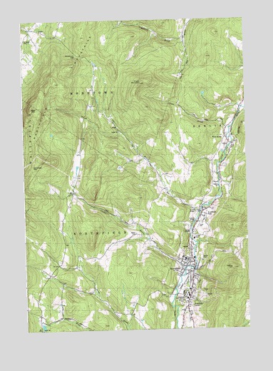
Northfield, VT USGS Topographic Map
Click on map above to begin viewing in our Map Viewer.

This topographic map contains these locations and features:
Feature Name Type Latitude Longitude GNIS ID View Map
Aldrich CemeteryCemeteryN44.1638°W72.6880°1456135View Map
Bald MountainSummitN44.2148°W72.7454°1456229View Map
Berlin Volunteer Fire Department - Riverton StationBuildingN44.1999°W72.6345°2121363View Map
Chase BrookStreamN44.2076°W72.6351°1456856View Map
Chase MountainSummitN44.2245°W72.6832°1456860View Map
Cox BrookStreamN44.1723°W72.6534°1457035View Map
Cox Brook-Glinnis CemeteryCemeteryN44.1877°W72.6710°1919029View Map
Elmwood CemeteryCemeteryN44.1543°W72.6592°1919052View Map
Four Corners CemeteryCemeteryN44.1810°W72.7156°1919059View Map
Glidden SchoolSchoolN44.1539°W72.7204°1457557View Map
Grace Evangelical Free ChurchChurchN44.1648°W72.6568°1919060View Map
Herring BrookStreamN44.2439°W72.6593°1457805View Map
Lower Cox Covered BridgeBridgeN44.1728°W72.6526°1919103View Map
Moretown GapGapN44.2362°W72.7193°1458531View Map
NorthfieldPopulated PlaceN44.1512°W72.6565°1461817View Map
Northfield Ambulance ServiceBuildingN44.1607°W72.6574°2578114View Map
Northfield Bible Fellowship ChurchChurchN44.1512°W72.6598°1919144View Map
Northfield Census Designated PlaceCensusN44.1531°W72.6557°2765037View Map
Northfield CenterPopulated PlaceN44.1348°W72.6609°1458778View Map
Northfield Day CareSchoolN44.1507°W72.6577°2427481View Map
Northfield Elementary SchoolSchoolN44.1543°W72.6621°1919145View Map
Northfield FallsPopulated PlaceN44.1720°W72.6509°1458779View Map
Northfield Falls CemeteryCemeteryN44.1691°W72.6508°1919146View Map
Northfield Falls Covered BridgeBridgeN44.1726°W72.6512°1919147View Map
Northfield Falls Post OfficePost OfficeN44.1719°W72.6494°1919148View Map
Northfield Fire DepartmentBuildingN44.1488°W72.6588°1919149View Map
Northfield Methodist ChurchChurchN44.1467°W72.6557°1919151View Map
Northfield Middle / High SchoolSchoolN44.1536°W72.6606°1919152View Map
Northfield Municipal ForestForestN44.1451°W72.6304°1919153View Map
Northfield Police DepartmentBuildingN44.1488°W72.6584°2752772View Map
Northfield Post OfficePost OfficeN44.1471°W72.6561°1919154View Map
Northfield Shopping CenterLocaleN44.1537°W72.6551°1919155View Map
Northfield Town HallBuildingN44.1487°W72.6554°1919156View Map
Northfield Village Municipal ForestForestN44.1742°W72.6323°1919157View Map
Norwich UniversitySchoolN44.1388°W72.6600°1458787View Map
Norwich University CemeteryCemeteryN44.1342°W72.6757°1919161View Map
Norwich University MuseumBuildingN44.1395°W72.6618°1919162View Map
Norwich University Ski AreaLocaleN44.1390°W72.6423°1919163View Map
Number 9 SchoolSchoolN44.2473°W72.6593°1458692View Map
Old Catholic CemeteryCemeteryN44.1527°W72.6517°1919164View Map
Saint Johns Roman Catholic ChurchChurchN44.1523°W72.6593°1919198View Map
Saint Marys ChurchChurchN44.1462°W72.6559°1919199View Map
Slaughterhouse Covered BridgeBridgeN44.1684°W72.6546°1919206View Map
Town of NorthfieldCivilN44.1453°W72.6841°1462163View Map
Turkey HillSummitN44.1506°W72.6346°1459966View Map
Union BrookStreamN44.1498°W72.6607°1459986View Map
United ChurchChurchN44.1534°W72.6568°1919229View Map
Upper Cox Brook Covered BridgeBridgeN44.1737°W72.6554°1919233View Map
Village of Northfield (historical)CivilN44.1531°W72.6557°2378320View Map
Waitsfield GapGapN44.1920°W72.7429°1460039View Map
Washington South Supervisory UnionSchoolN44.1538°W72.6613°2427436View Map
West BerlinPopulated PlaceN44.2001°W72.6329°1459207View Map
West Berlin CemeteryCemeteryN44.2026°W72.6362°1919188View Map
West Berlin SchoolSchoolN44.2028°W72.6379°1460112View Map
WNUB-FM (Northfield)TowerN44.1423°W72.6582°1461897View Map

Note: Coordinates in the location and feature list above are referenced to NAD83 datum.


Copyright (C) 2008-2025 Ryan Niemi / Sunset Dynamics ... All Rights Reserved