TopoQuest Logo
Do you find TopoQuest useful?
Help keep TopoQuest running and adding new maps/features by donating!
Bitcoin:  19c7KJd3qBynnjoSw5npx9KScwjBe4ifkT
Litecoin:  LXs6TkuXGGXo1vDsWCkWVdjQX94eUKd6ui
Home View Maps Find Maps Find Places Resources & Links


Waitsfield, Vermont Topographic Map

USGS Map Title: Waitsfield, VT
USGS Map MRC: 44072B7
DRG (GeoTIFF) Download: o44072b7.tif


Neighboring USGS Topographic Map Quads:


  Huntington, VT  
44072C8
 

  Waterbury, VT  
44072C7
 

  Middlesex, VT  
44072C6
 

  Mount Ellen, VT  
44072B8
 

  Waitsfield, VT  
44072B7
 

  Northfield, VT  
44072B6
 

  Lincoln, VT  
44072A8
 

  Warren, VT  
44072A7
 

  Roxbury, VT  
44072A6


Map MRC Location:

N45°
W73°
N45°
W72°
H8 H7 H6 H5 H4 H3 H2 H1
G8 G7 G6 G5 G4 G3 G2 G1
F8 F7 F6 F5 F4 F3 F2 F1
E8 E7 E6 E5 E4 E3 E2 E1
D8 D7 D6 D5 D4 D3 D2 D1
C8 C7 C6 C5 C4 C3 C2 C1
B8 B7 B6 B5 B4 B3 B2 B1
A8 A7 A6 A5 A4 A3 A2 A1
N44°
W73°
N44°
W72°

Waitsfield, VT USGS 1:24K Topographic Map Preview:
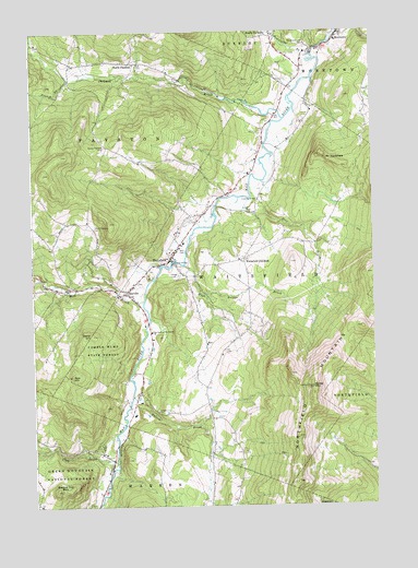
Waitsfield, VT USGS Topographic Map
Click on map above to begin viewing in our Map Viewer.

This topographic map contains these locations and features:
Feature Name Type Latitude Longitude GNIS ID View Map
Angus Airways Airport (historical)AirportN44.2301°W72.7907°1461969View Map
Belding CemeteryCemeteryN44.2439°W72.7626°1918992View Map
Center Fayston CemeteryCemeteryN44.2199°W72.8481°1460714View Map
Chase BrookStreamN44.1851°W72.8715°1460719View Map
Clay BrookStreamN44.1373°W72.8448°1460734View Map
Dana HillSummitN44.1701°W72.8532°1460773View Map
Deer BrookStreamN44.2453°W72.8740°1460781View Map
Double Top MountainSummitN44.1292°W72.8671°1460800View Map
Dowsville BrookStreamN44.2428°W72.7726°1460808View Map
Federated ChurchChurchN44.1934°W72.8232°1919056View Map
Folsom BrookStreamN44.1251°W72.8104°1460879View Map
French BrookStreamN44.2378°W72.8607°1460885View Map
Great Eddy Covered BridgeBridgeN44.1892°W72.8234°1919067View Map
Green Mountain Valley SchoolSchoolN44.1855°W72.8504°2427421View Map
Green MountainsRangeN44.1455°W72.8540°1460934View Map
High Bridge BrookStreamN44.1887°W72.8198°1460988View Map
IrasvillePopulated PlaceN44.1814°W72.8404°1461016View Map
Irasville CemeteryCemeteryN44.1837°W72.8365°1919078View Map
Joslin Memorial LibraryBuildingN44.1920°W72.8243°1919088View Map
Ketcham Landing AreaAirportN44.1626°W72.8342°1461968View Map
Kew HillSummitN44.1592°W72.8609°1461045View Map
Mad River Fly-In Airport (historical)AirportN44.2264°W72.7933°1461967View Map
Mad River Valley Alliance ChurchChurchN44.1934°W72.8232°1919106View Map
Mad River Valley Ambulance ServiceBuildingN44.1924°W72.8217°2578131View Map
Mill BrookStreamN44.1792°W72.8343°1461157View Map
Moretown Elementary SchoolSchoolN44.2476°W72.7626°1919133View Map
Moretown United Methodist CHurchChurchN44.2484°W72.7626°1919136View Map
Moretown Volunteer Fire DepartmentBuildingN44.2493°W72.7620°2121372View Map
Mount WaitsfieldSummitN44.2145°W72.7593°1461572View Map
Mountain View CemeteryCemeteryN44.2468°W72.7738°1461190View Map
North FaystonPopulated PlaceN44.2420°W72.8382°1461225View Map
North Fayston CemeteryCemeteryN44.2426°W72.8355°1919142View Map
Northfield MountainsRangeN44.1302°W72.7627°1461234View Map
Our Lady of the Snows ChurchChurchN44.1709°W72.8315°1461249View Map
Pine BrookStreamN44.2076°W72.7951°1461276View Map
Pine Brook Covered BridgeBridgeN44.2059°W72.7921°1919176View Map
Scrag MountainSummitN44.1564°W72.7732°1461379View Map
Shepard BrookStreamN44.2270°W72.7829°1461394View Map
South DuxburyPopulated PlaceN44.2487°W72.7865°1461429View Map
South Fayston CemeteryCemeteryN44.1986°W72.8522°1461431View Map
Spring Hill SchoolSchoolN44.1898°W72.8081°2427471View Map
Sunrise SchoolSchoolN44.1746°W72.8150°2427409View Map
Town of FaystonCivilN44.2130°W72.8749°1462096View Map
Town of WaitsfieldCivilN44.1813°W72.7946°1462237View Map
Tucker Hill Ski CenterLocaleN44.1820°W72.8684°1919225View Map
Village CemeteryCemeteryN44.1861°W72.8220°1461564View Map
Village CemeteryCemeteryN44.2448°W72.7718°1461831View Map
Wait CemeteryCemeteryN44.1929°W72.8198°1461568View Map
WaitsfieldPopulated PlaceN44.1901°W72.8248°1461570View Map
Waitsfield Census Designated PlaceCensusN44.1900°W72.8245°2586658View Map
Waitsfield Children's CenterSchoolN44.1708°W72.8308°2427480View Map
Waitsfield CommonPopulated PlaceN44.1901°W72.7976°1461571View Map
Waitsfield Elementary SchoolSchoolN44.1944°W72.8194°1919252View Map
Waitsfield Fayston Fire DepartmentBuildingN44.1931°W72.8203°2121370View Map
Waitsfield Post OfficePost OfficeN44.1846°W72.8388°1919253View Map
Waitsfield Village Historic DistrictParkN44.1901°W72.8246°1919254View Map

Note: Coordinates in the location and feature list above are referenced to NAD83 datum.


Copyright (C) 2008-2024 Ryan Niemi / Sunset Dynamics ... All Rights Reserved