TopoQuest Logo
Do you find TopoQuest useful?
Help keep TopoQuest running and adding new maps/features by donating!
Bitcoin:  19c7KJd3qBynnjoSw5npx9KScwjBe4ifkT
Litecoin:  LXs6TkuXGGXo1vDsWCkWVdjQX94eUKd6ui
Home View Maps Find Maps Find Places Resources & Links


Northspur, California Topographic Map

USGS Map Title: Northspur, CA
USGS Map MRC: 39123D5
DRG (GeoTIFF) Download: o39123d5.tif


Neighboring USGS Topographic Map Quads:


  Dutchmans Knoll, CA  
39123E6
 

  Sherwood Peak, CA  
39123E5
 

  Longvale, CA  
39123E4
 

  Noyo Hill, CA  
39123D6
 

  Northspur, CA  
39123D5
 

  Burbeck, CA  
39123D4
 

  Mathison Peak, CA  
39123C6
 

  Comptche, CA  
39123C5
 

  Greenough Ridge, CA  
39123C4


Map MRC Location:

N40°
W124°
N40°
W123°
H8 H7 H6 H5 H4 H3 H2 H1
G8 G7 G6 G5 G4 G3 G2 G1
F8 F7 F6 F5 F4 F3 F2 F1
E8 E7 E6 E5 E4 E3 E2 E1
D8 D7 D6 D5 D4 D3 D2 D1
C8 C7 C6 C5 C4 C3 C2 C1
B8 B7 B6 B5 B4 B3 B2 B1
A8 A7 A6 A5 A4 A3 A2 A1
N39°
W124°
N39°
W123°

Northspur, CA USGS 1:24K Topographic Map Preview:
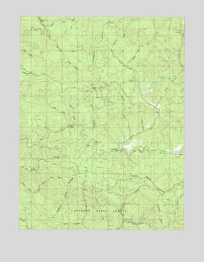
Northspur, CA USGS Topographic Map
Click on map above to begin viewing in our Map Viewer.

This topographic map contains these locations and features:
Feature Name Type Latitude Longitude GNIS ID View Map
AlpinePopulated PlaceN39.4363°W123.5833°1657918View Map
Alpine GulchValleyN39.4366°W123.5861°218166View Map
Arvola GulchValleyN39.3810°W123.5472°218419View Map
Banfill TurnLocaleN39.4627°W123.5414°218643View Map
Big Stump RanchLocaleN39.4207°W123.5197°1724153View Map
Camp FourLocaleN39.4643°W123.5120°220459View Map
Camp MendocinoLocaleN39.4235°W123.5703°1662290View Map
Camp NoyoLocaleN39.4241°W123.6095°253209View Map
Camp Saint AlbertLocaleN39.4216°W123.5489°220484View Map
Camp Silverado (historical)LocaleN39.4241°W123.6120°253210View Map
Camp Ten GulchValleyN39.3971°W123.6108°1724072View Map
Center RidgeRidgeN39.3813°W123.5642°220820View Map
Dewarren CreekStreamN39.4766°W123.5547°222333View Map
Duffy GulchValleyN39.4354°W123.5908°222701View Map
Gulch ElevenValleyN39.4785°W123.5958°224724View Map
Gulch FiveValleyN39.4332°W123.5328°224725View Map
Gulch OneValleyN39.4941°W123.6100°224726View Map
Gulch SevenValleyN39.4471°W123.5222°224728View Map
Gulch SixteenValleyN39.3782°W123.5792°224729View Map
Gulch ThirtyoneValleyN39.4363°W123.5792°224730View Map
Hayworth CreekStreamN39.4543°W123.5333°225083View Map
IrmulcoPopulated PlaceN39.4221°W123.5175°1658833View Map
Marble Creek RanchLocaleN39.4291°W123.5450°1724110View Map
Marble GulchValleyN39.4299°W123.5425°228069View Map
Marble PlacePopulated PlaceN39.4582°W123.5725°1659054View Map
Middle Fork of North Fork Noyo RiverStreamN39.4710°W123.5456°234285View Map
North Fork Hayworth CreekStreamN39.4699°W123.5020°229681View Map
North Fork James CreekStreamN39.3782°W123.5011°229687View Map
North Fork Noyo RiverStreamN39.4207°W123.5525°229702View Map
NorthspurPopulated PlaceN39.4227°W123.5520°1659255View Map
Old Camp SevenLocaleN39.4266°W123.5703°229965View Map
Olds CreekStreamN39.4204°W123.5033°229994View Map
Redwood CreekStreamN39.4924°W123.6097°231431View Map
Three Chop RidgeRidgeN39.4038°W123.5511°236307View Map
WanhalaPopulated PlaceN39.4707°W123.5450°1724277View Map

Note: Coordinates in the location and feature list above are referenced to NAD83 datum.


Copyright (C) 2008-2025 Ryan Niemi / Sunset Dynamics ... All Rights Reserved