TopoQuest Logo
Do you find TopoQuest useful?
Help keep TopoQuest running and adding new maps/features by donating!
Bitcoin:  19c7KJd3qBynnjoSw5npx9KScwjBe4ifkT
Litecoin:  LXs6TkuXGGXo1vDsWCkWVdjQX94eUKd6ui
Home View Maps Find Maps Find Places Resources & Links


Comptche, California Topographic Map

USGS Map Title: Comptche, CA
USGS Map MRC: 39123C5
DRG (GeoTIFF) Download: o39123c5.tif


Neighboring USGS Topographic Map Quads:


  Noyo Hill, CA  
39123D6
 

  Northspur, CA  
39123D5
 

  Burbeck, CA  
39123D4
 

  Mathison Peak, CA  
39123C6
 

  Comptche, CA  
39123C5
 

  Greenough Ridge, CA  
39123C4
 

  Elk, CA  
39123B6
 

  Navarro, CA  
39123B5
 

  Bailey Ridge, CA  
39123B4


Map MRC Location:

N40°
W124°
N40°
W123°
H8 H7 H6 H5 H4 H3 H2 H1
G8 G7 G6 G5 G4 G3 G2 G1
F8 F7 F6 F5 F4 F3 F2 F1
E8 E7 E6 E5 E4 E3 E2 E1
D8 D7 D6 D5 D4 D3 D2 D1
C8 C7 C6 C5 C4 C3 C2 C1
B8 B7 B6 B5 B4 B3 B2 B1
A8 A7 A6 A5 A4 A3 A2 A1
N39°
W124°
N39°
W123°

Comptche, CA USGS 1:24K Topographic Map Preview:
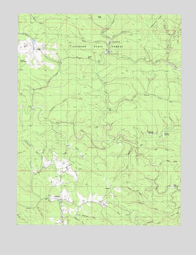
Comptche, CA USGS Topographic Map
Click on map above to begin viewing in our Map Viewer.

This topographic map contains these locations and features:
Feature Name Type Latitude Longitude GNIS ID View Map
Anderson GulchValleyN39.2554°W123.5106°218258View Map
Biggs GulchValleyN39.2879°W123.5150°219284View Map
Bowman GulchValleyN39.2593°W123.5061°233540View Map
Burns CampLocaleN39.3188°W123.6161°220207View Map
CameronPopulated PlaceN39.2724°W123.5545°1655861View Map
Caspar Lumber Company Camp Number 20 (historical)LocaleN39.3527°W123.5572°1653005View Map
Chamberlain CreekStreamN39.3518°W123.5570°220890View Map
Chamberlain Creek Conservation CampLocaleN39.3579°W123.5564°220891View Map
Chamberlain RidgeRidgeN39.3693°W123.5295°220893View Map
Clark OpeningFlatN39.2735°W123.5067°221162View Map
ComptchePopulated PlaceN39.2649°W123.5911°255911View Map
Comptche Census Designated PlaceCensusN39.2651°W123.5897°2628722View Map
Comptche Elementary SchoolSchoolN39.2654°W123.5952°1724173View Map
Comptche Post OfficePost OfficeN39.2648°W123.5921°2760024View Map
Comptche Volunteer Fire DepartmentBuildingN39.2587°W123.5912°2621978View Map
Dietz GulchValleyN39.2985°W123.5383°222370View Map
Docker HillSummitN39.2927°W123.5814°1655974View Map
Dunlap (historical)Populated PlaceN39.3513°W123.5525°1653018View Map
Dunlap PassGapN39.3482°W123.5708°222729View Map
East Branch North Fork Big RiverStreamN39.3199°W123.5558°222859View Map
Freathy CreekStreamN39.3554°W123.5561°1653031View Map
Grimes RanchLocaleN39.2643°W123.5756°1653035View Map
James CreekStreamN39.3474°W123.5125°234080View Map
Kelly GulchValleyN39.2946°W123.5258°226471View Map
Layton Sky RanchLocaleN39.2713°W123.5489°1653058View Map
Little McDonald GulchValleyN39.2560°W123.5814°1662306View Map
Marsh CreekStreamN39.2549°W123.5922°228133View Map
McDonald GulchValleyN39.2541°W123.5828°228346View Map
McDuffy OpeningFlatN39.3043°W123.5139°228355View Map
McGuire 1386 DamDamN39.3599°W123.6145°1664306View Map
McGuire HillSummitN39.3554°W123.6245°1656155View Map
McGuire MillLocaleN39.3524°W123.6117°1724214View Map
Mettick CreekStreamN39.2579°W123.5070°228548View Map
Morrison GulchValleyN39.2605°W123.6117°229083View Map
Nathaniel Smith OpeningFlatN39.2977°W123.5467°1891023View Map
North Fork Albion RiverStreamN39.2652°W123.6081°229637View Map
North Fork Big RiverStreamN39.3010°W123.5520°229644View Map
North Fork CampLocaleN39.3179°W123.5561°229648View Map
Old Camp 19 (historical)LocaleN39.3538°W123.6097°1653083View Map
Park GulchValleyN39.3596°W123.5556°230343View Map
Portuguese GulchValleyN39.2910°W123.6092°230970View Map
Poverty GulchValleyN39.2627°W123.5286°231005View Map
Ramon CreekStreamN39.2716°W123.5039°231201View Map
Russel RanchLocaleN39.2688°W123.5683°1653106View Map
Russell BrookStreamN39.3091°W123.5000°232037View Map
Sindel GulchValleyN39.3621°W123.5086°233171View Map
Soda SpringSpringN39.2838°W123.6083°234840View Map
Soda Spring CreekStreamN39.2827°W123.6075°234846View Map
South Fork Big RiverStreamN39.2952°W123.5339°234972View Map
South Fork CampLocaleN39.2999°W123.5511°234981View Map
Tramway GulchValleyN39.3129°W123.6045°236516View Map
Two Log CreekStreamN39.3202°W123.6147°236728View Map
Water GulchValleyN39.3557°W123.5575°237324View Map
Wild Horse OpeningFlatN39.3041°W123.5239°237759View Map
Yordis Bark Camp (historical)LocaleN39.2827°W123.5289°1724286View Map

Note: Coordinates in the location and feature list above are referenced to NAD83 datum.


Copyright (C) 2008-2024 Ryan Niemi / Sunset Dynamics ... All Rights Reserved