TopoQuest Logo
Do you find TopoQuest useful?
Help keep TopoQuest running and adding new maps/features by donating!
Bitcoin:  19c7KJd3qBynnjoSw5npx9KScwjBe4ifkT
Litecoin:  LXs6TkuXGGXo1vDsWCkWVdjQX94eUKd6ui
Home View Maps Find Maps Find Places Resources & Links


Northwest Goldsboro, North Carolina Topographic Map

USGS Map Title: Northwest Goldsboro, NC
USGS Map MRC: 35078D1
DRG (GeoTIFF) Download: o35078d1.tif


Neighboring USGS Topographic Map Quads:


  Kenly West, NC  
35078E2
 

  Kenly East, NC  
35078E1
 

  Fremont, NC  
35077E8
 

  Princeton, NC  
35078D2
 

  Northwest Goldsboro, NC  
35078D1
 

  Northeast Goldsboro, NC  
35077D8
 

  Grantham, NC  
35078C2
 

  Southwest Goldsboro, NC  
35078C1
 

  Southeast Goldsboro, NC  
35077C8


Map MRC Location:

N36°
W79°
N36°
W78°
H8 H7 H6 H5 H4 H3 H2 H1
G8 G7 G6 G5 G4 G3 G2 G1
F8 F7 F6 F5 F4 F3 F2 F1
E8 E7 E6 E5 E4 E3 E2 E1
D8 D7 D6 D5 D4 D3 D2 D1
C8 C7 C6 C5 C4 C3 C2 C1
B8 B7 B6 B5 B4 B3 B2 B1
A8 A7 A6 A5 A4 A3 A2 A1
N35°
W79°
N35°
W78°

Northwest Goldsboro, NC USGS 1:24K Topographic Map Preview:
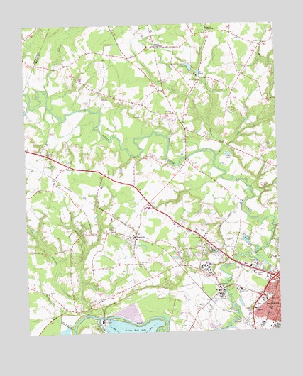
Northwest Goldsboro, NC USGS Topographic Map
Click on map above to begin viewing in our Map Viewer.

This topographic map contains these locations and features:
Feature Name Type Latitude Longitude GNIS ID View Map
Antioch Baptist ChurchChurchN35.3791°W78.0085°2506082View Map
Antioch ChurchChurchN35.3916°W78.1130°980228View Map
Barnes ChapelChurchN35.4166°W78.0842°980568View Map
Beaverdam CreekStreamN35.3829°W78.0936°980848View Map
Benton's Airfield (historical)AirportN35.4998°W78.0322°2679240View Map
Borden HomesPopulated PlaceN35.4007°W78.0094°1005272View Map
Browns ChapelChurchN35.4771°W78.0375°982029View Map
Buck SwampStreamN35.4493°W78.0261°982119View Map
Cedar LakeLakeN35.4471°W78.0236°982883View Map
Charles BranchStreamN35.3899°W78.0986°983037View Map
Cherry HospitalHospitalN35.3901°W78.0279°1023902View Map
Cogdells PondReservoirN35.4079°W78.0300°983343View Map
Da-lin Mobile Home ParkPopulated PlaceN35.4401°W78.0500°2505451View Map
Dees Mobile Home ParkPopulated PlaceN35.4781°W78.1020°2505457View Map
Dennis BranchStreamN35.4735°W78.1130°984133View Map
Ebenezer ChurchChurchN35.4427°W78.1033°984592View Map
Evergreen Memorial CemeteryCemeteryN35.4446°W78.1039°984882View Map
Faith Free Will Baptist ChurchChurchN35.3996°W78.0128°2505812View Map
Halfmile BranchStreamN35.3771°W78.1022°986300View Map
Holland BranchStreamN35.4096°W78.0950°986925View Map
Johnston Ambulance ServiceBuildingN35.4263°W78.0631°2720639View Map
Little RiverStreamN35.3766°W78.0253°1024106View Map
Little River Volunteer Fire DepartmentBuildingN35.4691°W78.0710°2638270View Map
Little Rock ChurchChurchN35.4643°W78.0508°988759View Map
Mill CreekStreamN35.4466°W78.0297°989923View Map
Mount Zion ChurchChurchN35.3829°W78.0114°990643View Map
Neuse Correctional InstitutionBuildingN35.3879°W78.0368°2769842View Map
North Carolina State Highway Patrol Troop C District 2BuildingN35.3985°W78.0017°2131070View Map
Now Faith ChurchChurchN35.4422°W78.0014°2506195View Map
O'Berry Neuro - Medical Treatment CenterBuildingN35.3988°W78.0345°2701543View Map
O'Berry Training SchoolSchoolN35.4016°W78.0355°991337View Map
Partins PondReservoirN35.4753°W78.0024°991901View Map
Peacock BranchStreamN35.4602°W78.0339°991982View Map
Peacock CrossroadsPopulated PlaceN35.4965°W78.0339°1021844View Map
Peele AcresPopulated PlaceN35.4071°W78.0442°1005268View Map
Pike CrossroadsPopulated PlaceN35.4910°W78.0594°1006329View Map
Pine Frost ChurchChurchN35.4027°W78.0686°992236View Map
Pleasant Grove ChurchChurchN35.4921°W78.0050°992476View Map
Pleasant Hill ChurchChurchN35.4743°W78.0903°992526View Map
Quaker Neck EstatesPopulated PlaceN35.3974°W78.0650°1005269View Map
Roses PondReservoirN35.4788°W78.0375°993715View Map
RosewoodPopulated PlaceN35.4135°W78.0708°993718View Map
Rosewood Elementary SchoolSchoolN35.4135°W78.0711°1006977View Map
Rosewood First Baptist ChurchChurchN35.4128°W78.0705°2505632View Map
Rosewood Volunteer Fire DepartmentBuildingN35.4147°W78.0745°2638124View Map
Rosewood Worship CenterChurchN35.4120°W78.0396°2505633View Map
Saint James African Methodist Episcopal Zion ChurchChurchN35.3822°W78.0005°2505640View Map
Saint James Church of ChristChurchN35.3834°W78.0069°2505641View Map
Saint Josephs ChurchChurchN35.4096°W78.0208°993978View Map
Saint Mark Church of ChristChurchN35.3878°W78.0064°2505653View Map
School Street Elementary SchoolSchoolN35.3818°W78.0039°1006983View Map
Spring Hill ChurchChurchN35.4132°W78.0383°995348View Map
Spring Hill Free Will Baptist ChurchChurchN35.4132°W78.0383°2506274View Map
The CanalStreamN35.4060°W78.0200°995961View Map
Township of Buck SwampCivilN35.4871°W78.0482°1027310View Map
Township of ForkCivilN35.4090°W78.0886°1027311View Map
Trinity Independent Baptist ChurchChurchN35.4412°W78.0852°2506285View Map
WEQR-FM (Goldsboro)TowerN35.3985°W78.0103°1018268View Map
WestoverPopulated PlaceN35.4043°W78.0358°1005271View Map
Westover IIPopulated PlaceN35.4041°W78.0458°1005270View Map
Westwood ChurchChurchN35.4091°W78.0333°997088View Map
WGBR-AM (Goldsboro)TowerN35.3979°W78.0086°1018444View Map
Whitley ChurchChurchN35.4482°W78.1136°997267View Map
WoodhavenPopulated PlaceN35.4096°W78.0686°1005939View Map
WSSG-AM (Goldsboro)TowerN35.4024°W78.0219°1018445View Map

Note: Coordinates in the location and feature list above are referenced to NAD83 datum.


Copyright (C) 2008-2024 Ryan Niemi / Sunset Dynamics ... All Rights Reserved