TopoQuest Logo
Do you find TopoQuest useful?
Help keep TopoQuest running and adding new maps/features by donating!
Bitcoin:  19c7KJd3qBynnjoSw5npx9KScwjBe4ifkT
Litecoin:  LXs6TkuXGGXo1vDsWCkWVdjQX94eUKd6ui
Home View Maps Find Maps Find Places Resources & Links


Grantham, North Carolina Topographic Map

USGS Map Title: Grantham, NC
USGS Map MRC: 35078C2
DRG (GeoTIFF) Download: o35078c2.tif


Neighboring USGS Topographic Map Quads:


  Four Oaks NE, NC  
35078D3
 

  Princeton, NC  
35078D2
 

  Northwest Goldsboro, NC  
35078D1
 

  Newton Grove North, NC  
35078C3
 

  Grantham, NC  
35078C2
 

  Southwest Goldsboro, NC  
35078C1
 

  Newton Grove South, NC  
35078B3
 

  Dobbersville, NC  
35078B2
 

  Mount Olive, NC  
35078B1


Map MRC Location:

N36°
W79°
N36°
W78°
H8 H7 H6 H5 H4 H3 H2 H1
G8 G7 G6 G5 G4 G3 G2 G1
F8 F7 F6 F5 F4 F3 F2 F1
E8 E7 E6 E5 E4 E3 E2 E1
D8 D7 D6 D5 D4 D3 D2 D1
C8 C7 C6 C5 C4 C3 C2 C1
B8 B7 B6 B5 B4 B3 B2 B1
A8 A7 A6 A5 A4 A3 A2 A1
N35°
W79°
N35°
W78°

Grantham, NC USGS 1:24K Topographic Map Preview:
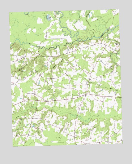
Grantham, NC USGS Topographic Map
Click on map above to begin viewing in our Map Viewer.

This topographic map contains these locations and features:
Feature Name Type Latitude Longitude GNIS ID View Map
Bethany ChurchChurchN35.3329°W78.2133°981073View Map
Camp WacobocLocaleN35.3202°W78.2361°982561View Map
Cox MillLocaleN35.3346°W78.2164°1023561View Map
Cox-Grantham AirfieldAirportN35.2921°W78.1780°2679186View Map
Eureka ChurchChurchN35.2704°W78.2289°984847View Map
Falling CreekStreamN35.3554°W78.1333°1000721View Map
Falling Creek ChurchChurchN35.3079°W78.1622°984986View Map
Falling Creek ChurchChurchN35.3107°W78.1597°984987View Map
GranthamPopulated PlaceN35.2971°W78.1636°985926View Map
Grantham Elementary SchoolSchoolN35.2966°W78.1650°1006967View Map
Grantham Volunteer Fire DepartmentBuildingN35.2969°W78.1660°2639423View Map
Harrington Mobile Home ParkPopulated PlaceN35.3036°W78.1341°2505597View Map
Johnson BranchStreamN35.2843°W78.2061°987651View Map
Kelley CreekStreamN35.2827°W78.2017°987899View Map
Kennedy Mill BranchStreamN35.3432°W78.1939°987921View Map
Manley Grove ChurchChurchN35.2518°W78.2172°989276View Map
Mill BranchStreamN35.3399°W78.2103°1025530View Map
Mill CreekStreamN35.3471°W78.1739°1025535View Map
Moccasin CreekStreamN35.3507°W78.1533°990117View Map
Piney Grove ChurchChurchN35.2757°W78.2408°992346View Map
Pleasant Union ChurchChurchN35.2954°W78.1739°992570View Map
Ranyor Mill BranchStreamN35.2791°W78.2400°993037View Map
Rhodes ChurchChurchN35.2518°W78.1417°993267View Map
Riverside ChurchChurchN35.3549°W78.2075°993391View Map
Scottbrook Farm AirportAirportN35.3412°W78.1561°2679185View Map
Selah ChurchChurchN35.3193°W78.2217°994488View Map
Stevens ChapelChurchN35.3210°W78.1361°995478View Map
Sylvania Lake DamDamN35.3418°W78.2497°998837View Map
Sylvinia LakeReservoirN35.3418°W78.2497°998836View Map
Township of GranthamCivilN35.2785°W78.1941°1027313View Map
Wayne County Emergency Medical Services Station 3BuildingN35.2970°W78.1656°2720483View Map

Note: Coordinates in the location and feature list above are referenced to NAD83 datum.


Copyright (C) 2008-2024 Ryan Niemi / Sunset Dynamics ... All Rights Reserved