TopoQuest Logo
Do you find TopoQuest useful?
Help keep TopoQuest running and adding new maps/features by donating!
Bitcoin:  19c7KJd3qBynnjoSw5npx9KScwjBe4ifkT
Litecoin:  LXs6TkuXGGXo1vDsWCkWVdjQX94eUKd6ui
Home View Maps Find Maps Find Places Resources & Links


Nucla, Colorado Topographic Map

USGS Map Title: Nucla, CO
USGS Map MRC: 38108C5
DRG (GeoTIFF) Download: o38108c5.tif


Neighboring USGS Topographic Map Quads:


  Atkinson Creek, CO  
38108D6
 

  Windy Point, CO  
38108D5
 

  Starvation Point, CO  
38108D4
 

  Uravan, CO  
38108C6
 

  Nucla, CO  
38108C5
 

  Big Bucktail Creek, CO  
38108C4
 

  Naturita NW, CO  
38108B6
 

  Naturita, CO  
38108B5
 

  Redvale, CO  
38108B4


Map MRC Location:

N39°
W109°
N39°
W108°
H8 H7 H6 H5 H4 H3 H2 H1
G8 G7 G6 G5 G4 G3 G2 G1
F8 F7 F6 F5 F4 F3 F2 F1
E8 E7 E6 E5 E4 E3 E2 E1
D8 D7 D6 D5 D4 D3 D2 D1
C8 C7 C6 C5 C4 C3 C2 C1
B8 B7 B6 B5 B4 B3 B2 B1
A8 A7 A6 A5 A4 A3 A2 A1
N38°
W109°
N38°
W108°

Nucla, CO USGS 1:24K Topographic Map Preview:
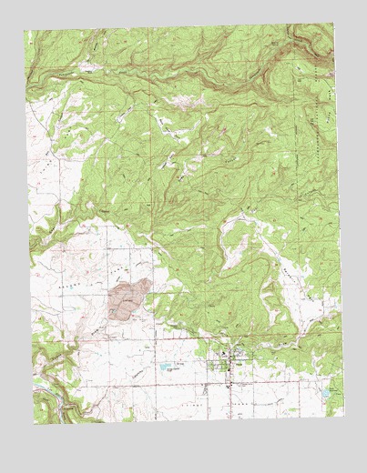
Nucla, CO USGS Topographic Map
Click on map above to begin viewing in our Map Viewer.

This topographic map contains these locations and features:
Feature Name Type Latitude Longitude GNIS ID View Map
C C Ditch - Second Park LateralCanalN38.2944°W108.5906°201790View Map
C C Ditch - South LateralCanalN38.2517°W108.5606°201791View Map
C C Ditch - West LateralCanalN38.2792°W108.5740°201792View Map
Calamity BridgeLocaleN38.2544°W108.6145°185893View Map
Calamity DrawValleyN38.2566°W108.6136°185897View Map
Cottonwood MineMineN38.2708°W108.5487°1735525View Map
Doby CanyonValleyN38.3085°W108.5774°185896View Map
Farmer Boy MineMineN38.2705°W108.5429°1735534View Map
Forty-seven CreekStreamN38.3694°W108.5179°185767View Map
Gypsy ParkFlatN38.3486°W108.5845°185885View Map
Horse ParkFlatN38.3319°W108.5687°185883View Map
Navajo MineMineN38.2930°W108.5820°185891View Map
Nix MineMineN38.2822°W108.5787°185890View Map
NuclaPopulated PlaceN38.2694°W108.5479°185887View Map
Nucla - Naturita Fire Department Station 1BuildingN38.2680°W108.5454°2666951View Map
Nucla CemeteryCemeteryN38.2791°W108.5636°185888View Map
Nucla DivisionCivilN38.3029°W108.6041°1935535View Map
Nucla Domestic DamDamN38.2583°W108.5073°199754View Map
Nucla Post OfficePost OfficeN38.2690°W108.5466°2750966View Map
Oberding MineMineN38.2797°W108.5659°185889View Map
Ross Fort ParkFlatN38.3417°W108.5673°185884View Map
Second ParkFlatN38.2972°W108.6006°203172View Map
Shavano CreekStreamN38.3572°W108.6234°185756View Map
Spradlin ParkFlatN38.2917°W108.5173°185895View Map
Stinking SpringsSpringN38.3684°W108.5225°185882View Map
Templeton RanchLocaleN38.3619°W108.6006°185886View Map
Town of NuclaCivilN38.2665°W108.5487°2413058View Map
Town ReservoirReservoirN38.2575°W108.5076°185894View Map
Tuttle DrawValleyN38.2648°W108.6223°185898View Map
USV MineMineN38.2503°W108.5993°185892View Map

Note: Coordinates in the location and feature list above are referenced to NAD83 datum.


Copyright (C) 2008-2025 Ryan Niemi / Sunset Dynamics ... All Rights Reserved