TopoQuest Logo
Do you find TopoQuest useful?
Help keep TopoQuest running and adding new maps/features by donating!
Bitcoin:  19c7KJd3qBynnjoSw5npx9KScwjBe4ifkT
Litecoin:  LXs6TkuXGGXo1vDsWCkWVdjQX94eUKd6ui
Home View Maps Find Maps Find Places Resources & Links


Uravan, Colorado Topographic Map

USGS Map Title: Uravan, CO
USGS Map MRC: 38108C6
DRG (GeoTIFF) Download: o38108c6.tif


Neighboring USGS Topographic Map Quads:


  Red Canyon, CO  
38108D7
 

  Atkinson Creek, CO  
38108D6
 

  Windy Point, CO  
38108D5
 

  Davis Mesa, CO  
38108C7
 

  Uravan, CO  
38108C6
 

  Nucla, CO  
38108C5
 

  Bull Canyon, CO  
38108B7
 

  Naturita NW, CO  
38108B6
 

  Naturita, CO  
38108B5


Map MRC Location:

N39°
W109°
N39°
W108°
H8 H7 H6 H5 H4 H3 H2 H1
G8 G7 G6 G5 G4 G3 G2 G1
F8 F7 F6 F5 F4 F3 F2 F1
E8 E7 E6 E5 E4 E3 E2 E1
D8 D7 D6 D5 D4 D3 D2 D1
C8 C7 C6 C5 C4 C3 C2 C1
B8 B7 B6 B5 B4 B3 B2 B1
A8 A7 A6 A5 A4 A3 A2 A1
N38°
W109°
N38°
W108°

Uravan, CO USGS 1:24K Topographic Map Preview:
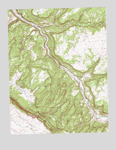
Uravan, CO USGS Topographic Map
Click on map above to begin viewing in our Map Viewer.

This topographic map contains these locations and features:
Feature Name Type Latitude Longitude GNIS ID View Map
Bench ClaimMineN38.3328°W108.7126°1735514View Map
Bitter Creek MinesMineN38.2647°W108.6993°185870View Map
Black Dinah Dump MineMineN38.3003°W108.7479°1735400View Map
Black Dinah MineMineN38.3000°W108.7479°185874View Map
Blitz MineMineN38.3064°W108.7476°1735517View Map
Bogus MineMineN38.3692°W108.7343°1735518View Map
Box CanyonValleyN38.3060°W108.6644°185880View Map
Butterfly MineMineN38.3403°W108.7337°1735775View Map
Campbell CreekStreamN38.3600°W108.6637°185755View Map
Club MinesMineN38.3669°W108.7482°185879View Map
Coal CanyonValleyN38.3073°W108.6487°185881View Map
Coloradian MineMineN38.3692°W108.7343°1735506View Map
Dakota MineMineN38.3419°W108.7293°1735827View Map
Dog Tail MineMineN38.3692°W108.7343°1735527View Map
Donald D MineMineN38.3692°W108.7343°1735528View Map
Donna K MineMineN38.2842°W108.6790°185869View Map
Eagle MineMineN38.3419°W108.7293°1735828View Map
Effie F MineMineN38.3692°W108.7343°1735530View Map
Emma May MineMineN38.3692°W108.7343°1735531View Map
Fairy King MineMineN38.3419°W108.7293°1735829View Map
Fall Creek MineMineN38.3692°W108.7343°1735533View Map
Forty-five Ninety MineMineN38.3350°W108.7326°185878View Map
Golden Eagle MineMineN38.3358°W108.7354°1735268View Map
Guadacanal MineMineN38.2961°W108.7332°185873View Map
Hardscrabble MineMineN38.3692°W108.7343°1735539View Map
Hieroglyphic CanyonValleyN38.3675°W108.7352°185865View Map
Horsethief SpringSpringN38.2980°W108.7057°185871View Map
Julian Group MineMineN38.3419°W108.7293°1735830View Map
Knaess and Young PlacerMineN38.3692°W108.7343°1735544View Map
Long ParkFlatN38.2967°W108.7457°203169View Map
Long Park Group MineMineN38.2939°W108.7354°1735642View Map
Long Park Number 6 MineMineN38.2955°W108.7409°185875View Map
Long Park Number One MineMineN38.2925°W108.7312°1735831View Map
Long Park Number Two MineMineN38.2969°W108.7470°1735832View Map
Media MineMineN38.2905°W108.7370°185868View Map
Mineral Park MineMineN38.2972°W108.7479°1735549View Map
New Good Hope MineMineN38.3419°W108.7293°1735833View Map
New Hope MineMineN38.3419°W108.7293°1735834View Map
Petrified Tree MineMineN38.3692°W108.7343°1735555View Map
Red Fox MineMineN38.3419°W108.7293°1735835View Map
Rex Thirty-eight MineMineN38.3580°W108.7290°1735825View Map
Rock Raven MineMineN38.3644°W108.7151°185876View Map
South Blackfoot MineMineN38.3467°W108.7293°1735836View Map
Spring CreekStreamN38.3569°W108.7118°185752View Map
Sunbeam MineMineN38.3364°W108.7357°185877View Map
Tabeguache CreekStreamN38.3572°W108.7118°185780View Map
Third ParkFlatN38.3389°W108.6354°203171View Map
Three Jacks MineMineN38.3686°W108.7115°1735785View Map
Triangulation MineMineN38.2883°W108.7248°185866View Map
UravanPopulated PlaceN38.3683°W108.7365°203153View Map
Uravan Number Three MineMineN38.3550°W108.7484°1735838View Map
Virgin MineMineN38.3053°W108.7376°185872View Map
Whitney MineMineN38.2842°W108.7195°185867View Map
Yellow Spot MineMineN38.3692°W108.7343°1735578View Map

Note: Coordinates in the location and feature list above are referenced to NAD83 datum.


Copyright (C) 2008-2024 Ryan Niemi / Sunset Dynamics ... All Rights Reserved