TopoQuest Logo
Do you find TopoQuest useful?
Help keep TopoQuest running and adding new maps/features by donating!
Bitcoin:  19c7KJd3qBynnjoSw5npx9KScwjBe4ifkT
Litecoin:  LXs6TkuXGGXo1vDsWCkWVdjQX94eUKd6ui
Home View Maps Find Maps Find Places Resources & Links


Nugent Park, Wyoming Topographic Map

USGS Map Title: Nugent Park, WY
USGS Map MRC: 42110B7
DRG (GeoTIFF) Download: o42110b7.tif


Neighboring USGS Topographic Map Quads:


  Huff Lake, WY  
42110C8
 

  Big Park, WY  
42110C7
 

  Devils Hole Creek, WY  
42110C6
 

  Marse, WY  
42110B8
 

  Nugent Park, WY  
42110B7
 

  Pole Creek, WY  
42110B6
 

  Cokeville, WY  
42110A8
 

  Sublette Canyon, WY  
42110A7
 

  Wilkinson Creek, WY  
42110A6


Map MRC Location:

N43°
W111°
N43°
W110°
H8 H7 H6 H5 H4 H3 H2 H1
G8 G7 G6 G5 G4 G3 G2 G1
F8 F7 F6 F5 F4 F3 F2 F1
E8 E7 E6 E5 E4 E3 E2 E1
D8 D7 D6 D5 D4 D3 D2 D1
C8 C7 C6 C5 C4 C3 C2 C1
B8 B7 B6 B5 B4 B3 B2 B1
A8 A7 A6 A5 A4 A3 A2 A1
N42°
W111°
N42°
W110°

Nugent Park, WY USGS 1:24K Topographic Map Preview:
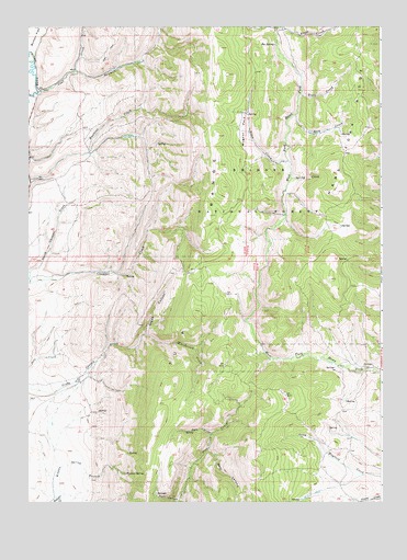
Nugent Park, WY USGS Topographic Map
Click on map above to begin viewing in our Map Viewer.

This topographic map contains these locations and features:
Feature Name Type Latitude Longitude GNIS ID View Map
Allen CreekStreamN42.2147°W110.7830°1604767View Map
Basin CreekStreamN42.2494°W110.7843°1597945View Map
Bear CanyonValleyN42.1388°W110.8110°1597984View Map
Big SpringSpringN42.2453°W110.7879°1598172View Map
Big Spring Recreation SiteLocaleN42.2447°W110.7882°1608751View Map
Buck CanyonValleyN42.1252°W110.8224°1598429View Map
Coal CreekStreamN42.2324°W110.8716°1598826View Map
Grade CanyonValleyN42.1697°W110.8332°1600003View Map
Hams Fork RidgeRidgeN42.2074°W110.7655°1600186View Map
Kelley CreekStreamN42.2499°W110.7866°1600685View Map
North Chappel CreekStreamN42.1822°W110.8744°1601725View Map
Nugent ParkFlatN42.2230°W110.7981°1601879View Map
Pole CanyonValleyN42.1430°W110.8105°1602239View Map
Rock CreekStreamN42.2266°W110.7793°1602573View Map
Sawmill CreekStreamN42.2383°W110.8577°1602743View Map
Sliderock CreekStreamN42.1688°W110.8341°1602985View Map
Smiths Fork MineMineN42.2255°W110.8663°1746397View Map
Spring CreekStreamN42.2105°W110.7810°1603235View Map
Trail CreekStreamN42.2322°W110.7774°1603722View Map
Tunp RangeRangeN42.2213°W110.8063°1603792View Map
West Branch Hams Fork Creek MineMineN42.2408°W110.7866°1746398View Map
Wyman SpringSpringN42.1325°W110.8408°1604294View Map
Wyman Spring BranchStreamN42.1272°W110.8638°1604295View Map

Note: Coordinates in the location and feature list above are referenced to NAD83 datum.


Copyright (C) 2008-2024 Ryan Niemi / Sunset Dynamics ... All Rights Reserved