TopoQuest Logo
Do you find TopoQuest useful?
Help keep TopoQuest running and adding new maps/features by donating!
Bitcoin:  19c7KJd3qBynnjoSw5npx9KScwjBe4ifkT
Litecoin:  LXs6TkuXGGXo1vDsWCkWVdjQX94eUKd6ui
Home View Maps Find Maps Find Places Resources & Links


Oblong North, Illinois Topographic Map

USGS Map Title: Oblong North, IL
USGS Map MRC: 39087A8
DRG (GeoTIFF) Download: o39087a8.tif


Neighboring USGS Topographic Map Quads:


  Hazel Dell, IL  
39088B1
 

  Moriah, IL  
39087B8
 

  Annapolis, IL  
39087B7
 

  Yale, IL  
39088A1
 

  Oblong North, IL  
39087A8
 

  Porterville, IL  
39087A7
 

  Sainte Marie, IL  
38088H1
 

  Oblong South, IL  
38087H8
 

  Stoy, IL  
38087H7


Map MRC Location:

N40°
W88°
N40°
W87°
H8 H7 H6 H5 H4 H3 H2 H1
G8 G7 G6 G5 G4 G3 G2 G1
F8 F7 F6 F5 F4 F3 F2 F1
E8 E7 E6 E5 E4 E3 E2 E1
D8 D7 D6 D5 D4 D3 D2 D1
C8 C7 C6 C5 C4 C3 C2 C1
B8 B7 B6 B5 B4 B3 B2 B1
A8 A7 A6 A5 A4 A3 A2 A1
N39°
W88°
N39°
W87°

Oblong North, IL USGS 1:24K Topographic Map Preview:
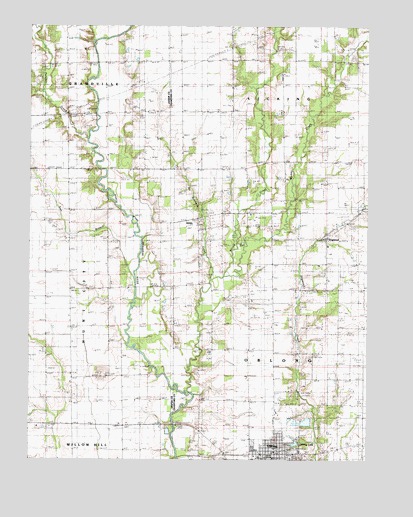
Oblong North, IL USGS Topographic Map
Click on map above to begin viewing in our Map Viewer.

This topographic map contains these locations and features:
Feature Name Type Latitude Longitude GNIS ID View Map
Bailey FarmsLocaleN39.0708°W87.9847°2724511View Map
Baily CemeteryCemeteryN39.0664°W87.9878°1923075View Map
Bethany ChurchChurchN39.0245°W87.9850°404250View Map
Central United Methodist ChurchChurchN39.0025°W87.9092°1962321View Map
Dart FarmLocaleN39.0303°W87.8781°2725022View Map
DogwoodPopulated PlaceN39.0639°W87.8909°422633View Map
Dogwood Creek FarmLocaleN39.0481°W87.8975°2725023View Map
Evangelical United Methodist ChurchChurchN39.0020°W87.9078°1962322View Map
First Baptist Church of OblongChurchN39.0006°W87.9078°1962323View Map
First Christian ChurchChurchN39.0037°W87.9092°1962324View Map
Harmony CemeteryCemeteryN39.1159°W87.9234°1934886View Map
KibbiePopulated PlaceN39.0698°W87.9381°422875View Map
Meese FarmsLocaleN39.0239°W87.9200°2725017View Map
Mound CemeteryCemeteryN39.0242°W87.9709°1923133View Map
Mound ChurchChurchN39.0245°W87.9711°413907View Map
Muddy CreekStreamN39.0534°W87.9284°414210View Map
Musgrave FarmsLocaleN39.0450°W87.8756°2725027View Map
Nethery FarmsLocaleN39.0828°W87.9975°2724509View Map
New Harmony Church (historical)ChurchN39.1150°W87.9253°414403View Map
Newbold FarmsLocaleN39.0150°W87.9386°2725019View Map
No Business CreekStreamN39.0523°W87.9334°414540View Map
OblongPopulated PlaceN39.0020°W87.9089°414948View Map
Oblong CemeteryCemeteryN39.0011°W87.9003°1940757View Map
Oblong Elementary SchoolSchoolN39.0009°W87.9148°1807724View Map
Oblong LakeLakeN39.0048°W87.9016°414949View Map
Oblong Police DepartmentBuildingN39.0006°W87.9091°2759092View Map
Oblong Post OfficePost OfficeN39.0036°W87.9088°2725032View Map
Oblong Township Fire Protection DistrictBuildingN39.0020°W87.9097°2681845View Map
Our Lady of Lourdes ChurchChurchN39.0006°W87.9136°1962325View Map
Panther CreekStreamN39.0925°W87.9786°415352View Map
Randolph CemeteryCemeteryN39.0786°W87.9322°416381View Map
Sackrider FarmsLocaleN39.0050°W87.8753°2725021View Map
Sam BranchStreamN39.0581°W87.9600°417911View Map
Sand Rock CemeteryCemeteryN39.0634°W87.9581°1923578View Map
Township of LickingCivilN39.1236°W87.8966°429256View Map
Township of OblongCivilN39.0121°W87.8805°429474View Map
Village of OblongCivilN39.0023°W87.9110°2399553View Map
White Oak CemeteryCemeteryN39.0684°W87.9367°1940781View Map
Willow CreekStreamN39.0200°W87.9423°421239View Map

Note: Coordinates in the location and feature list above are referenced to NAD83 datum.


Copyright (C) 2008-2025 Ryan Niemi / Sunset Dynamics ... All Rights Reserved