TopoQuest Logo
Do you find TopoQuest useful?
Help keep TopoQuest running and adding new maps/features by donating!
Bitcoin:  19c7KJd3qBynnjoSw5npx9KScwjBe4ifkT
Litecoin:  LXs6TkuXGGXo1vDsWCkWVdjQX94eUKd6ui
Home View Maps Find Maps Find Places Resources & Links


Ocean Forest, South Carolina Topographic Map

USGS Map Title: Ocean Forest, SC
USGS Map MRC: 33078F7
DRG (GeoTIFF) Download: o33078f7.tif


Neighboring USGS Topographic Map Quads:


  Nixonville, SC  
33078G8
 

  Hand, SC  
33078G7
 

  Wampee, SC  
33078G6
 

  Myrtle Beach, SC  
33078F8
 

  Ocean Forest, SC  
33078F7


  Surfside Beach, SC  
33078E8


Map MRC Location:

N34°
W79°
N34°
W78°
H8 H7 H6 H5 H4 H3 H2 H1
G8 G7 G6 G5 G4 G3 G2 G1
F8 F7 F6 F5 F4 F3 F2 F1
E8 E7 E6 E5 E4 E3 E2 E1
D8 D7 D6 D5 D4 D3 D2 D1
C8 C7 C6 C5 C4 C3 C2 C1
B8 B7 B6 B5 B4 B3 B2 B1
A8 A7 A6 A5 A4 A3 A2 A1
N33°
W79°
N33°
W78°

Ocean Forest, SC USGS 1:24K Topographic Map Preview:
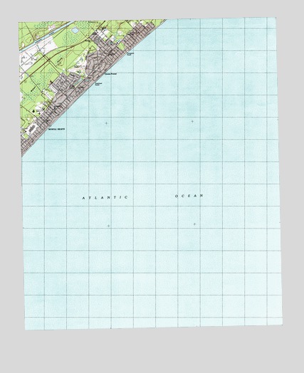
Ocean Forest, SC USGS Topographic Map
Click on map above to begin viewing in our Map Viewer.

This topographic map contains these locations and features:
Feature Name Type Latitude Longitude GNIS ID View Map
Bear BranchStreamN33.7482°W78.8061°1244993View Map
Benton ParkPopulated PlaceN33.7266°W78.8495°1243609View Map
Black CreekStreamN33.7427°W78.8681°1220767View Map
Blynn AcresPopulated PlaceN33.7432°W78.8370°1243616View Map
Cane PatchPopulated PlaceN33.7410°W78.8228°1243632View Map
Canepatch SwashBeachN33.7349°W78.8261°1221317View Map
Central Baptist ChurchChurchN33.7218°W78.8636°1243641View Map
Chabad Academy of Myrtle BeachSchoolN33.7107°W78.8672°2486436View Map
Childrens Museum of South CarolinaBuildingN33.7030°W78.8721°2490434View Map
Church of ChristChurchN33.7279°W78.8700°1243648View Map
Coastal AcademySchoolN33.7454°W78.8364°1243653View Map
Coastal Community ChurchChurchN33.7168°W78.8636°1243654View Map
Deephead SwashBeachN33.7252°W78.8395°1221986View Map
Dunes Shopping CenterLocaleN33.7366°W78.8317°1243697View Map
East ChesterPopulated PlaceN33.7021°W78.8720°1243700View Map
Fairway ParkPopulated PlaceN33.7171°W78.8589°1243708View Map
Federal Bureau of InvestigationBuildingN33.7453°W78.8208°2334992View Map
First Church of Christ ScientistChurchN33.7385°W78.8275°1243716View Map
First Free Will Baptist ChurchChurchN33.7463°W78.8344°1243731View Map
Forest DunesPopulated PlaceN33.7377°W78.8267°1243723View Map
Grand Strand Unity ChurchChurchN33.7107°W78.8614°1243747View Map
Green Bay ParkPopulated PlaceN33.7224°W78.8581°1243749View Map
HighlandsPopulated PlaceN33.7343°W78.8303°1243770View Map
Horry Georgetown Technical CollegeSchoolN33.7459°W78.8365°2486505View Map
Lake ShorePopulated PlaceN33.7377°W78.8392°1243803View Map
Live Oak Post OfficePost OfficeN33.7452°W78.8322°2489854View Map
Long BayPopulated PlaceN33.7460°W78.8136°1243815View Map
Myrtle Beach Elementary SchoolSchoolN33.7132°W78.8653°1243840View Map
Myrtle Beach Fire Department Station 2BuildingN33.7270°W78.8420°2368072View Map
Myrtle Beach Fire Department Station 6BuildingN33.7229°W78.8646°2368440View Map
Myrtle Beach High SchoolSchoolN33.7192°W78.8683°1243842View Map
Myrtle Beach Intermediate SchoolSchoolN33.7150°W78.8630°2486528View Map
Myrtle Beach Middle SchoolSchoolN33.7190°W78.8648°1243844View Map
Myrtle Beach Primary SchoolSchoolN33.7143°W78.8681°1243846View Map
Myrtle Beach Racquet ClubLocaleN33.7354°W78.8617°1243847View Map
Myrtle HeightsPopulated PlaceN33.7146°W78.8553°1243850View Map
Myrtle Square Mall Shopping CenterLocaleN33.7071°W78.8692°1243851View Map
Oak ParkPopulated PlaceN33.7196°W78.8492°1243868View Map
Oakland HeightsPopulated PlaceN33.7435°W78.8303°1243870View Map
Ocean ForestPopulated PlaceN33.7299°W78.8381°1231609View Map
Ocean View ChurchChurchN33.7449°W78.8206°1243874View Map
Pepper Geddings Recreation CenterBuildingN33.7142°W78.8641°2489974View Map
Pine Lake EstatesPopulated PlaceN33.7246°W78.8539°1243897View Map
Pine Lakes ChurchChurchN33.7232°W78.8467°1243896View Map
Pine Lakes Country ClubLocaleN33.7321°W78.8439°1249938View Map
Saint Andrews ChurchChurchN33.7149°W78.8578°1243942View Map
Saint Andrews SchoolSchoolN33.7149°W78.8580°1243943View Map
Saint Philips Lutheran ChurchChurchN33.7363°W78.8311°1243892View Map
Saint Phillip's Lutheran KindergartenSchoolN33.7361°W78.8313°2486471View Map
Sea Hawk Memorial StadiumParkN33.7154°W78.8664°1253498View Map
Seventh Day Adventist ChurchChurchN33.7421°W78.8393°1243862View Map
Seventieth Avenue North Shopping CenterLocaleN33.7424°W78.8247°1243957View Map
Temple EmanuelChurchN33.7379°W78.8284°1243984View Map
The Church of Jesus Christ of Latter Day SaintsChurchN33.7341°W78.8600°1243650View Map
Trinity Episcopal ChurchChurchN33.7096°W78.8628°1243999View Map
Washington ParkPopulated PlaceN33.7085°W78.8650°1244017View Map
Withers SwampSwampN33.7212°W78.8697°1227668View Map

Note: Coordinates in the location and feature list above are referenced to NAD83 datum.


Copyright (C) 2008-2024 Ryan Niemi / Sunset Dynamics ... All Rights Reserved