TopoQuest Logo
Do you find TopoQuest useful?
Help keep TopoQuest running and adding new maps/features by donating!
Bitcoin:  19c7KJd3qBynnjoSw5npx9KScwjBe4ifkT
Litecoin:  LXs6TkuXGGXo1vDsWCkWVdjQX94eUKd6ui
Home View Maps Find Maps Find Places Resources & Links


Surfside Beach, South Carolina Topographic Map

USGS Map Title: Surfside Beach, SC
USGS Map MRC: 33078E8
DRG (GeoTIFF) Download: o33078e8.tif


Neighboring USGS Topographic Map Quads:


  Bucksville, SC  
33079F1
 

  Myrtle Beach, SC  
33078F8
 

  Ocean Forest, SC  
33078F7
 

  Brookgreen, SC  
33079E1
 

  Surfside Beach, SC  
33078E8


  Magnolia Beach, SC  
33079D1


Map MRC Location:

N34°
W79°
N34°
W78°
H8 H7 H6 H5 H4 H3 H2 H1
G8 G7 G6 G5 G4 G3 G2 G1
F8 F7 F6 F5 F4 F3 F2 F1
E8 E7 E6 E5 E4 E3 E2 E1
D8 D7 D6 D5 D4 D3 D2 D1
C8 C7 C6 C5 C4 C3 C2 C1
B8 B7 B6 B5 B4 B3 B2 B1
A8 A7 A6 A5 A4 A3 A2 A1
N33°
W79°
N33°
W78°

Surfside Beach, SC USGS 1:24K Topographic Map Preview:
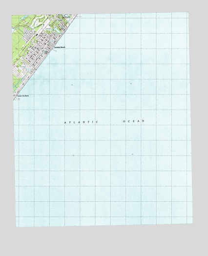
Surfside Beach, SC USGS Topographic Map
Click on map above to begin viewing in our Map Viewer.

This topographic map contains these locations and features:
Feature Name Type Latitude Longitude GNIS ID View Map
CaropinePopulated PlaceN33.6113°W78.9895°1243635View Map
Deer Track Golf ClubLocaleN33.6204°W78.9803°1243688View Map
Dogwood LakeReservoirN33.6157°W78.9678°1243692View Map
Episcopal Church of the ResurrectionChurchN33.6116°W78.9767°1243705View Map
First Baptist Church of SurfsideChurchN33.6224°W78.9676°1243980View Map
Floral LakeReservoirN33.6029°W78.9777°1243720View Map
Garden City Baptist ChurchChurchN33.5796°W78.9981°1243735View Map
Grand Strand Tennis ClubLocaleN33.6157°W78.9842°1243746View Map
Heron Point Golf ClubLocaleN33.5913°W78.9905°2490021View Map
Horry County Fire Department SurfsideBuildingN33.6125°W78.9798°2368452View Map
Horry County Memorial Library Surfside BranchBuildingN33.6079°W78.9748°2490395View Map
Indian Wells Golf ClubLocaleN33.6057°W78.9984°1243787View Map
Indigo Creek Golf ClubLocaleN33.6010°W78.9989°1243788View Map
Long BayBayN33.5904°W78.9606°1246452View Map
LongleafPopulated PlaceN33.6204°W78.9900°1243818View Map
Murrells Inlet Fire Department Station 77BuildingN33.5769°W78.9997°2368461View Map
Ocean Lakes Family CampgroundLocaleN33.6224°W78.9609°1243872View Map
Oceanside VillagePopulated PlaceN33.5946°W78.9909°1243875View Map
SeacroftPopulated PlaceN33.6110°W78.9956°1243955View Map
Surf PinesPopulated PlaceN33.6168°W78.9898°1243977View Map
Surfside BeachPopulated PlaceN33.6060°W78.9731°1231847View Map
Surfside Beach Fire Department Surfside BeachBuildingN33.6121°W78.9800°2368111View Map
Surfside Beach Police DepartmentBuildingN33.6123°W78.9794°2334822View Map
Surfside Beach Post OfficePost OfficeN33.6141°W78.9789°1252299View Map
Surfside Beach Town HallBuildingN33.6127°W78.9803°1243978View Map
Surfside Fishing PierLocaleN33.6043°W78.9706°1243979View Map
Town of Surfside BeachCivilN33.6094°W78.9773°2406696View Map

Note: Coordinates in the location and feature list above are referenced to NAD83 datum.


Copyright (C) 2008-2024 Ryan Niemi / Sunset Dynamics ... All Rights Reserved