TopoQuest Logo
Do you find TopoQuest useful?
Help keep TopoQuest running and adding new maps/features by donating!
Bitcoin:  19c7KJd3qBynnjoSw5npx9KScwjBe4ifkT
Litecoin:  LXs6TkuXGGXo1vDsWCkWVdjQX94eUKd6ui
Home View Maps Find Maps Find Places Resources & Links


Oceana, West Virginia Topographic Map

USGS Map Title: Oceana, WV
USGS Map MRC: 37081F6
DRG (GeoTIFF) Download: o37081f6.tif


Neighboring USGS Topographic Map Quads:


  Amherstdale, WV  
37081G7
 

  Lorado, WV  
37081G6
 

  Pilot Knob, WV  
37081G5
 

  Mallory, WV  
37081F7
 

  Oceana, WV  
37081F6
 

  Matheny, WV  
37081F5
 

  Gilbert, WV  
37081E7
 

  Baileysville, WV  
37081E6
 

  Pineville, WV  
37081E5


Map MRC Location:

N38°
W82°
N38°
W81°
H8 H7 H6 H5 H4 H3 H2 H1
G8 G7 G6 G5 G4 G3 G2 G1
F8 F7 F6 F5 F4 F3 F2 F1
E8 E7 E6 E5 E4 E3 E2 E1
D8 D7 D6 D5 D4 D3 D2 D1
C8 C7 C6 C5 C4 C3 C2 C1
B8 B7 B6 B5 B4 B3 B2 B1
A8 A7 A6 A5 A4 A3 A2 A1
N37°
W82°
N37°
W81°

Oceana, WV USGS 1:24K Topographic Map Preview:
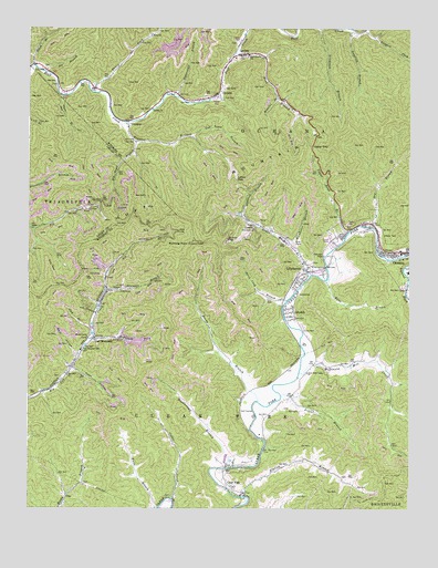
Oceana, WV USGS Topographic Map
Click on map above to begin viewing in our Map Viewer.

This topographic map contains these locations and features:
Feature Name Type Latitude Longitude GNIS ID View Map
Bans BranchStreamN37.6848°W81.6521°1535203View Map
Barn HollowValleyN37.6651°W81.7332°1535246View Map
Beech BranchStreamN37.7404°W81.7490°1535517View Map
Big Cub ChurchChurchN37.6596°W81.7373°1535832View Map
Burning RockSummitN37.6940°W81.6979°1554033View Map
Burning Rock Lookout TowerLocaleN37.6943°W81.6976°1741444View Map
CampusLocaleN37.7257°W81.7179°1536982View Map
Campus Church of GodChurchN37.7243°W81.7173°1741445View Map
Cedar CreekStreamN37.6276°W81.7026°1537125View Map
Clay BranchStreamN37.6726°W81.7290°1537362View Map
Clear ForkPopulated PlaceN37.6309°W81.6829°1554143View Map
Clear Fork Post OfficePost OfficeN37.6283°W81.6793°1741451View Map
Clear Fork Valley ChurchChurchN37.6604°W81.6587°1537396View Map
Clear Fork Valley Golf CourseLocaleN37.6506°W81.6747°2634071View Map
Coal MountainPopulated PlaceN37.6696°W81.7284°1537461View Map
Coal Mountain Number 9b Mine Refuse Disposal DamDamN37.6701°W81.7148°1559344View Map
Coal Mountain Post OfficePost OfficeN37.6830°W81.7247°1741452View Map
Coal Mountain School (historical)SchoolN37.6665°W81.7326°1537463View Map
Coal Mountain Volunteer Fire DepartmentBuildingN37.6825°W81.7243°2577721View Map
Cub Trace BranchStreamN37.7218°W81.6971°1537900View Map
CyclonePopulated PlaceN37.7329°W81.6887°1537953View Map
Cyclone ChurchChurchN37.7290°W81.7101°1537954View Map
Cyclone Post OfficePost OfficeN37.7350°W81.6870°1741457View Map
Cyclone Volunteer Fire DepartmentBuildingN37.7431°W81.6777°2577947View Map
Dave BranchStreamN37.7323°W81.7390°1538013View Map
Dingess ForkStreamN37.7482°W81.6371°1538203View Map
District 3CivilN37.6973°W81.6440°1928236View Map
Doublecamp BranchStreamN37.6357°W81.6848°1538291View Map
Dry BranchStreamN37.6982°W81.6373°1538331View Map
Elk Trace BranchStreamN37.7207°W81.7154°1538640View Map
Elklick BranchStreamN37.6282°W81.6793°1538657View Map
Huff MountainSummitN37.7157°W81.6668°1540554View Map
Jacob Cook BranchStreamN37.6793°W81.6654°1540792View Map
Joe BranchStreamN37.7390°W81.7451°1540919View Map
LacomaPopulated PlaceN37.7434°W81.6796°1541303View Map
Lacoma Baptist ChurchChurchN37.7423°W81.6826°1741483View Map
LillydalePopulated PlaceN37.6762°W81.6632°1541964View Map
Lillydale Census Designated PlaceCensusN37.6744°W81.6586°2586844View Map
LillyhavenPopulated PlaceN37.6871°W81.6590°1541965View Map
Lillyhaven Census Designated PlaceCensusN37.6882°W81.6622°2586845View Map
Little BranchStreamN37.6543°W81.6671°1542036View Map
Longlick BranchStreamN37.7498°W81.6448°1542432View Map
Lower GapGapN37.7107°W81.6823°1542543View Map
Lower Road BranchStreamN37.6857°W81.6579°1542563View Map
Lower Road Branch Lynco Number Two DamDamN37.7018°W81.6815°1559342View Map
LyncoPopulated PlaceN37.6982°W81.6771°1555013View Map
Lynco Number Two LakeReservoirN37.7018°W81.6812°1559343View Map
Lynco Post OfficePost OfficeN37.6859°W81.6582°2774611View Map
McDonald ForkStreamN37.6693°W81.7290°1542989View Map
McDonald Mill CreekStreamN37.6601°W81.6615°1542990View Map
Milty T Morgan CemeteryCemeteryN37.6596°W81.7396°2586343View Map
Oceana High School (historical)SchoolN37.6868°W81.6254°1741497View Map
Oceana Middle SchoolSchoolN37.6867°W81.6253°2088298View Map
Oceana Police DepartmentBuildingN37.6923°W81.6335°2728204View Map
Oceana Post OfficePost OfficeN37.6956°W81.6347°1741498View Map
Oceana Public LibraryBuildingN37.6955°W81.6352°2727397View Map
Oceana Volunteer Fire DepartmentBuildingN37.6925°W81.6338°2577671View Map
Oldhouse BranchStreamN37.7015°W81.6793°1544384View Map
Paynter BranchStreamN37.7257°W81.7184°1544661View Map
Reedy BranchStreamN37.6529°W81.6746°1545489View Map
Riggins BranchStreamN37.7323°W81.6687°1545595View Map
Road BranchStreamN37.7437°W81.6829°1545790View Map
Rockhouse BranchStreamN37.6940°W81.6651°1545966View Map
Straight ForkStreamN37.7496°W81.6401°1547562View Map
Sugarcamp BranchStreamN37.7321°W81.7018°1547661View Map
Toler ChurchChurchN37.7487°W81.7098°1548110View Map
Toler HollowValleyN37.6618°W81.7357°1548112View Map
Toney ForkStreamN37.7334°W81.7284°1548161View Map
Town of OceanaCivilN37.6927°W81.6324°2391343View Map
UnoPopulated PlaceN37.6287°W81.7371°1555855View Map
Upper GapGapN37.7190°W81.6573°1548520View Map
Upper Road BranchStreamN37.6968°W81.6454°1548545View Map
Upper Sturgeon BranchStreamN37.6821°W81.7248°1548557View Map
Walls BranchStreamN37.6251°W81.7071°1548745View Map
Westside High SchoolSchoolN37.6564°W81.6630°2088406View Map

Note: Coordinates in the location and feature list above are referenced to NAD83 datum.


Copyright (C) 2008-2024 Ryan Niemi / Sunset Dynamics ... All Rights Reserved