TopoQuest Logo
Do you find TopoQuest useful?
Help keep TopoQuest running and adding new maps/features by donating!
Bitcoin:  19c7KJd3qBynnjoSw5npx9KScwjBe4ifkT
Litecoin:  LXs6TkuXGGXo1vDsWCkWVdjQX94eUKd6ui
Home View Maps Find Maps Find Places Resources & Links


Oceanside, California Topographic Map

USGS Map Title: Oceanside, CA
USGS Map MRC: 33117B4
DRG (GeoTIFF) Download: o33117b4.tif


Neighboring USGS Topographic Map Quads:


  San Onofre Bluff, CA  
33117C5
 

  Las Pulgas Canyon, CA  
33117C4
 

  Morro Hill, CA  
33117C3


  Oceanside, CA  
33117B4
 

  San Luis Rey, CA  
33117B3


  Encinitas, CA  
33117A3


Map MRC Location:

N34°
W118°
N34°
W117°
H8 H7 H6 H5 H4 H3 H2 H1
G8 G7 G6 G5 G4 G3 G2 G1
F8 F7 F6 F5 F4 F3 F2 F1
E8 E7 E6 E5 E4 E3 E2 E1
D8 D7 D6 D5 D4 D3 D2 D1
C8 C7 C6 C5 C4 C3 C2 C1
B8 B7 B6 B5 B4 B3 B2 B1
A8 A7 A6 A5 A4 A3 A2 A1
N33°
W118°
N33°
W117°

Oceanside, CA USGS 1:24K Topographic Map Preview:
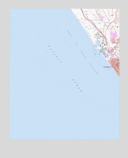
Oceanside, CA USGS Topographic Map
Click on map above to begin viewing in our Map Viewer.

This topographic map contains these locations and features:
Feature Name Type Latitude Longitude GNIS ID View Map
Camp Del MarLocaleN33.2248°W117.3995°240085View Map
Camp PendletonLocaleN33.2103°W117.3928°253271View Map
Camp Pendleton Boat BasinHarborN33.2167°W117.4000°1702715View Map
Camp Pendleton Fire Department Station 5BuildingN33.2188°W117.3862°2664749View Map
Camp Pendleton South Census Designated PlaceCensusN33.2283°W117.3791°2407947View Map
Cape Cod Village Shopping CenterLocaleN33.2142°W117.3978°1868450View Map
Capistrano ParkParkN33.2114°W117.3814°240224View Map
Church of GodChurchN33.1964°W117.3761°1868457View Map
Del Mar Boat BasinBasinN33.2173°W117.4006°253281View Map
Fallbrook JunctionPopulated PlaceN33.2234°W117.3942°1660627View Map
First Baptist ChurchChurchN33.1984°W117.3800°1868472View Map
First Christian ChurchChurchN33.1948°W117.3770°1868474View Map
First Methodist Episcopal ChurchChurchN33.1956°W117.3773°1868475View Map
First Street Post OfficePost OfficeN33.1952°W117.3781°1868496View Map
Harbor BeachBeachN33.2050°W117.3942°1702717View Map
Interchange 54ACrossingN33.2031°W117.3799°2457048View Map
Interchange 54BCrossingN33.2071°W117.3850°2457049View Map
Interchange 54CCrossingN33.2042°W117.3833°2457050View Map
Lawrence CanyonValleyN33.2078°W117.3812°244674View Map
Mission Square Shopping CenterLocaleN33.2000°W117.3756°1868600View Map
Naval Hospital Camp PendletonHospitalN33.2224°W117.3890°2660977View Map
Newton CanyonValleyN33.2389°W117.3964°246525View Map
North HarborHarborN33.2106°W117.3956°1868486View Map
North Terrace Elementary SchoolSchoolN33.2173°W117.3786°246655View Map
OceansidePopulated PlaceN33.1959°W117.3795°1652761View Map
Oceanside Chamber of Commerce and Visitor Information CenterBuildingN33.2034°W117.3839°1868491View Map
Oceanside City BeachBeachN33.1953°W117.3853°1702721View Map
Oceanside City HallBuildingN33.1981°W117.3787°1868492View Map
Oceanside City HospitalHospitalN33.2014°W117.3778°1868493View Map
Oceanside Community CenterBuildingN33.1950°W117.3842°1868494View Map
Oceanside Fire Department Station 1BuildingN33.1982°W117.3783°2664807View Map
Oceanside HarborHarborN33.2078°W117.3950°246814View Map
Oceanside PierLocaleN33.1928°W117.3867°1702722View Map
Pacific Street Linear ParkParkN33.1925°W117.3823°1868497View Map
Rotary ParkParkN33.1942°W117.3837°1868501View Map
Saint Marys Star of the Sea Roman Catholic ChurchChurchN33.1973°W117.3787°1868504View Map
San Luis Rey RiverStreamN33.2023°W117.3923°273500View Map
San Rafael Elementary SchoolSchoolN33.2131°W117.3850°1868507View Map
Santa Margarita MarshSwampN33.2351°W117.4143°1702724View Map
Santa Margarita RiverStreamN33.2320°W117.4162°273559View Map
Santa Margarita SchoolSchoolN33.2325°W117.3784°249081View Map
South HarborHarborN33.2056°W117.3912°1868514View Map
Stuart MesaSummitN33.2475°W117.4023°1661513View Map
The StrandLocaleN33.1886°W117.3789°1868518View Map
Tyson Street ParkParkN33.1911°W117.3809°1868522View Map
YaldoraPopulated PlaceN33.2328°W117.3937°253280View Map

Note: Coordinates in the location and feature list above are referenced to NAD83 datum.


Copyright (C) 2008-2024 Ryan Niemi / Sunset Dynamics ... All Rights Reserved