TopoQuest Logo
Do you find TopoQuest useful?
Help keep TopoQuest running and adding new maps/features by donating!
Bitcoin:  19c7KJd3qBynnjoSw5npx9KScwjBe4ifkT
Litecoin:  LXs6TkuXGGXo1vDsWCkWVdjQX94eUKd6ui
Home View Maps Find Maps Find Places Resources & Links


Oconto East, Wisconsin Topographic Map

USGS Map Title: Oconto East, WI
USGS Map MRC: 44087H7
DRG (GeoTIFF) Download: o44087h7.tif


Neighboring USGS Topographic Map Quads:


  Porterfield SW, WI  
45087A8
 

  Harmony, WI  
45087A7
 

  Marinette West, WI  
45087A6
 

  Oconto West, WI  
44087H8
 

  Oconto East, WI  
44087H7
 

  Peshtigo Harbor, WI  
44087H6
 

  Pensaukee, WI  
44087G8
 

  Oconto SE, WI  
44087G7
 

  Little Sturgeon SW, WI  
44087G6


Map MRC Location:

N45°
W88°
N45°
W87°
H8 H7 H6 H5 H4 H3 H2 H1
G8 G7 G6 G5 G4 G3 G2 G1
F8 F7 F6 F5 F4 F3 F2 F1
E8 E7 E6 E5 E4 E3 E2 E1
D8 D7 D6 D5 D4 D3 D2 D1
C8 C7 C6 C5 C4 C3 C2 C1
B8 B7 B6 B5 B4 B3 B2 B1
A8 A7 A6 A5 A4 A3 A2 A1
N44°
W88°
N44°
W87°

Oconto East, WI USGS 1:24K Topographic Map Preview:
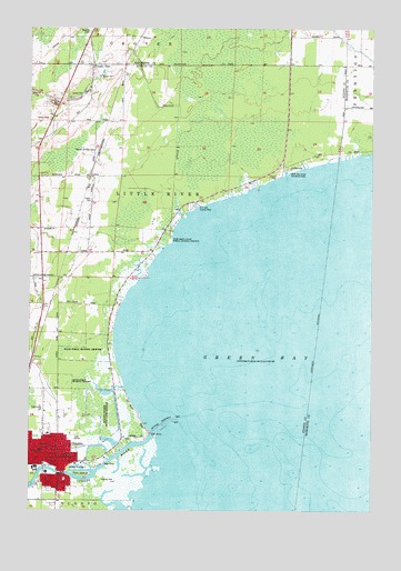
Oconto East, WI USGS Topographic Map
Click on map above to begin viewing in our Map Viewer.

This topographic map contains these locations and features:
Feature Name Type Latitude Longitude GNIS ID View Map
Ajax IslandIslandN44.8842°W87.8565°1560718View Map
Bellin Health Oconto Hospital and ClinicHospitalN44.8964°W87.8658°2698483View Map
City of OcontoCivilN44.8916°W87.8683°1583850View Map
County LinePopulated PlaceN44.9903°W87.8526°1563451View Map
CullenPopulated PlaceN44.9617°W87.8532°1577562View Map
Cullen CemeteryCemeteryN44.9550°W87.8532°1563614View Map
D E Hall County ParkParkN44.9539°W87.8159°1563651View Map
Farnsworth Public LibraryBuildingN44.8889°W87.8723°1843958View Map
First American Lutheran ChurchChurchN44.8919°W87.8712°1843959View Map
First Presbyterian ChurchChurchN44.8880°W87.8673°1843961View Map
Garden of Hope CemeteryCemeteryN44.9683°W87.8515°1565398View Map
Hall School (historical)SchoolN44.9758°W87.8598°1843970View Map
Labbies SloughReservoirN44.9054°W87.8469°1793223View Map
Lincoln SchoolSchoolN44.8894°W87.8623°1568118View Map
Lindsey CemeteryCemeteryN44.8830°W87.8484°1568145View Map
Municipal WharfLocaleN44.8872°W87.8473°1577996View Map
Municipal WharfLocaleN44.8872°W87.8473°1581460View Map
Newport MarinaHarborN44.8892°W87.8445°1577995View Map
North Bay Shore Recreation AreaParkN44.9633°W87.7809°1570355View Map
OcontoPopulated PlaceN44.8872°W87.8645°1570741View Map
Oconto City HallBuildingN44.8869°W87.8659°1843993View Map
Oconto County CourthouseBuildingN44.8894°W87.8662°1843994View Map
Oconto County HospitalHospitalN44.8844°W87.8640°1843995View Map
Oconto County JailBuildingN44.8895°W87.8655°1843996View Map
Oconto County Sheriff's OfficeBuildingN44.8895°W87.8656°2759434View Map
Oconto Elementary SchoolSchoolN44.8790°W87.8719°2713413View Map
Oconto Fire and Rescue DepartmentBuildingN44.8867°W87.8652°2696701View Map
Oconto Gospel ChapelChurchN44.8883°W87.8726°1844001View Map
Oconto High SchoolSchoolN44.9013°W87.8708°1844002View Map
Oconto Literacy Charter SchoolSchoolN44.8792°W87.8725°2713379View Map
Oconto Marsh State Game RefugeParkN44.9017°W87.8482°1570744View Map
Oconto Marsh Wildlife Area 3WR350 DamDamN44.9067°W87.8451°1793222View Map
Oconto Middle SchoolSchoolN44.8909°W87.8712°1844033View Map
Oconto Police DepartmentBuildingN44.8867°W87.8655°2759723View Map
Oconto Post OfficePost OfficeN44.8884°W87.8681°1844003View Map
Oconto RiverStreamN44.8950°W87.8290°1580049View Map
Oconto Utility Commission Wastewater Treatment FacilityLocaleN44.8858°W87.8539°2710347View Map
Oconto Yacht ClubLocaleN44.8858°W87.8507°1577994View Map
Rush Point State Public Hunting GroundsParkN44.9455°W87.8254°1572742View Map
Saint Joseph ChurchChurchN44.8914°W87.8651°1844012View Map
Saint Josephs SchoolSchoolN44.8914°W87.8668°1844013View Map
Saint Josephs SchoolSchoolN44.8914°W87.8665°1573197View Map
Saint Marks Episcopal ChurchChurchN44.8883°W87.8643°1844014View Map
Saint Pauls German Evangelical Church (historical)ChurchN44.8908°W87.8701°1844016View Map
South Pierh LightBuildingN44.8978°W87.8226°1577998View Map
Sweetwater Bay Seaplane BaseAirportN44.9519°W87.8084°1582121View Map
Thomas SloughStreamN44.9508°W87.8187°1575374View Map
Trinity Lutheran ChurchChurchN44.8914°W87.8682°1844029View Map
WilcoxPopulated PlaceN44.9978°W87.8354°1577885View Map
Zion Lutheran ChurchChurchN44.9005°W87.8695°1844038View Map

Note: Coordinates in the location and feature list above are referenced to NAD83 datum.


Copyright (C) 2008-2025 Ryan Niemi / Sunset Dynamics ... All Rights Reserved