TopoQuest Logo
Do you find TopoQuest useful?
Help keep TopoQuest running and adding new maps/features by donating!
Bitcoin:  19c7KJd3qBynnjoSw5npx9KScwjBe4ifkT
Litecoin:  LXs6TkuXGGXo1vDsWCkWVdjQX94eUKd6ui
Home View Maps Find Maps Find Places Resources & Links


Pensaukee, Wisconsin Topographic Map

USGS Map Title: Pensaukee, WI
USGS Map MRC: 44087G8
DRG (GeoTIFF) Download: o44087g8.tif


Neighboring USGS Topographic Map Quads:


  Lena, WI  
44088H1
 

  Oconto West, WI  
44087H8
 

  Oconto East, WI  
44087H7
 

  Abrams, WI  
44088G1
 

  Pensaukee, WI  
44087G8
 

  Oconto SE, WI  
44087G7
 

  Suamico, WI  
44088F1
 

  Little Tail Point, WI  
44087F8
 

  Dyckesville, WI  
44087F7


Map MRC Location:

N45°
W88°
N45°
W87°
H8 H7 H6 H5 H4 H3 H2 H1
G8 G7 G6 G5 G4 G3 G2 G1
F8 F7 F6 F5 F4 F3 F2 F1
E8 E7 E6 E5 E4 E3 E2 E1
D8 D7 D6 D5 D4 D3 D2 D1
C8 C7 C6 C5 C4 C3 C2 C1
B8 B7 B6 B5 B4 B3 B2 B1
A8 A7 A6 A5 A4 A3 A2 A1
N44°
W88°
N44°
W87°

Pensaukee, WI USGS 1:24K Topographic Map Preview:
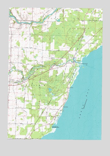
Pensaukee, WI USGS Topographic Map
Click on map above to begin viewing in our Map Viewer.

This topographic map contains these locations and features:
Feature Name Type Latitude Longitude GNIS ID View Map
Brick School (historical)SchoolN44.7650°W87.9890°1843942View Map
BrooksidePopulated PlaceN44.8047°W87.9979°1562245View Map
Brookside CemeteryCemeteryN44.8059°W87.9801°1843943View Map
Brookside CreekStreamN44.8092°W87.9798°1562247View Map
Brookside Station (historical)LocaleN44.7647°W87.9632°1843944View Map
Charles Pond State Natural AreaParkN44.7608°W87.9419°2081911View Map
Charles Pond State Public Hunting GroundsParkN44.7605°W87.9415°1562954View Map
Couillardville School (historical)SchoolN44.8630°W87.9843°1843954View Map
Little RiverStreamN44.8664°W87.9940°1568386View Map
Oak OrchardPopulated PlaceN44.7814°W87.9259°1570668View Map
PensaukeePopulated PlaceN44.8230°W87.9132°1571183View Map
Pensaukee Census Designated PlaceCensusN44.8291°W87.9034°2586542View Map
Pensaukee Fire DepartmentBuildingN44.8051°W87.9987°2696775View Map
Pensaukee Harbor LightBuildingN44.8214°W87.8962°1577983View Map
Pensaukee RiverStreamN44.8225°W87.9018°1571185View Map
Pensaukee State Public Hunting GroundsParkN44.8105°W87.9132°1571187View Map
Town of PensaukeeCivilN44.8053°W87.9639°1583907View Map

Note: Coordinates in the location and feature list above are referenced to NAD83 datum.


Copyright (C) 2008-2024 Ryan Niemi / Sunset Dynamics ... All Rights Reserved