TopoQuest Logo
Do you find TopoQuest useful?
Help keep TopoQuest running and adding new maps/features by donating!
Bitcoin:  19c7KJd3qBynnjoSw5npx9KScwjBe4ifkT
Litecoin:  LXs6TkuXGGXo1vDsWCkWVdjQX94eUKd6ui
Home View Maps Find Maps Find Places Resources & Links


Odell Lake, Montana Topographic Map

USGS Map Title: Odell Lake, MT
USGS Map MRC: 45113E2
DRG (GeoTIFF) Download: o45113e2.tif


Neighboring USGS Topographic Map Quads:


  Proposal Rock, MT  
45113F3
 

  Shaw Mountain, MT  
45113F2
 

  Stine Mountain, MT  
45113F1
 

  Stewart Mountain, MT  
45113E3
 

  Odell Lake, MT  
45113E2
 

  Maurice Mountain, MT  
45113E1
 

  Jackson Hill, MT  
45113D3
 

  Maverick Mountain, MT  
45113D2
 

  Elkhorn Hot Springs, MT  
45113D1


Map MRC Location:

N46°
W114°
N46°
W113°
H8 H7 H6 H5 H4 H3 H2 H1
G8 G7 G6 G5 G4 G3 G2 G1
F8 F7 F6 F5 F4 F3 F2 F1
E8 E7 E6 E5 E4 E3 E2 E1
D8 D7 D6 D5 D4 D3 D2 D1
C8 C7 C6 C5 C4 C3 C2 C1
B8 B7 B6 B5 B4 B3 B2 B1
A8 A7 A6 A5 A4 A3 A2 A1
N45°
W114°
N45°
W113°

Odell Lake, MT USGS 1:24K Topographic Map Preview:
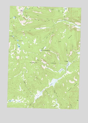
Odell Lake, MT USGS Topographic Map
Click on map above to begin viewing in our Map Viewer.

This topographic map contains these locations and features:
Feature Name Type Latitude Longitude GNIS ID View Map
Anderson Meadows Cow CampLocaleN45.5585°W113.1462°779036View Map
Armor CreekStreamN45.5305°W113.1723°779133View Map
Bear LakeLakeN45.5081°W113.2453°779543View Map
Bearpaw MineMineN45.5860°W113.2431°802519View Map
Bobcat CreekStreamN45.6049°W113.1695°780180View Map
Bobcat LakesLakeN45.6219°W113.2209°780184View Map
Bobcat Lakes TrailTrailN45.6083°W113.2020°780185View Map
Bobcat MountainSummitN45.6191°W113.2320°780186View Map
Deer CreekStreamN45.5066°W113.2050°782239View Map
Giant Powder CreekStreamN45.5235°W113.1873°783915View Map
Grassy LakeLakeN45.6106°W113.2429°784212View Map
Grassy Lake TrailTrailN45.6127°W113.2323°784213View Map
Halfway CreekStreamN45.5294°W113.1731°784473View Map
Lake of the WoodsLakeN45.5827°W113.2356°793526View Map
Lambrecht CreekStreamN45.6249°W113.1517°785939View Map
Lower Anderson MeadowsSwampN45.5544°W113.1464°786657View Map
Odell CreekStreamN45.5491°W113.1481°788385View Map
Odell LakeLakeN45.5758°W113.2335°788387View Map
Odell MeadowsSwampN45.5474°W113.1584°788388View Map
Rabbia CreekStreamN45.5155°W113.1956°789308View Map
Schwinegar LakeLakeN45.5877°W113.2435°790148View Map
Seymore MountainSummitN45.5213°W113.1478°790256View Map
Skull CreekStreamN45.6024°W113.1728°790607View Map
Skull Creek MeadowsSwampN45.5735°W113.1731°790609View Map
Stringer CreekStreamN45.5524°W113.1484°791604View Map
Table CreekStreamN45.5569°W113.1450°791844View Map
Table MountainSummitN45.5808°W113.1712°791845View Map
Upper Anderson MeadowsSwampN45.5249°W113.1837°792606View Map

Note: Coordinates in the location and feature list above are referenced to NAD83 datum.


Copyright (C) 2008-2025 Ryan Niemi / Sunset Dynamics ... All Rights Reserved