TopoQuest Logo
Do you find TopoQuest useful?
Help keep TopoQuest running and adding new maps/features by donating!
Bitcoin:  19c7KJd3qBynnjoSw5npx9KScwjBe4ifkT
Litecoin:  LXs6TkuXGGXo1vDsWCkWVdjQX94eUKd6ui
Home View Maps Find Maps Find Places Resources & Links


Ohanapecosh Hot Springs, Washington Topographic Map

USGS Map Title: Ohanapecosh Hot Springs, WA
USGS Map MRC: 46121F5
DRG (GeoTIFF) Download: o46121f5.tif


Neighboring USGS Topographic Map Quads:


  Mount Rainier East, WA  
46121G6
 

  Chinook Pass, WA  
46121G5
 

  Cougar Lake, WA  
46121G4
 

  Tatoosh Lakes, WA  
46121F6
 

  Ohanapecosh Hot Springs, WA  
46121F5
 

  White Pass, WA  
46121F4
 

  Packwood, WA  
46121E6
 

  Packwood Lake, WA  
46121E5
 

  Old Snowy Mountain, WA  
46121E4


Map MRC Location:

N47°
W122°
N47°
W121°
H8 H7 H6 H5 H4 H3 H2 H1
G8 G7 G6 G5 G4 G3 G2 G1
F8 F7 F6 F5 F4 F3 F2 F1
E8 E7 E6 E5 E4 E3 E2 E1
D8 D7 D6 D5 D4 D3 D2 D1
C8 C7 C6 C5 C4 C3 C2 C1
B8 B7 B6 B5 B4 B3 B2 B1
A8 A7 A6 A5 A4 A3 A2 A1
N46°
W122°
N46°
W121°

Ohanapecosh Hot Springs, WA USGS 1:24K Topographic Map Preview:
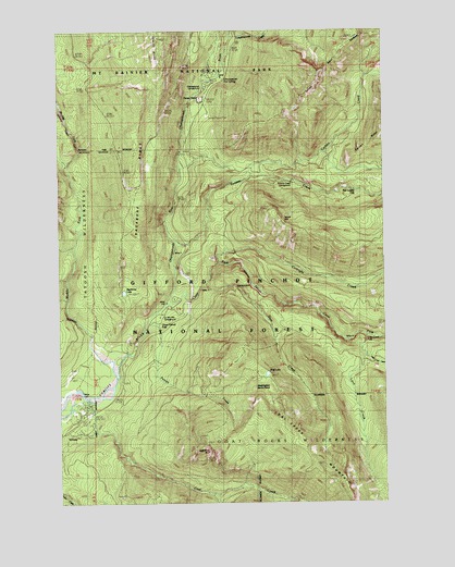
Ohanapecosh Hot Springs, WA USGS Topographic Map
Click on map above to begin viewing in our Map Viewer.

This topographic map contains these locations and features:
Feature Name Type Latitude Longitude GNIS ID View Map
Ayance CanyonValleyN46.6884°W121.5649°1515997View Map
Backbone LakeLakeN46.6807°W121.6012°1516015View Map
Backbone RidgeRidgeN46.7340°W121.5932°1516016View Map
Backbone Ridge TrailTrailN46.6993°W121.6018°1516017View Map
Big BottomValleyN46.6623°W121.6054°1529154View Map
Bluff LakeLakeN46.6589°W121.5464°1516723View Map
Bluff Lake TrailTrailN46.6373°W121.5306°1516725View Map
Boundary TrailTrailN46.7351°W121.5237°1516877View Map
Carlton CreekStreamN46.7115°W121.5520°1517404View Map
Clear Fork Cowlitz RiverStreamN46.6779°W121.5851°1517830View Map
Coal CreekStreamN46.6509°W121.6218°1517894View Map
Coal Creek BluffCliffN46.6387°W121.5681°1517896View Map
Coal Creek Forest CampLocaleN46.6471°W121.6140°1534087View Map
Cortright CreekStreamN46.6884°W121.5651°1518132View Map
Dam CreekStreamN46.6821°W121.5698°1518465View Map
Dinky CreekStreamN46.7001°W121.5687°1529169View Map
Fish Ladder FallsFallsN46.7073°W121.5115°1519585View Map
Grant Purcell FallsFallsN46.6709°W121.5876°1520244View Map
Hatchery RV CampgroundLocaleN46.6790°W121.5818°1529608View Map
Huntington Berry PatchAreaN46.6551°W121.5481°1521084View Map
La Wis Wis CampgroundLocaleN46.6737°W121.5879°1521798View Map
Laughingwater CreekStreamN46.7479°W121.5595°1521934View Map
Laurel HillSummitN46.6982°W121.5379°1521939View Map
Laurel Hill OutlookLocaleN46.7048°W121.5618°1529168View Map
Lava CreekStreamN46.6687°W121.5076°1521947View Map
Lava Creek Falls ViewpointLocaleN46.6707°W121.5068°1529167View Map
Little Lava CreekStreamN46.6640°W121.5079°1522255View Map
Lost CreekStreamN46.6273°W121.5679°1522466View Map
Muddy Fork Cowlitz RiverStreamN46.6618°W121.6062°1533592View Map
OhanapecoshLocaleN46.7382°W121.5668°1529611View Map
Ohanapecosh CampgroundLocaleN46.7309°W121.5715°1523972View Map
Ohanapecosh Hot SpringsSpringN46.7373°W121.5626°1523973View Map
Ohanapecosh RiverStreamN46.6779°W121.5845°1533602View Map
Ohanapecosh Visitor CenterBuildingN46.7359°W121.5659°1984587View Map
PalisadesCliffN46.6815°W121.5531°1524148View Map
Palisades CampgroundLocaleN46.6846°W121.5484°1529609View Map
Palisades ViewpointLocaleN46.6834°W121.5481°1524149View Map
Purcell CreekStreamN46.6701°W121.5937°1524695View Map
River Bar CampgroundLocaleN46.6526°W121.6070°1525069View Map
Stevens CanyonLocaleN46.7157°W121.6026°1529610View Map
Summit CreekStreamN46.6940°W121.5815°1526712View Map
Summit Creek CampgroundLocaleN46.7104°W121.5368°1526713View Map

Note: Coordinates in the location and feature list above are referenced to NAD83 datum.


Copyright (C) 2008-2025 Ryan Niemi / Sunset Dynamics ... All Rights Reserved