TopoQuest Logo
Do you find TopoQuest useful?
Help keep TopoQuest running and adding new maps/features by donating!
Bitcoin:  19c7KJd3qBynnjoSw5npx9KScwjBe4ifkT
Litecoin:  LXs6TkuXGGXo1vDsWCkWVdjQX94eUKd6ui
Home View Maps Find Maps Find Places Resources & Links


Old Pickens, South Carolina Topographic Map

USGS Map Title: Old Pickens, SC
USGS Map MRC: 34082G8
DRG (GeoTIFF) Download: o34082g8.tif


Neighboring USGS Topographic Map Quads:


  Tamassee, SC  
34083H1
 

  Salem, SC  
34082H8
 

  Sunset, SC  
34082H7
 

  Walhalla, SC  
34083G1
 

  Old Pickens, SC  
34082G8
 

  Six Mile, SC  
34082G7
 

  Westminster, SC  
34083F1
 

  Seneca, SC  
34082F8
 

  Clemson, SC  
34082F7


Map MRC Location:

N35°
W83°
N35°
W82°
H8 H7 H6 H5 H4 H3 H2 H1
G8 G7 G6 G5 G4 G3 G2 G1
F8 F7 F6 F5 F4 F3 F2 F1
E8 E7 E6 E5 E4 E3 E2 E1
D8 D7 D6 D5 D4 D3 D2 D1
C8 C7 C6 C5 C4 C3 C2 C1
B8 B7 B6 B5 B4 B3 B2 B1
A8 A7 A6 A5 A4 A3 A2 A1
N34°
W83°
N34°
W82°

Old Pickens, SC USGS 1:24K Topographic Map Preview:
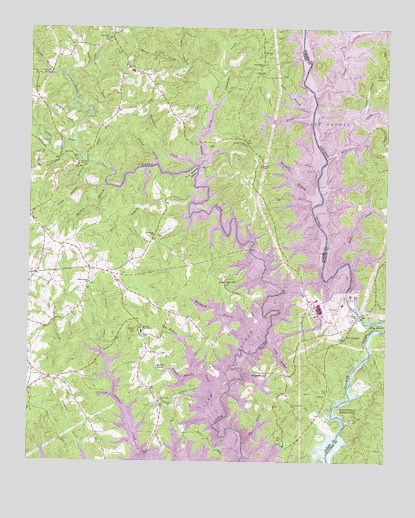
Old Pickens, SC USGS Topographic Map
Click on map above to begin viewing in our Map Viewer.

This topographic map contains these locations and features:
Feature Name Type Latitude Longitude GNIS ID View Map
Barkshed BranchStreamN34.7815°W82.9226°1220325View Map
Beaman BranchStreamN34.8295°W82.9732°1220384View Map
Betty BranchStreamN34.8509°W82.9013°1220629View Map
Big BendBendN34.7895°W82.8779°1220663View Map
Big CreekStreamN34.7559°W82.9246°1220692View Map
Boones Creek School (historical)SchoolN34.7826°W82.8951°1242927View Map
Camp Bottom BranchStreamN34.8365°W82.9790°1221234View Map
Caney BranchStreamN34.8476°W82.9018°1221321View Map
Cary CemeteryCemeteryN34.7702°W82.8964°1221379View Map
Cater BranchStreamN34.7815°W82.9749°1221398View Map
Cornhouse CreekStreamN34.8526°W82.9346°1247394View Map
Craig Memorial CemeteryCemeteryN34.7916°W82.8869°1221815View Map
Crow CreekStreamN34.8554°W82.9007°1229608View Map
DAR MonumentParkN34.8590°W82.9085°1242965View Map
Davis BranchStreamN34.8629°W82.9460°1229623View Map
Dogwood HeightsPopulated PlaceN34.7707°W82.9526°1242966View Map
Emerson BridgeBridgeN34.7759°W82.9254°1222281View Map
Fernwood AcresPopulated PlaceN34.7704°W82.9985°1242989View Map
Flat Shoals BridgeBridgeN34.8620°W82.9929°1222444View Map
Flat Shoals RiverStreamN34.8548°W82.9818°1247774View Map
Fork Bottom BendBendN34.8332°W82.9435°1222489View Map
Fort George School (historical)SchoolN34.8634°W82.9657°1242994View Map
Fort Prince George (historical)MilitaryN34.8581°W82.8939°1243354View Map
Frenge BranchStreamN34.7751°W82.9415°1222561View Map
Gap Hill LandingLocaleN34.8473°W82.8863°1243357View Map
Hawks Nest Farm AirportAirportN34.8085°W82.9986°2650826View Map
High FallsFallsN34.8112°W82.9226°1223157View Map
High Falls CemeteryCemeteryN34.8016°W82.9309°1244801View Map
High Falls ChurchChurchN34.8018°W82.9307°1245976View Map
Hunnicut BridgeBridgeN34.8290°W82.9418°1223394View Map
Isaqueena CemeteryCemeteryN34.8648°W82.9188°1244803View Map
Isaqueena ChurchChurchN34.8645°W82.9193°1246131View Map
Isaqueena School Number 1 (historical)SchoolN34.8248°W82.9174°1243021View Map
Isaqueena School Number 2 (historical)SchoolN34.8657°W82.9185°1243022View Map
Kelly CreekStreamN34.8051°W82.8929°1223709View Map
Keowee Baptist ChurchChurchN34.8615°W82.8754°1246238View Map
Keowee CemeteryCemeteryN34.8618°W82.8763°1243403View Map
Keowee Fire DepartmentBuildingN34.8227°W82.9168°2578314View Map
Keowee High SchoolSchoolN34.7884°W82.9607°1223719View Map
Keowee School (historical)SchoolN34.8143°W82.9568°1243033View Map
Lake KeoweeReservoirN34.8059°W82.9201°1238598View Map
Lakeside EstatesPopulated PlaceN34.7529°W82.9513°1243040View Map
Lakeside Mobile Home ParkPopulated PlaceN34.7529°W82.9321°1243041View Map
Long BranchStreamN34.7837°W82.9171°1224138View Map
Mile CreekStreamN34.8376°W82.8963°1224493View Map
Mile Creek County ParkParkN34.8534°W82.8868°1243443View Map
Mile Creek LandingLocaleN34.8518°W82.8829°1243444View Map
Morgan Memorial ChurchChurchN34.7757°W82.9165°1246722View Map
Mount Sinai Church (historical)ChurchN34.8084°W82.9110°1243061View Map
Mountain View CemeteryCemeteryN34.8710°W82.9736°1244808View Map
Mountain View ChurchChurchN34.8712°W82.9735°1249749View Map
Neal BranchStreamN34.8348°W82.9588°1224935View Map
New Foundation CemeteryCemeteryN34.7670°W82.9076°1224968View Map
New Foundation Church (historical)ChurchN34.7668°W82.9079°1243068View Map
New Hope Baptist ChurchChurchN34.7676°W82.9538°1249831View Map
New Hope CemeteryCemeteryN34.7670°W82.9542°1244810View Map
Nimmons BridgeBridgeN34.8584°W82.9038°1225050View Map
Nimmons Bridge (historical)BridgeN34.8579°W82.9026°1243075View Map
Norton School (historical)SchoolN34.7673°W82.9079°1243077View Map
Oconee County Rural Fire Department KeoweeBuildingN34.7768°W82.9056°2737342View Map
Oconee County Rural Fire Department Keowee EbenezerBuildingN34.7864°W82.9598°2578310View Map
Oconee CreekStreamN34.8415°W82.9838°1249941View Map
Old New Hope CemeteryCemeteryN34.7697°W82.9760°1225205View Map
Old PickensPopulated PlaceN34.7862°W82.8888°1249966View Map
Old Pickens BridgeBridgeN34.7923°W82.8840°1225206View Map
Old Pickens CemeteryCemeteryN34.7918°W82.8877°1244813View Map
Old Pickens ChurchChurchN34.7912°W82.8865°1243096View Map
Owens ChapelChurchN34.7762°W82.9276°1225262View Map
Parker LakesReservoirN34.7765°W82.9544°1225302View Map
Robertsons FordCrossingN34.7918°W82.8835°1243129View Map
Rogers CemeteryCemeteryN34.8415°W82.9932°1225996View Map
Ross CemeteryCemeteryN34.8676°W82.9682°1226035View Map
Saint Peters ChurchChurchN34.8148°W82.9563°1250693View Map
Saxony ForestPopulated PlaceN34.7709°W82.9624°1243138View Map
South Carolina Noname 39017 DamDamN34.8001°W82.8865°1238597View Map
Stamp CreekStreamN34.8354°W82.9410°1230362View Map
Stamp Creek Baptist ChurchChurchN34.8418°W82.9251°1251026View Map
Stamp Creek CemeteryCemeteryN34.8418°W82.9251°1244824View Map
Sugar HillPopulated PlaceN34.7682°W82.9443°1243173View Map
Tanyard BridgeBridgeN34.8365°W82.9799°1227035View Map
Todd BranchStreamN34.8370°W82.9751°1227162View Map
Von Hollen CreekStreamN34.7620°W82.9332°1227351View Map
Whetner BranchStreamN34.8234°W82.9013°1227518View Map
Whetstone CreekStreamN34.8354°W82.9424°1227519View Map
White HarborPopulated PlaceN34.7573°W82.9513°1243228View Map
Wilson BranchStreamN34.8357°W82.9557°1227636View Map
Wolf Stake Baptist ChurchChurchN34.8015°W82.9788°1251492View Map
Wolf Stake CemeteryCemeteryN34.8023°W82.9787°1244828View Map
Yarborough BranchStreamN34.8379°W82.9824°1230523View Map

Note: Coordinates in the location and feature list above are referenced to NAD83 datum.


Copyright (C) 2008-2024 Ryan Niemi / Sunset Dynamics ... All Rights Reserved