TopoQuest Logo
Do you find TopoQuest useful?
Help keep TopoQuest running and adding new maps/features by donating!
Bitcoin:  19c7KJd3qBynnjoSw5npx9KScwjBe4ifkT
Litecoin:  LXs6TkuXGGXo1vDsWCkWVdjQX94eUKd6ui
Home View Maps Find Maps Find Places Resources & Links


Olinda, California Topographic Map

USGS Map Title: Olinda, CA
USGS Map MRC: 40122D4
DRG (GeoTIFF) Download: o40122d4.tif


Neighboring USGS Topographic Map Quads:


  Igo, CA  
40122E5
 

  Redding, CA  
40122E4
 

  Enterprise, CA  
40122E3
 

  Ono, CA  
40122D5
 

  Olinda, CA  
40122D4
 

  Cottonwood, CA  
40122D3
 

  Chickabally Mountain, CA  
40122C5
 

  Mitchell Gulch, CA  
40122C4
 

  Hooker, CA  
40122C3


Map MRC Location:

N41°
W123°
N41°
W122°
H8 H7 H6 H5 H4 H3 H2 H1
G8 G7 G6 G5 G4 G3 G2 G1
F8 F7 F6 F5 F4 F3 F2 F1
E8 E7 E6 E5 E4 E3 E2 E1
D8 D7 D6 D5 D4 D3 D2 D1
C8 C7 C6 C5 C4 C3 C2 C1
B8 B7 B6 B5 B4 B3 B2 B1
A8 A7 A6 A5 A4 A3 A2 A1
N40°
W123°
N40°
W122°

Olinda, CA USGS 1:24K Topographic Map Preview:
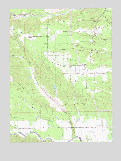
Olinda, CA USGS Topographic Map
Click on map above to begin viewing in our Map Viewer.

This topographic map contains these locations and features:
Feature Name Type Latitude Longitude GNIS ID View Map
Baker GulchValleyN40.4071°W122.4342°218546View Map
China GulchValleyN40.4138°W122.4431°221039View Map
Clear Creek PitMineN40.4925°W122.4803°2676081View Map
CloverdalePopulated PlaceN40.4735°W122.4758°221254View Map
Cloverdale CemeteryCemeteryN40.4669°W122.4552°221255View Map
Cloverdale School (historical)SchoolN40.4743°W122.4545°1661790View Map
Coal Pit GulchValleyN40.4535°W122.4817°221276View Map
Dry CreekStreamN40.3793°W122.4222°222631View Map
Dutch GulchValleyN40.3860°W122.4900°222767View Map
Happy ValleyValleyN40.4496°W122.3800°224906View Map
Happy Valley Elementary SchoolSchoolN40.4472°W122.4083°224910View Map
Happy Valley Fire Protection District Station 1BuildingN40.4463°W122.4095°2621787View Map
Happy Valley Fire Protection District Station 2BuildingN40.4744°W122.4558°2622086View Map
Happy Valley Primary SchoolSchoolN40.4746°W122.4524°1682492View Map
Niles CanyonValleyN40.4949°W122.3845°229554View Map
North Fork Spring GulchValleyN40.4624°W122.4083°229720View Map
OlindaPopulated PlaceN40.4438°W122.4075°230000View Map
Olinda ReservoirReservoirN40.4393°W122.4133°230002View Map
Readings BarBarN40.4915°W122.4928°231302View Map
Redding Sky Ranch (historical)AirportN40.4982°W122.3786°1653870View Map
Saeltzer Dam (historical)DamN40.4932°W122.4706°1661858View Map
Salzman GulchValleyN40.3940°W122.4172°232348View Map
South Fork Spanish CanyonValleyN40.4693°W122.3870°235052View Map
South Fork Spring GulchValleyN40.4621°W122.4083°235055View Map
Wagon Road GulchValleyN40.4210°W122.4575°237151View Map
West Valley Volunteer Fire Company Station 55BuildingN40.3890°W122.3897°2622104View Map

Note: Coordinates in the location and feature list above are referenced to NAD83 datum.


Copyright (C) 2008-2025 Ryan Niemi / Sunset Dynamics ... All Rights Reserved