TopoQuest Logo
Do you find TopoQuest useful?
Help keep TopoQuest running and adding new maps/features by donating!
Bitcoin:  19c7KJd3qBynnjoSw5npx9KScwjBe4ifkT
Litecoin:  LXs6TkuXGGXo1vDsWCkWVdjQX94eUKd6ui
Home View Maps Find Maps Find Places Resources & Links


Igo, California Topographic Map

USGS Map Title: Igo, CA
USGS Map MRC: 40122E5
DRG (GeoTIFF) Download: o40122e5.tif


Neighboring USGS Topographic Map Quads:


  French Gulch, CA  
40122F6
 

  Whiskeytown, CA  
40122F5
 

  Shasta Dam, CA  
40122F4
 

  Shasta Bally, CA  
40122E6
 

  Igo, CA  
40122E5
 

  Redding, CA  
40122E4


  Ono, CA  
40122D5
 

  Olinda, CA  
40122D4


Map MRC Location:

N41°
W123°
N41°
W122°
H8 H7 H6 H5 H4 H3 H2 H1
G8 G7 G6 G5 G4 G3 G2 G1
F8 F7 F6 F5 F4 F3 F2 F1
E8 E7 E6 E5 E4 E3 E2 E1
D8 D7 D6 D5 D4 D3 D2 D1
C8 C7 C6 C5 C4 C3 C2 C1
B8 B7 B6 B5 B4 B3 B2 B1
A8 A7 A6 A5 A4 A3 A2 A1
N40°
W123°
N40°
W122°

Igo, CA USGS 1:24K Topographic Map Preview:
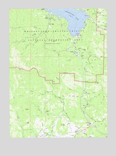
Igo, CA USGS Topographic Map
Click on map above to begin viewing in our Map Viewer.

This topographic map contains these locations and features:
Feature Name Type Latitude Longitude GNIS ID View Map
Andrews CreekStreamN40.5218°W122.5581°218275View Map
Bogus GulchValleyN40.5335°W122.5567°1661775View Map
Brandy CreekStreamN40.6235°W122.5572°219778View Map
Brandy Creek CampgroundLocaleN40.6157°W122.5750°1661776View Map
Buck HollowValleyN40.5740°W122.5250°219989View Map
Clair A. Hill Whiskeytown DamDamN40.5993°W122.5411°1664695View Map
Dog GulchValleyN40.5935°W122.5456°222468View Map
Dows GulchValleyN40.6185°W122.5653°222574View Map
Grouse MountainSummitN40.5274°W122.6025°224667View Map
IgoPopulated PlaceN40.5054°W122.5417°225832View Map
Igo - Ono Elementary SchoolSchoolN40.5034°W122.5406°1661810View Map
Igo - Ono Volunteer Fire Company Station 50BuildingN40.5050°W122.5436°2622017View Map
Igo Post OfficePost OfficeN40.5043°W122.5415°2783797View Map
Kanaka CreekStreamN40.5415°W122.5333°226416View Map
Kanaka PeakSummitN40.5615°W122.5550°226421View Map
Little Kanaka CreekStreamN40.5393°W122.5364°227288View Map
Monarch MountainSummitN40.5926°W122.5717°228914View Map
Mount Shasta MineMineN40.5849°W122.5289°1661834View Map
Mule MountainSummitN40.5527°W122.5147°229309View Map
Orofino GulchValleyN40.5801°W122.5356°230105View Map
Paige BarPopulated PlaceN40.5813°W122.5425°1661843View Map
Paige BarBarN40.5826°W122.5467°230235View Map
Paige Boulder CreekStreamN40.5821°W122.5420°1661844View Map
Paige SoubeStreamN40.5821°W122.5428°230236View Map
Papoose CreekStreamN40.6043°W122.5842°230316View Map
Papoose GulchValleyN40.6040°W122.5833°1661846View Map
Petty ButteSummitN40.5124°W122.5592°230585View Map
Potosi MineMineN40.5307°W122.5295°1661853View Map
Rich GulchValleyN40.5904°W122.6025°231537View Map
Richie PeakSummitN40.5143°W122.6045°1661856View Map
Salt CreekStreamN40.5718°W122.5325°232303View Map
Salt GulchValleyN40.5976°W122.5956°232321View Map
Sheep CampLocaleN40.5999°W122.5945°1661861View Map
Silver Falls MineMineN40.5254°W122.5795°1661863View Map
South Fork Clear CreekStreamN40.5157°W122.5256°234988View Map
South Fork MountainSummitN40.5665°W122.6122°1654906View Map
South Fork School (historical)SchoolN40.5024°W122.5758°1661866View Map
Stony GulchValleyN40.5407°W122.5317°235550View Map
Sunshine MineMineN40.6232°W122.5272°1661868View Map
Whiskeytown CemeteryCemeteryN40.5857°W122.5392°1661879View Map
Whiskeytown-Shasta-Trinity National Recreation AreaParkN40.6136°W122.6023°277264View Map

Note: Coordinates in the location and feature list above are referenced to NAD83 datum.


Copyright (C) 2008-2025 Ryan Niemi / Sunset Dynamics ... All Rights Reserved