TopoQuest Logo
Do you find TopoQuest useful?
Help keep TopoQuest running and adding new maps/features by donating!
Bitcoin:  19c7KJd3qBynnjoSw5npx9KScwjBe4ifkT
Litecoin:  LXs6TkuXGGXo1vDsWCkWVdjQX94eUKd6ui
Home View Maps Find Maps Find Places Resources & Links


Olivehurst, California Topographic Map

USGS Map Title: Olivehurst, CA
USGS Map MRC: 39121A5
DRG (GeoTIFF) Download: o39121a5.tif


Neighboring USGS Topographic Map Quads:


  Sutter, CA  
39121B6
 

  Yuba City, CA  
39121B5
 

  Browns Valley, CA  
39121B4
 

  Gilsizer Slough, CA  
39121A6
 

  Olivehurst, CA  
39121A5
 

  Wheatland, CA  
39121A4
 

  Sutter Causeway, CA  
38121H6
 

  Nicolaus, CA  
38121H5
 

  Sheridan, CA  
38121H4


Map MRC Location:

N40°
W122°
N40°
W121°
H8 H7 H6 H5 H4 H3 H2 H1
G8 G7 G6 G5 G4 G3 G2 G1
F8 F7 F6 F5 F4 F3 F2 F1
E8 E7 E6 E5 E4 E3 E2 E1
D8 D7 D6 D5 D4 D3 D2 D1
C8 C7 C6 C5 C4 C3 C2 C1
B8 B7 B6 B5 B4 B3 B2 B1
A8 A7 A6 A5 A4 A3 A2 A1
N39°
W122°
N39°
W121°

Olivehurst, CA USGS 1:24K Topographic Map Preview:
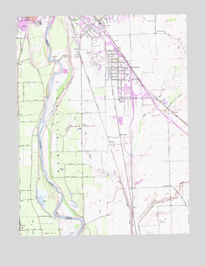
Olivehurst, CA USGS Topographic Map
Click on map above to begin viewing in our Map Viewer.

This topographic map contains these locations and features:
Feature Name Type Latitude Longitude GNIS ID View Map
Abbott LakeLakeN39.0201°W121.6093°217937View Map
Algodon SloughGutN39.0132°W121.5433°218118View Map
AliciaPopulated PlaceN39.1027°W121.5816°1657913View Map
Alicia Intermediate SchoolSchoolN39.1116°W121.5711°218124View Map
ArbogaPopulated PlaceN39.0513°W121.5558°1657942View Map
Arboga Elementary SchoolSchoolN39.0507°W121.5552°1703527View Map
Best SloughStreamN39.0057°W121.5430°219094View Map
Blackburn Talley ParkParkN39.1066°W121.6147°1703357View Map
Boardman RanchLocaleN39.1146°W121.5172°219559View Map
BoguePopulated PlaceN39.0979°W121.6250°252634View Map
Casa Mia Mobile Home ParkPopulated PlaceN39.1042°W121.5406°2507946View Map
Cedar Lane Elementary SchoolSchoolN39.1227°W121.5852°220787View Map
Clark SloughGutN39.0516°W121.5775°221166View Map
East ArbogaPopulated PlaceN39.0568°W121.5516°1658455View Map
Eliza BendBendN39.1024°W121.5908°223098View Map
Ella Elementary SchoolSchoolN39.0946°W121.5527°223147View Map
Ella School (historical)SchoolN39.0702°W121.5708°1703484View Map
Hillcrest ParkParkN39.1157°W121.6233°1703380View Map
Hock Farm (historical)LocaleN39.0477°W121.6161°1703382View Map
Hutchinson CreekStreamN39.0716°W121.5252°225809View Map
Johnson Park Elementary SchoolSchoolN39.0799°W121.5358°1703554View Map
Linda Census Designated PlaceCensusN39.1241°W121.5422°2408613View Map
Linda DivisionCivilN39.1087°W121.5689°1935166View Map
Linda Fire Protection District Station 1BuildingN39.1221°W121.5678°2621912View Map
Linda Fire Protection District Station 2BuildingN39.0509°W121.5591°2622225View Map
Linda Fire Protection District Station 3BuildingN39.0037°W121.5530°2622231View Map
Lindhurst High SchoolSchoolN39.0840°W121.5372°1703558View Map
Marysville Army Air Field (historical)MilitaryN39.0972°W121.5694°1988678View Map
Marysville Drive-In (historical)LocaleN39.1142°W121.5622°2548256View Map
Marysville Municipal Golf CourseLocaleN39.0366°W121.5650°1654320View Map
Messick LakeLakeN39.0369°W121.5925°228540View Map
OlivehurstPopulated PlaceN39.0954°W121.5522°1659301View Map
Olivehurst Census Designated PlaceCensusN39.0817°W121.5549°2408986View Map
Olivehurst DivisionCivilN39.0220°W121.5531°1935230View Map
Olivehurst Elementary SchoolSchoolN39.0768°W121.5519°230011View Map
Olivehurst Post OfficePost OfficeN39.0984°W121.5517°2769455View Map
Olivehurst Public Utility District Fire DepartmentBuildingN39.0913°W121.5439°2621917View Map
OstromPopulated PlaceN39.0693°W121.5116°1659320View Map
Peach Mobile EstatesPopulated PlaceN39.1119°W121.5653°2507940View Map
PearsonPopulated PlaceN39.0618°W121.5775°1659361View Map
Plumas Elementary SchoolSchoolN39.0274°W121.5138°230827View Map
Plumas LakePopulated PlaceN39.0207°W121.5580°2037166View Map
Plumas Lake (historical)LakeN39.0260°W121.5616°1703507View Map
Plumas LandingLocaleN39.0096°W121.5789°1703576View Map
Reach Air Medical ServicesBuildingN39.0982°W121.5641°2662295View Map
Reeds CreekStreamN39.0463°W121.5427°231464View Map
Rupert SidingLocaleN39.1191°W121.5636°232015View Map
Shanghai BendBendN39.1007°W121.6005°232858View Map
Shanghai Bend ParkParkN39.0963°W121.5994°1703426View Map
Sierra View Memorial ParkCemeteryN39.0871°W121.5374°233096View Map
Star BendBendN39.0129°W121.5991°235385View Map
Starrs LandingLocaleN39.0110°W121.5997°1703429View Map
The Garden Mobile Home ParkPopulated PlaceN39.1233°W121.5803°2507947View Map
TudorPopulated PlaceN39.0049°W121.6236°1660038View Map
Villa Seville Mobile Home ParkPopulated PlaceN39.0794°W121.5322°2507938View Map
Vinboy Trailer ParkPopulated PlaceN39.1000°W121.5481°2507949View Map
West LindaPopulated PlaceN39.1183°W121.5789°2414579View Map
Yuba (historical)Populated PlaceN39.1191°W121.5705°1703592View Map
Yuba City Farm Labor CenterBuildingN39.1202°W121.6091°238291View Map
Yuba City Fire Department Station 3BuildingN39.1130°W121.6222°2622052View Map
Yuba CollegeSchoolN39.1240°W121.5400°238292View Map
Yuba County AirportAirportN39.0970°W121.5673°1653728View Map
Yuba Gardens Intermediate SchoolSchoolN39.0871°W121.5436°1703596View Map
Yuba Mobile Home ParkPopulated PlaceN39.0753°W121.5456°2507942View Map

Note: Coordinates in the location and feature list above are referenced to NAD83 datum.


Copyright (C) 2008-2025 Ryan Niemi / Sunset Dynamics ... All Rights Reserved