TopoQuest Logo
Do you find TopoQuest useful?
Help keep TopoQuest running and adding new maps/features by donating!
Bitcoin:  19c7KJd3qBynnjoSw5npx9KScwjBe4ifkT
Litecoin:  LXs6TkuXGGXo1vDsWCkWVdjQX94eUKd6ui
Home View Maps Find Maps Find Places Resources & Links


Gilsizer Slough, California Topographic Map

USGS Map Title: Gilsizer Slough, CA
USGS Map MRC: 39121A6
DRG (GeoTIFF) Download: o39121a6.tif


Neighboring USGS Topographic Map Quads:


  Sutter Buttes, CA  
39121B7
 

  Sutter, CA  
39121B6
 

  Yuba City, CA  
39121B5
 

  Tisdale Weir, CA  
39121A7
 

  Gilsizer Slough, CA  
39121A6
 

  Olivehurst, CA  
39121A5
 

  Kirkville, CA  
38121H7
 

  Sutter Causeway, CA  
38121H6
 

  Nicolaus, CA  
38121H5


Map MRC Location:

N40°
W122°
N40°
W121°
H8 H7 H6 H5 H4 H3 H2 H1
G8 G7 G6 G5 G4 G3 G2 G1
F8 F7 F6 F5 F4 F3 F2 F1
E8 E7 E6 E5 E4 E3 E2 E1
D8 D7 D6 D5 D4 D3 D2 D1
C8 C7 C6 C5 C4 C3 C2 C1
B8 B7 B6 B5 B4 B3 B2 B1
A8 A7 A6 A5 A4 A3 A2 A1
N39°
W122°
N39°
W121°

Gilsizer Slough, CA USGS 1:24K Topographic Map Preview:
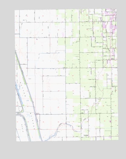
Gilsizer Slough, CA USGS Topographic Map
Click on map above to begin viewing in our Map Viewer.

This topographic map contains these locations and features:
Feature Name Type Latitude Longitude GNIS ID View Map
AbbottPopulated PlaceN39.0204°W121.6255°1657885View Map
Barry Elementary SchoolSchoolN39.0767°W121.6334°218707View Map
Barry SubstationLocaleN39.0693°W121.6905°1654163View Map
Central Gaither Elementary SchoolSchoolN39.0045°W121.6633°220839View Map
Gilsizer SloughGutN39.0429°W121.6447°224184View Map
Grace ChurchChurchN39.0254°W121.6714°224372View Map
Grant School (historical)SchoolN39.0685°W121.6894°1703378View Map
Holy Angel SchoolSchoolN39.1238°W121.6252°1703384View Map
KUBA-AM (Yuba City)TowerN39.0999°W121.6561°1662786View Map
KXCL-FM (Yuba City)TowerN39.0999°W121.6561°1663147View Map
Lincoln Elementary SchoolSchoolN39.1119°W121.6431°227152View Map
Lincrest Elementary SchoolSchoolN39.1070°W121.6310°1703391View Map
Little Blue CreekStreamN39.0985°W121.7364°227195View Map
O'Bannon School (historical)SchoolN39.0252°W121.6716°1703411View Map
OswaldPopulated PlaceN39.0691°W121.6261°1659321View Map
Saint Isidore Catholic ChurchChurchN39.1241°W121.6258°1703423View Map
Snake RiverStreamN39.0027°W121.7105°234748View Map
Snake SloughGutN39.1052°W121.7105°234749View Map
South Yuba CityPopulated PlaceN39.1166°W121.6391°1867060View Map
South Yuba City Census Designated Place (historical)CensusN39.1126°W121.6427°2408781View Map
Sutter By-PassCanalN39.0346°W121.7369°233372View Map
Sutter CountyCivilN39.0345°W121.6948°277315View Map
Sutter County Fire DepartmentBuildingN39.0761°W121.6343°2622252View Map
Sutter National Wildlife RefugeParkN39.0645°W121.7471°235848View Map
Vanderford Ranch Company AirportAirportN39.0961°W121.7177°1654134View Map
Yuba City Southwest DivisionCivilN39.0291°W121.6670°1935390View Map

Note: Coordinates in the location and feature list above are referenced to NAD83 datum.


Copyright (C) 2008-2025 Ryan Niemi / Sunset Dynamics ... All Rights Reserved